
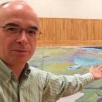
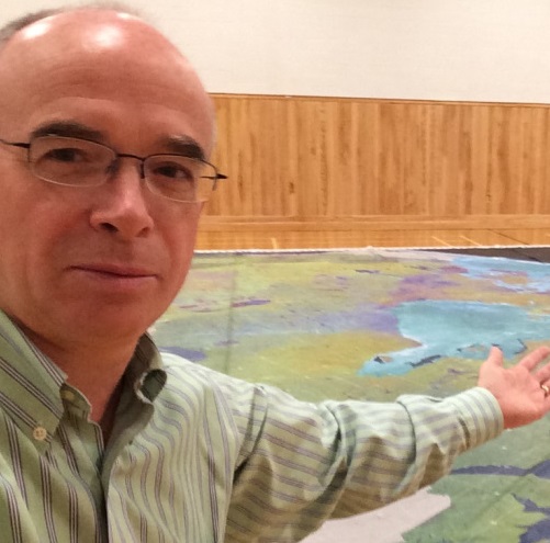
Dave MacLean: GIS Faculty, COGS Advanced Diploma in Geographic Sciences
GoGeomatics Canada is talking to Dave MacLean – a member of the GIS Faculty at the Centre of Geographic Sciences (COGS) in Lawrencetown, Nova Scotia.
GoGeomatics: Welcome to the GoGeomatics Canada community. To get started, can you tell us about where you are from and where you’ve lived in your GIS career?
Dave MacLean: I am a Maritimer, having grown up in southern NB, then NS with family in PEI, too. Along with my wife and two children, we have lived in Bridgetown, NS, since July 2001. As for my GIS-based career, I have also lived in Saint John, NB, while working as GIS Specialist for J.D. Irving, Ltd.; in Doha, Qatar, as GIS Applications Administrator at the Centre for GIS; and in Prince George, BC, as GIS Developer for Industrial Forest Service, Ltd. and Spatial Mapping Ltd.
GoGeomatics: Where did you get your geomatics education?
Dave MacLean: At what was then the Nova Scotia Land Survey Institute (NSLSI), in 1985-86. During our graduation, the name changed to the College of Geographic Sciences, and has been known by the acronym COGS ever since. Now, it is the Centre of Geographic Sciences, as part of the Nova Scotia Community College.
GoGeomatics: Tell us more about your first job in geomatics.
Dave MacLean: My first job was with J.D.Irving Ltd. (Woodlands Division) in Saint John, New Brunswick, from 1986 to 1990. As a GIS Specialist, I helped fine-tune the database design, and implement that design for about 6 million hectares of forest land throughout NB, NS and Maine. We worked on projects such as annual planting/silviculture maps and five- & 25-year management plans.
GoGeomatics: How would you describe your geomatics career so far? Can you tell us how you got to be where you are now as a GIS instructor at COGS?
Dave MacLean: A fabulous mash-up of opportunities implementing GIS and improving workflows with GIS technology. I feel lucky that my background matched an opening at COGS in the Advanced GIS programme (name has since changed) and our family interest to move closer to grandparents. It’s great to be able to draw upon diverse examples from the industry for course material.
GoGeomatics: COGS has long been described as one of the best GIS schools in Canada. Where did that reputation come from and why is it deserved?
Dave MacLean: More than 30 years ago, Dr. Bob Maher established a Scientific Computer Programming programme at NSLSI. Being a geographer, one of Bob’s main concentrations in this programme was the use of a new technology referred to as GIS. It wasn’t long before the place was known throughout Canada as a place to hire GIS-knowledgeable graduates. In the mid-80s, NSLSI changed its name and began offering a GIS programme. As one of the first educational institutions to do so, the reputation just kept growing, as did the industry. It has been a challenge to keep up with this ever-evolving technology, but it has also been a lot of fun and I think that we continue to do a great job.
GoGeomatics: What makes an excellent GIS program? How do you, as part of a GIS Faculty, make sure that what you are teaching and imparting to new GIS students is giving them the skills and the problem solving they will need for the work force?
Dave MacLean: An excellent GIS programme introduces and uses geomatics fundamentals with assignments and projects relevant to the industry. (I use the broader term geomatics, because the programme should include remote sensing and GPS as well as GIS to impart a wide range of abilities and understanding in each student.) It takes a range of instructors with a breadth of knowledge and ability in detailed aspects of our technologies. Then, it takes working-world examples of tasks and projects. By keeping up with technologies and industry direction, then creating assignments that allow students to explore these, they get the chance to ready themselves for industry.
It is also nice to have connections with industry. Many grads contribute ideas for course content; we are also closely connected with the Geomatics Association of NS (gans.ca) and other industry groups.
GoGeomatics: In terms of GIS concepts what is the most difficult item for you to teach?
Dave MacLean: I’d have to say co-ordinate systems; we use a range of examples and data sets to introduce this concept and students have to deal with different systems throughout the year.
GoGeomatics: What does COGS look for in a prospective student to the Advanced GIS program?
Dave MacLean: The requirements for the Advanced Geographic Science programme are either a University degree in related discipline (we usually look for science or business), or related experience. A penchant for maps and computers is certainly an asset.
GoGeomatics: Do you have any student portfolios that you would like to share with us? Some that might give other prospective students an idea of what to expect if they were to come to study with you at COGS?
Dave MacLean: Two ideas: first, here’s a link to an online map that presents many student assignments and projects. Some are first term, some second, some end-of-year. Many are presented as posters and YouTube videos. http://bit.ly/9P4p8I
Second, this http://bit.ly/COGSGrads2012 (case specific) links to the 2012 COGS Graduate Profile booklet (3 Mb PDF). 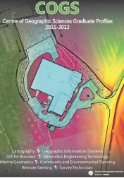 This highlights each participating student’s background and interests along with descriptions of each programme.
GoGeomatics: What makes the Advanced GIS program at COGS stand out from all the other programs out there? Why should someone go to COGS?
Dave MacLean: Students in our programme have the opportunity to immerse themselves in geomatics technologies. In a building with only geomatics subjects and about 200 students, there is a plethora of niches in which a student can specialise. There are opportunities for projects with our Applied Geomatics Research Group, for a Joint M.Sc. in Applied Geomatics with Acadia University, for projects with other agencies, and for courses that concentrate on database design, data processing and data presentation. Mostly, students get to leverage their (usually) science background with geomatics technologies, which lets them target specific niches in industry. We’ve had a great history of capable, interested students here over the years; upon graduation, they have integrated themselves in the industry, making a difference by immediately applying their backgrounds and geomatics expertise.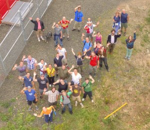
GoGeomatics: GoGeomatics has spoken with many graduates of COGS and they all remark upon one thing in particular: the isolation of Lawrencetown, and how there is really nothing else there but the school. How do you think this isolation affects the program?
Dave MacLean: Did they also perhaps talk of networking and life-long friendship with fellow students? Isolation provides the opportunity for students (in all programmes) to immerse themselves in their studies and in our surroundings. A much-anticipated part of the year is the annual broomball tournament between programmes.
We’d like to thank Dave MacLean for taking the time to talk to GoGeomatics Canada.


Dave your a valuable asset to both the education sector and the Geomatics community! Thanks for sharing
Having attended both UofT and COGS in the mid ’90s, I can tell you it was a toss up regarding academic rigour between the two institutions. But COGS gave me more hard skills oriented for the job market. COGS rocks!
Thanks for the note … COGS continues to attract lots of capable students and it’s fun to watch them in their fascinating careers; this year’s “crop” seems destined to do the same!
Hi there! your blog is so nice and its giving such wonderful information and i will be share it more and more, well thanks for sharing this valuable information.
Jaipur Engineering Colleges.
Thanks for your note … it’s fun and useful technology. All the best.