
Evaluation of the Data BC Portal, GIS Section
The province of British Columbia (B.C.) recently revised their portal. The main page offers a number of services to the general public of B.C., such as provincial services, ministries and governmental departments. Sub portals attached to the main portal include services such as JusticeBC, School finding tools, Energy Reports, Data on Geological Faults, Service Finder maps, Legal and Government services.
These services are also extended to include information for families and residents, tourists, investors, health and safety personnel, employment information, education information, recent news and geographical services. Users are provided with tools that encourage them to brainstorm apps that utilize B.C. data, and are provided with access to a number of extra sites on the page. The option to request more data from the B.C. government is also readily available, making data from B.C. readily accessible.
See the main portal here: DataBC Main Portal
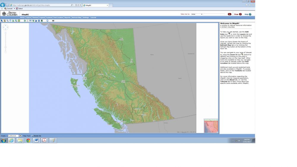
DataBC has decided to use the iMapBC application for its live online interactive mapping service. On entering the main portal, there are short and quick links to base maps, up to date land ownership and status maps and other quantitative data such as liquor sales by region and product type. These maps are housed in keyhole markup format (KML) for easy viewing and display in Google Earth. The iMapBC application is easy to find, and launches with the click of the “Launch Application” button.
See the ImapBC tool here: ImapBC 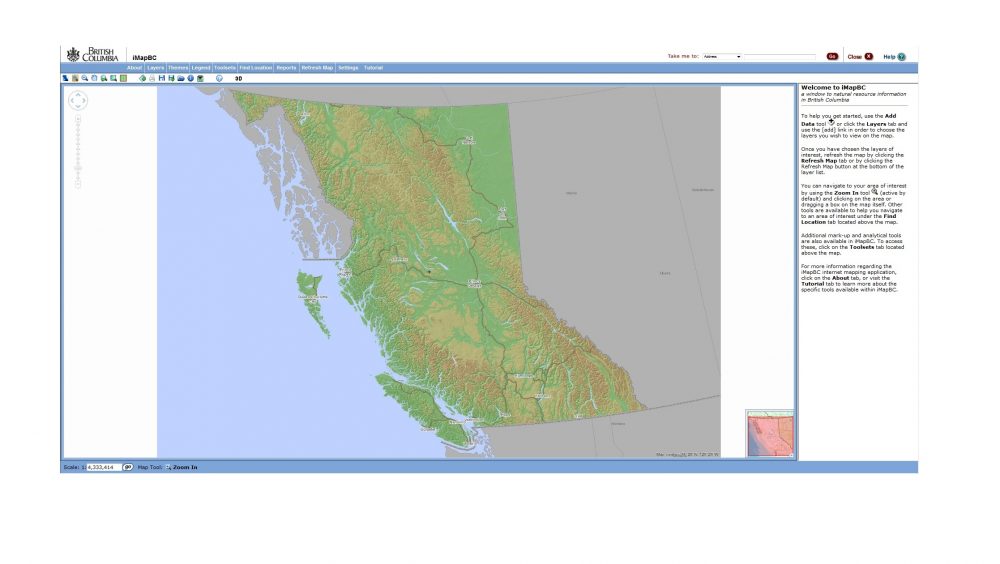
iMapBC is an interactive mapping system that accesses spatial data housed in the BC Geographic Warehouse, and in this case the supporting datasets are specific to the Province of B.C. The application is for creating web based interactive maps, supporting interactive query, allowing users to collaborate by saving and sharing their map sessions, and printing maps. This makes the tool fully operational online, without having to download any drivers, data or plug ins to support it. This is a convenient and hassle free option for GIS users.
The iMapBC application opens with an easy to follow tutorial, on how to add and subtract data, toggle and zoom the map, and information on how to refresh after adding data. On the map area of iMapBC, the layers are selected manually from a large list of topics. These are then added in real time through refreshing the map, either manually or automatically. The updated layers are then displayed on the map area, and users are ready to begin analysis.
Overall, the application works smoothly, features fast refreshing and display of data and is user friendly. There are also a number of customizable search tools at the top of the page that allow for displaying street addresses, place names and map sheets. Settings and view options are customizable through these tabs also, and locations can be found from a number of generic location types such as parks, radio stations, ski hills, hospitals and weather stations. A full legend is also included and links to reports are provided. Secondary help which is apart from the tutorials, is also provided in this area. This help link displays forms of contact for the B.C. government and the hours customer service is available.
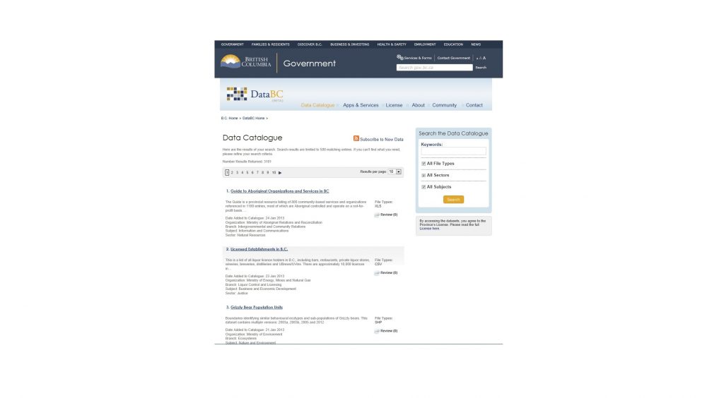
Needless to say, this application is provided with adequate tutorials and explanatory literature to provide users with an easy and enjoyable GIS experience. These tutorials prove handy when in doubt of how to use the buttons and links included on the standard iMapBC Page. The tabs provided at the top of the page also provide bridges to other relevant information relating to the iMapBC application in the ”About” link includes publications and news relating to geographic data in B.C., and a full description of the data catalogue, other apps and services, the license and contact information.
Vernon was used to assess the quality of data provided by the DataBC portal. While the option of viewing maps in three dimensions is there, the actual layers and shapefiles are not available for download via the iMapBC application but are downloadable via the Distribution Service The layers are thorough and complete and it is evident that this data has been the result of many years of collection, and many collaborating bodies. This is further proven in the metadata, which clearly states that data collection has been ongoing for quite some time and is the collective effort of many governmental departments. The subsets of data from the list of data are extensive, thorough and covers a wide range of spatial entities. For example: Layers containing data on protected rivers display in a point shapefile and again in line shapefile. The option of which feature type (point or line) will be displayed is left to the user’s discretion. Another example is streams and water reserves layers, which comes in points and lines. The way in which layer groups are named is also self-explanatory and straight forward.

Basemaps, maps illustrating first nations areas, and labels are also included in each layer group. The repository of aerial and satellite imagery is highly extensive, as possesses images in varying resolutions from 50mm to 30m. Layers also show aerial photography flight lines, air photo centers, and a full index that can be added to the map.
DataBC’s iMapBC tools are of a high standard. The entire look and feel of the iMapBC application is simple and straightforward to use, and the data is displayed in a quick and easy way. The only contrast with this portal is, the data is not available for download via the map viewer. On contacting tech support (data@gov.bc.ca), who not only responded almost instantly, but explained that B.C. data is available for download. Tech support then provided Google Custom search tools to query B.C. Geographic Data, and suggested that the data custodian listed in each set of metadata was a good point of contact to start with when interested in obtaining data.
DataBC’s iMapBC application is smooth to work with, is fully explained through tutorials and contact to customer support is easy to initiate. Layers in the map tool overlay easily and quickly and the data is simple to work with. The wide choice of layers and the fact that maps are fully customizable, works for easy analysis and manipulation of data. I understand that B.C. is working on a new release of the iMapBC application for spring 2013.
Geographic Metadata query here


iMapBC 2.0 was launched by the Province of B.C. today. It can be accessed at http://www.data.gov.bc.ca/dbc/geographic/view_and_analyze/imapbc/index.page?