Service New Brunswick (SNB) is serving up geospatial data to the community so lets have look at what they are doing. The portal allows access to all provincial services including, Service New Brunswick locations, employment information, information for residents, businesses and investors, and of course geographic data services. The geographic products include maps and aerial images of New Brunswick, in-addition to geographic data and map products for download or purchase.
See the Geographic Data and Maps page here: Service New Brunswick Geographic Data and Maps Webpage
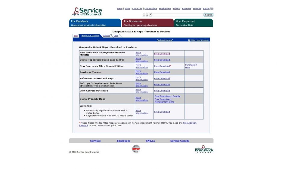
The portal is straightforward and easy to use. The main data menu is presented on the opening screen of Geographic Data and Maps section. The opening page is free of clutter and well laid out. Products displayed on the opening page include, atlases for purchase, digital topographic products, hydro network shapefiles, reference indexes and maps, orthophotos, wetlands shapefiles and digital property maps. There are also shapefiles showing civic addresses, and wetland buffer maps (30 m buffer zone) maps available.
Customer Support is provided in the form of FAQ’s and tutorials on tool use and supporting files such as AutoCAD support files, Adobe, ESRI ArcExplorer and feature code lookup files. There are links to other data portals such GeoBase, GeoGratis and ESRI provided on a separate page dedicated to external links. The options for customer service and support relating to map products are easy to find. There is a “contact us” function is sufficient for general inquires via email.
Contact Service New Brunswick here: Service New Brunswick Contact
SNB’s data download tools of are in good working order and simple to operate. SNB offers line, point and polygon feature classes in compressed format (ZIP) for download. The Geo NB (GNB) extension of SNB offers another gateway to up to date, high quality geographical information, data and maps. GNB also houses tools for GIS and mapping.
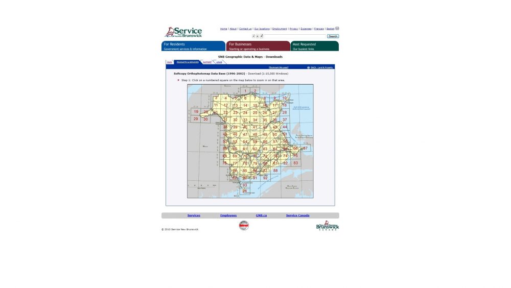
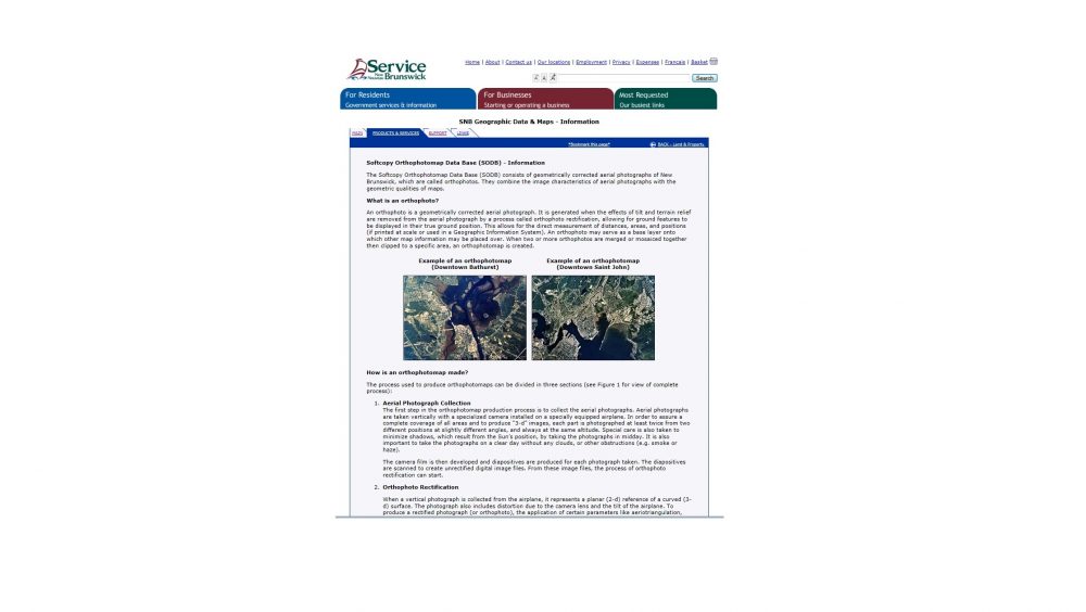
Most geographic data and maps from GNB and SNB are available for download or purchase in a few major formats; compressed zipped files (ZIP), CARIS GIS (ASCII) or Autodesk (DXF) file types. While SNB may not have the variety of datasets and filetypes that other data portals offer there are a full range of data-sets that should meet most needs. Layers come clearly named for convenience and ease. For example, layers such as wetlands, hydro network, roads and wetlands buffer zones all come clearly named before import into ArcGIS. Ortho photos and distortion free aerial photos are made available based on geographical area. They are defined by numerical grid, which divides the province into numbered sections. These photos range in year from 1996 to 2002, at a scale of 1:10 000 in two formats; Multi-Resolution Seamless Image (MRSID) and Tagged Image Format File (TIFF) formats.
Line feature data such as roads, streams, and rivers are somewhat harder to find on SNB. These features are only found from Geo NB after using the search tools provided. As expected, data from SNB is specific to New Brunswick only. No problem with that. Customer queries submitted via the support provided are responded to effectively and in a timely manner.
Grand Falls was used to analyze the strength of the data from SNB data portal. Just before the download page, where the selection from the numerical grid takes place, the display of the provincial map is somewhat weak. There is no option to zoom in or out, which leaves users not able to toggle around the area of interest. This is not ideal for working on a small scale in New Brunswick, unless there is some working knowledge of the area of interest. However, this can be averted by toggling the area of interest in Google Maps or Google Earth prior to download from SNB.
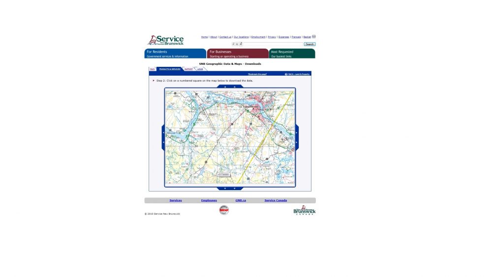
The page where users select the small scale of data for the area of interest is also rigid and lacking zoom tools. This makes it somewhat difficult to work in small urban areas. However, the informational pages provided in the support section of SNB, provide tutorials on downloading data, how to use the site and metadata on images and data-sets. Service New Brunswick has shown us that not only can they serve up New Brunswick data to the geomatics community, they can do it well.


Be the first to comment