
There is an art to delivering a rapid and effective pitch; for your project, product, or paper. Participants in the “Fast Pitches” session of the recent GoGeomatics Expo demonstrated such skills splendidly.
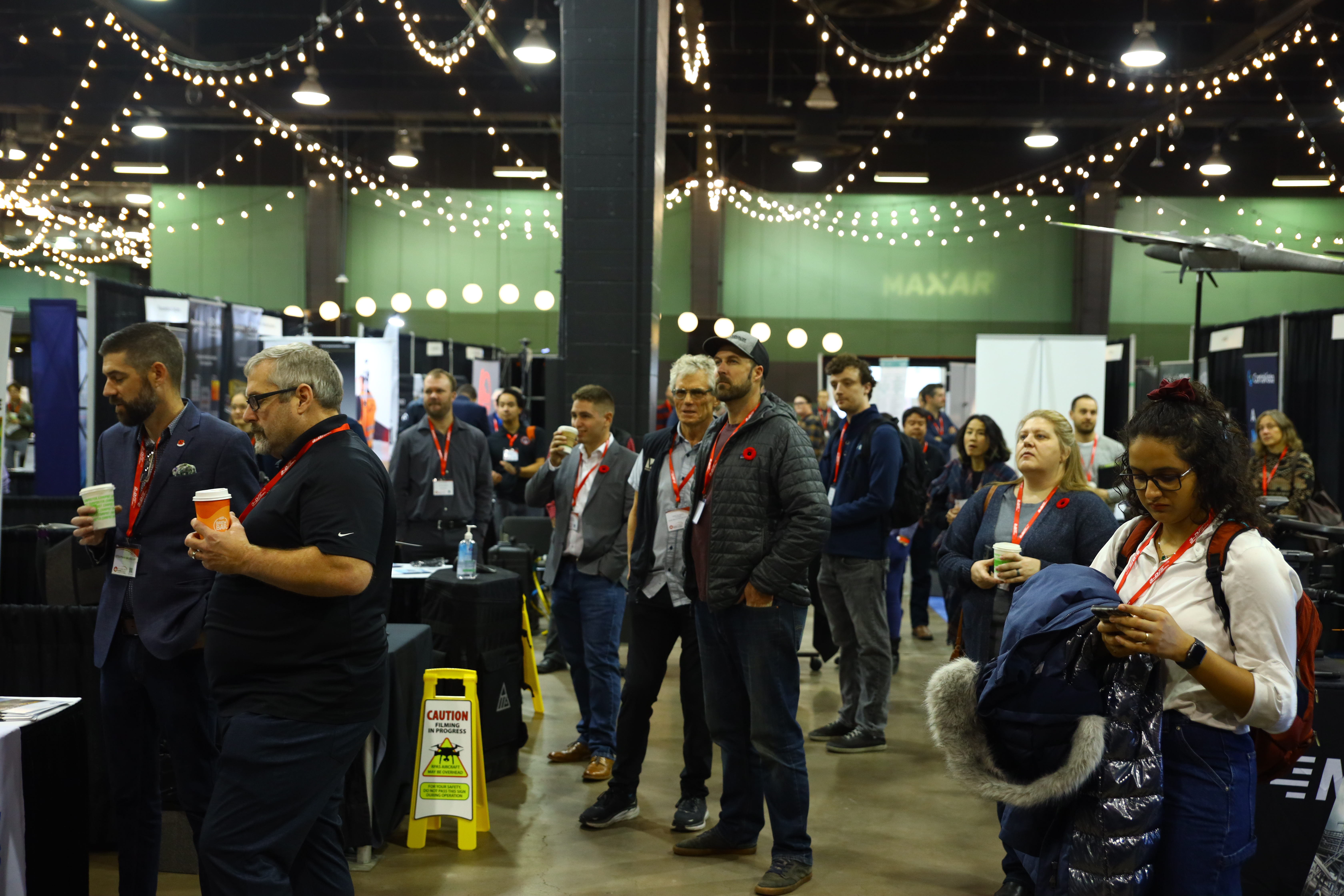
The GoGeomatics Expo, held in Calgary Canada November 6-8, 2023 exceeded all expectations, especially for an inaugural event. In addition to the large exhibit hall, there were educational sessions, industry talks, and a career fair. One of the featured sessions provided geospatial practitioners, vendors, and students an opportunity to practice their rapid presentation skills before an audience and panel of judges. Every presentation was not only delivered effectively, but also demonstrated advances in geospatial technologies and techniques. Overall, the session was also a lot of rapid-fire fun.
The format was 3-minute pitches (with or without PowerPoint decks), followed by 2 minutes of questions from the audience and judges. Presentations were judged on the effectiveness of the pitch, and not the merits of the project/product/paper (as all were pretty amazing on that count). “Fast pitches” was inspired in part by the “Pitch the Press” session of the GeoWeek event (held annually, in February in Denver), expanding the scope to encourage and include student projects/papers.
As noted, the presentations were all excellent, with a positive reception by the audience and judges. However, per plan, two top presentations were chosen (to be covered in full articles for publication in GoGeomatics and/or xyHt magazine).
First Top Pitch: Solar Potential
Ashling Redmond, teaching assistant at the University of Calgary, certified drone pilot, and founder of Aerobyte Analytics demonstrated the skill of immediately connecting with and engaging the audience. The focus of her presented research was “How can cities balance solar energy potential with urban densification goals?” First, the two key research questions were asked: “Do Higher density urban cores have lower potential than less dense areas within a city?” and “If so, do urban policies acknowledge this conflict?”
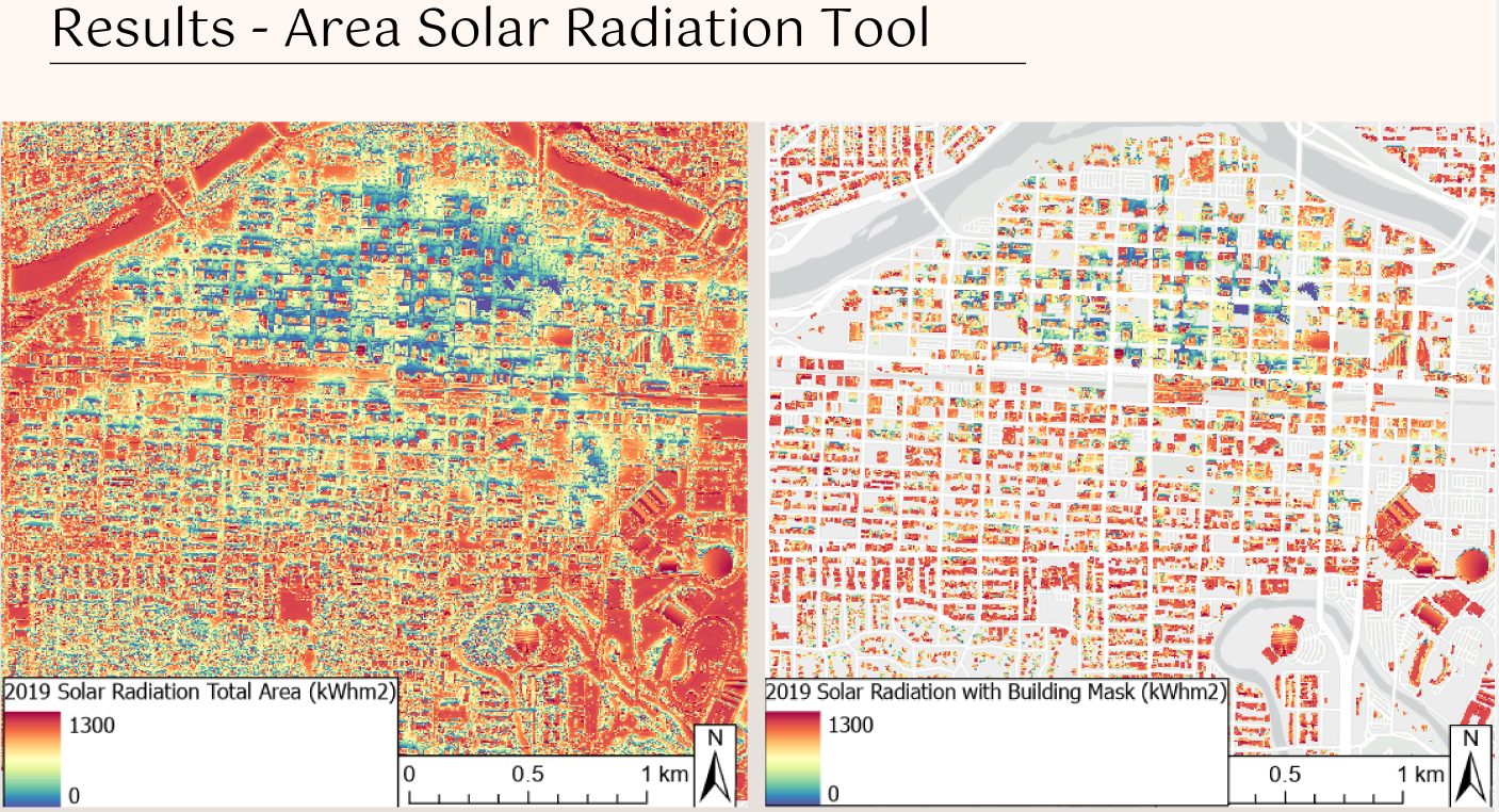
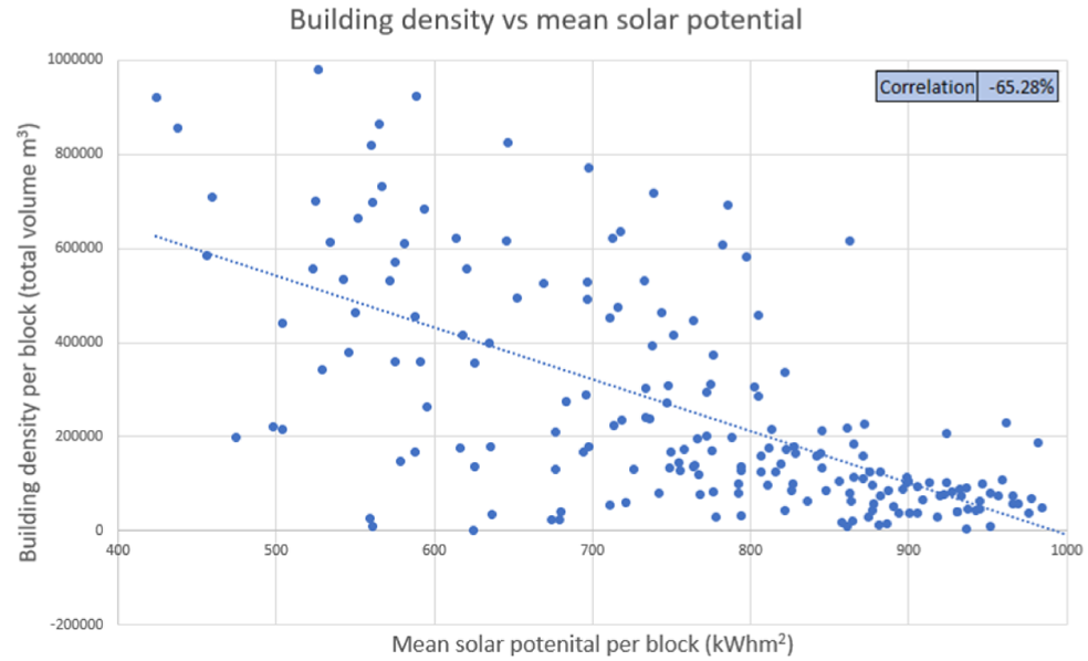
While the answer to the first question might seem obvious, Ashling shared her “Area Solar Radiation Tool” results correlating density and solar potential. This was followed by a discussion of policies (and lack thereof) related to the issue. Following conclusions and recommendations, Ashling posed a question to the audience: “What innovative approaches do you believe could help address the complex issue?” A lively discussion followed.
Second Top Pitch: Drone Imagery As-a-service
This presentation had a smooth and informative flow, and while a commercial service was being presented, Graham Anderson of Spexigon did not seem overly “salesy”. First, the high demand for higher resolution imagery was discussed, the various classes outlined (satellite, plane, and drone) and the challenges of each. The case was made for on-demand drone services, noting the recent maturation of foundational technologies and resources that make this viable. Such services were tried years ago by others, but the timing was not quite right.
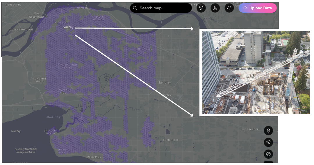
The focus shifted to how the Spexigon solution tackles the challenges of high-res drone imagery. For example, how local pilots are used and tasked, how 22-acre hexagonal areas have predefined flight plans that the operators initiate, simply, via an app, and a small class of drone is standard (one that is small enough not to be subject to much of regulations that might have otherwise been a barrier). Plus, examples of some cites in Canada that have used this service for their citywide aerial imaging needs. Situation, challenges, service model, and then examples: a solid pitch.
A Landfill Model for Analysis and Monitoring
Sebastian Widder presented a rather elegant solution he provided for the analysis and monitoring of a landfill in Germany; a true digital twin, without emphasizing the term “digital twin”. For the sprawling site, he noted how GNSS field observations were merged with extensive records and sample data for a one-stop Arc GIS-based resource.
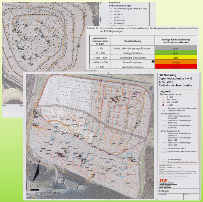
Multiple data sources were tapped: quantities deposited over time, remaining landfill balance, waste quantities (as legal proof for authorities, citizens, and approvals for continued operation), emissions behaviors, ground water monitoring data, and inspections based on borings and historic imagery—all referenced to a full DEM. A complete package for as-built data and land management. His tying of research elements to goals for the project was clearly presented.
Digital Tools for Small and Medium Sized Survey Firms
Presenting without a PowerPoint deck, Doug Kondor, CEO and founder of Cyanic Automation engaged the audience with the importance and potential gains of employing digital tools for survey firm workload, workflow, customer, and job management. The ready-made tools his firm has developed address costing, job book, field service, equipment maintenance and monitoring, training, incident reports, inventory, customer relationship, compliance, and more.
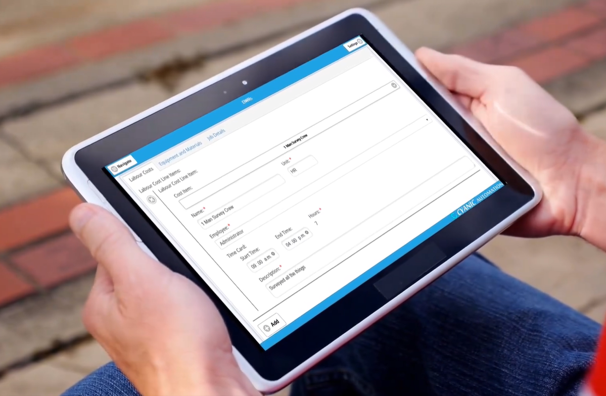
He concluded with examples of how much time/costs firms were able to save implementing specific tools (tens of thousands per month in one example). A pleasant conversational style added to the effectiveness of this pitch.
Flood Resiliency Hub
Also presenting without a PowerPoint deck, Renso Ronquillo, GIS technologist with the Alberta government opened with an example of the challenges facing, for example, a bridge engineer in correlating data with inspections. The question “What if there is an application that can solve operational and data management problems?” Renso answered with the introduction of the Flood Resiliency Hub that he and his team created.
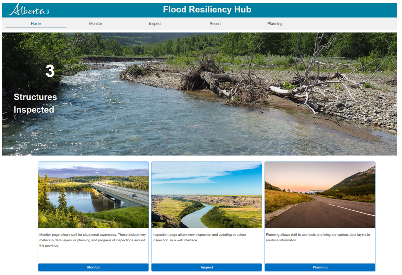
A one-stop application for use in both field and office operations, monitoring, inspections and planning is served by this GIS-based resource. Included in the data hub is data from consultant inspections, and hydrotechnical layers, enabling new inspections forms and automated reports. This is a model that could easily benefit other jurisdictions. A concisely crafted pitch.
A Helping Hand in Acquiring the Right Satellite Imagery for Your Needs
As Chris Humphrey of Pacific Geomatics noted early in his very effective presentation, there are a lot more people using satellite imagery nowadays, and a wide variety of sources to choose from. So many choices that it can often be a challenge for end users to choose the best options for their needs.
Without getting too salesy, Chris provided insights into their process for helping customers evaluate needs and match this with cost-effective options for the purchase of data from an ever-expanding market of data providers. The thrust of the pitch was how seeking external expertise is often a solid choice.
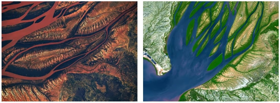
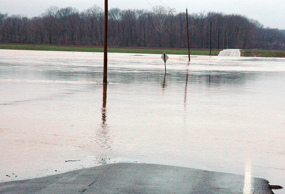
Gauging the Potential for Flooding
An intriguing research project was presented by a geomatics specialist and sessions instructor at the University of Calgary. Mark Empey stepped through the particulars of his research project that involved gathering data on flooding incidents in a small geographic area, analysis of the drainage and surface water handling infrastructure, and hydrological computations for the associated watershed. These were compiled into an ArcGIS-based interface showing the potential for flooding for specific locations.
This is the kind of solution that many areas are seeking: how best to gauge the potential for flooding to help guide inspections, contingency response measures, and design of systems. These goals were made clear though this excellent example study. We’re encouraging Chris to compile this research into an article that could help other jurisdictions facing the same challenges.
Overall, we were more than pleased with how this inaugural session went. Great projects, products and papers, delivered with such skill. May thanks to the presenters, and fellow judges Tania Frechette and noted geospatial journalist Mary Jo Wagner. And the attentive audience (we observed many taking notes) with their pointed questions. Fast Pitches will likely be a repeat session at the next GoGeomatics expo—get your pitches ready.
The Presenters:


Be the first to comment