

Geography Professor Stephen Swales at Ryerson University
I would like to welcome Professor Stephen Swales to the GoGeomatics community! Professor Swales teaches at Ryerson University in the Geography department. To find out more please read his article:
GoGeomatics: I would like to start off by saying thank you for taking the time to participate in the GoGeomatics magazine. Can you please begin the interview by telling us a little bit about yourself?

I grew up in North Yorkshire in England in a small village squeezed between a massive industrial complex and abeautiful national park. I was fascinated by the contrasting geographies. A love of maps and curiosity about places led me to formally move into the discipline.
GoGeomatics: What University did you attend for your studies and what is your field of interests?
I completed my undergraduate studies at the University of Liverpool and moved to the University of Calgary for post-graduate work. I enjoy most fields of geography but mostly urban-economic, environment and GIS.
GoGeomatics: Do you have any examples of your past or present GIS work that you are willing to share with us (maps, websites, drawings)?
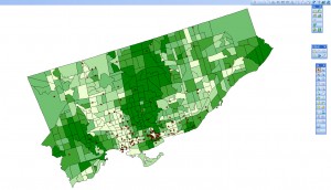
This is the first map I have students create when they start in GIS – I often also use it for visiting high school students. It lacks peripheral junk such as north arrow and scale bar – just the bare bones map. It shows income as the choropleth layer following the convention the-darker-the-greater. The points are the homes of shoplifters – all of them were caught at a single store downtown (just to the north of the islands). We discuss the patterns of the two variables individually, but of course the power of the geography and the GIS is to hypothesise about the spatial relationship between them.
“Income and Shoplifter Residence in the City of Toronto”
GoGeomatics: Why did you choose to teach at Ryerson University in Toronto, Ontario? What do you teach?
I have taught at five universities teaching classes as small as three and as large as 500. I’ve enjoyed teaching at all these universities but Ryerson has the combination of academic soundness, practical orientation and strong teaching tradition that I appreciate the most. I have taught a variety of courses ranging from environmental issues to marketing geography, but mostly location analysis and GIS.
GoGeomatics: Can you tell us about the Geographic Analysis program offered at Ryerson University.
The Geographic Analysis progam is one of two undergraduate progams in the Department of Geography, a recent addition is our Environment and Urban Sustainability (EUS) degree. We also have the Masters of Spatial Analysis which I know you are very familiar with Stephanie. The Geographic Analysis program has a strong emphasis on practical applications and use of geotechnologies.
GoGeomatics: Do the students participate in any Geography Field Trips?
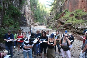
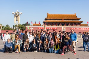
We consider field studies to be central to a geographic education. One of my colleagues refers to it as “geography through the soles of your boots”! Last week we led two one-day field trips for our first year class in the Niagara region. Our senior field studies class just returned from ten days in China. Past destinations have included Austria, Germany, Italy, Ireland, Jamaica, Vancouver Island and the Grand Canyon. It’s tough but somebody has to do it!
GoGeomatics: What do you find rewarding/challenging in your teaching career?
Equipped with our program our graduates get into interesting careers – that’s very rewarding from an instructor’s point of view. Challenging? The dance steps of the tango?
GoGeomatics: What is your favourite GIS application?
I tend not to have favourites of anything (except for dancing partners!) but I like any GIS application that is worthwhile in terms of supporting decision rather than just being of academic interest.


Hi, Stephanie
I’m an Information science engineer from India. I wish to pursue the Masters in Spatial Analysis program from Ryersons. Since I have been following your blog for quite some time now, I would like to ask you if you could in short tell me about your experience at ryersons. And how do you see the opportunities in GIS for programmers?