
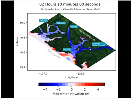
Tsunami mapping provides clearer picture of devastation for NW Vancouver Island
A $1.2 million collaboration between five First Nations, four municipalities, two Regional Districts, and several private stakeholders have produced Phase 1 of a comprehensive tsunami model of the northwest coast of Vancouver Island. The model covers previously unresearched areas and focuses on Alaska-sourced earthquakes as well. A tsunami event would raise water levels up 20 meters in less than 20 minutes for the exposed west coast, an area home to 45,000 residents. The model will assist in land use planning, conceptual mitigation options and evacuation considerations.
Flash Forest is in a Race to Scale up its Business and Save the Planet
Forest fires are ravaging forests around the world, particularly in North America. Reforestation is a vital and time-sensitive part of wildfire recovery; without trees, topsoil may erode and land becomes unusable. Flash Forest, a Toronto-based start-up, hopes to use unmanned aerial vehicles (UAVs) to plant trees quickly and efficiently through a combination of automation, aerial-mapping software, and meticulously engineered seed pods. The company has already run successful pilots on fire-affected sites and plans on planting one billion trees by 2028.
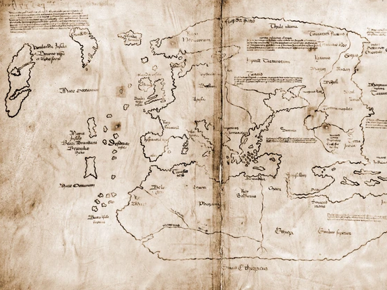
Vinland Map — the earliest known map of Canada — found to be a fake
The earliest cartographic evidence of Norse settlements in North America has been confirmed as an elaborate forgery. Initially thought to be a Medieval map of Greenland and Newfoundland, Yale University has now definitively confirmed it is a forgery. Though the parchment is over 500 years old, the ink has been found to contain titanium, a clear sign of it having been created in a post-industrial era. The maker, however, remains unknown.
Canadian Technology Companies Create Holographic Sonar Display for Hunting Submarines
The Canadian DND IDEaS project will lead to the development and testing of the world’s first holographic tactical display for passive SONAR tracking. This will reduce the cognitive load on passive SONAR analysts by visualizing complex undersea environments on a revolutionary holographic display. A holographic display reduces distorting illusions in the camera view and allows for multiple simultaneous viewing. 3D bathymetric data creates an accurate sensor picture that can be used to locate and identify possible undersea threats.

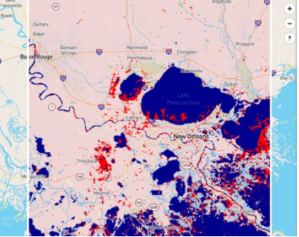
New Online Tool Offers Up-To-Date Maps Of Floods Worldwide
Due to climate change, floods are increasing in severity and occurrence. Low and middle-income countries remain especially vulnerable to floods. UN University-led experts have debuted a new tool that generates instant, accurate street-level resolution maps of floods worldwide since 1985. The tool lets users adjust variables to help locate gaps in flood defenses and responses and to plan future development of all kinds. Users simply choose an area of interest in a grid and a date range in the sidebar. Risk analysts and policy developers will find this tool especially useful.
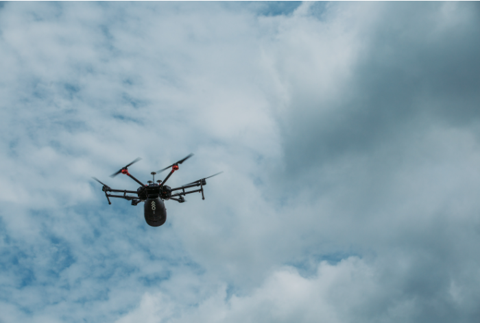
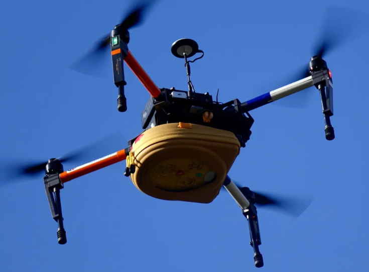
Why some first responders want to change the drone rules — and why not everyone agrees
First responders have been employing drones effectively in search and rescue missions, quickly covering remote and hard-to-reach areas. Regulations surrounding the use of drones remain strict, however. Some users insist that changes are needed to take full advantage of drones in emergency situations. Others say these changes to regulations will lead to ethical conundrums in the future. Transport Canada will be updating rules surrounding drone use in the near future.


Be the first to comment