
Introduction
In a recent project for Victoria International Airport (YYJ), Terra Remote Sensing Inc (TRSI) acquired high resolution photogrammetry and LiDAR data sets. These were acquired at 2cm resolution for the imagery and 30 points per m2 for LiDAR. As GIS coordinator for YYJ, Tim Albert spoke about the importance of such data to airport operations.
Tim’s Background
Since 1992, Tim has applied his GIS knowledge in statistics, geology, database design and supporting municipalities. His involvement with YYJ started approximately 19 years ago when he worked as a consultant to help move YYJ’s geospatial operations from a CAD environment to a GIS one.
Project Goals
The 1st goal was to update YYJ photogrammetric data sets every second year. While the 2nd goal was to get an idea of what potential obstacles are around the airport such as trees and buildings. This is done by acquiring LIDAR.
How the Ortho-Photography Supports YYJ’s Operations
As the default background of the ArcGIS web-app, YYJ overlays various datasets pertaining to maintenance of physical assets around the airport. These assets range from gates, signs, lighting, buildings, underground services, airfield surfaces and roads which are surveyed with RTK GNSS methodology. Maintenance information of the asset is also uploaded to the database. This then enables an operations team member to position an asset in question and its associated information on a tablet in the field without going back to the office and looking up records.
On top of allowing an operations team member to access the current condition of an asset in the field or in the office, historical imagery can be brought up as well. This will allow the team to determine temporal change in an asset which helps with decision making.
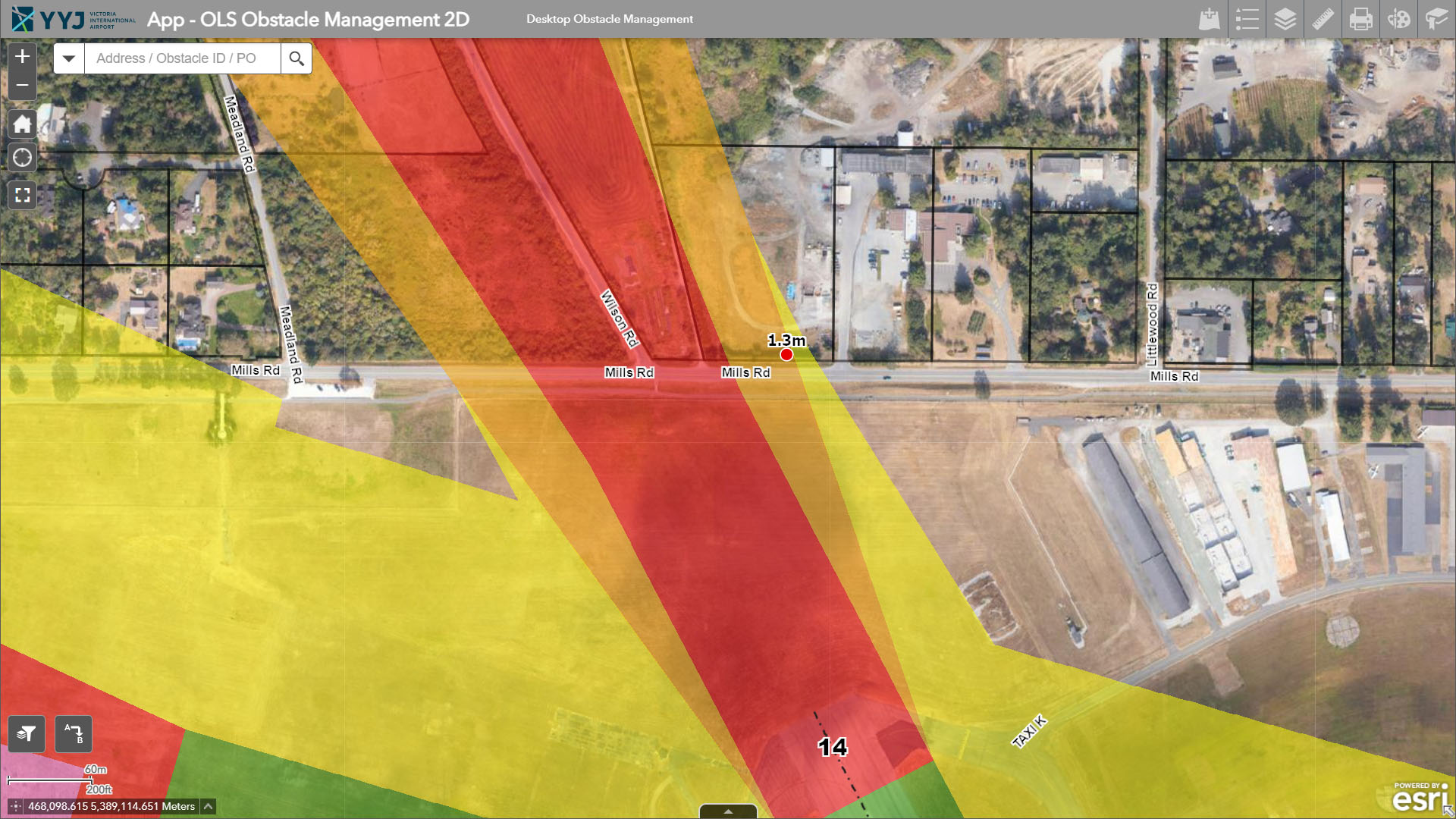
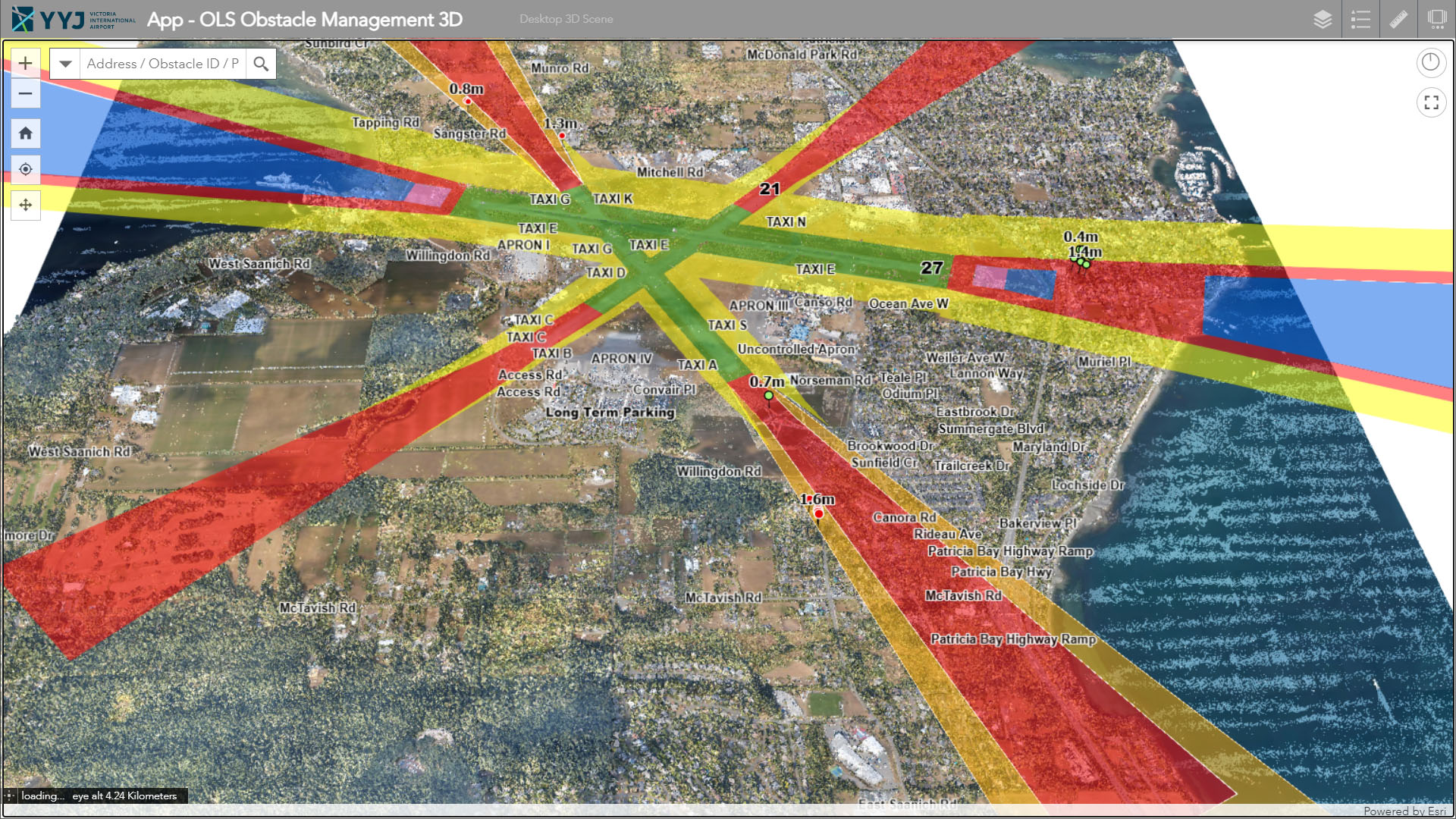
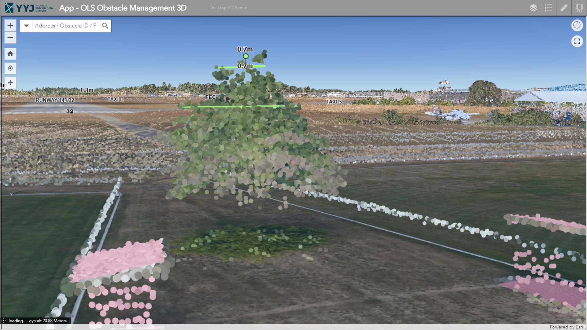
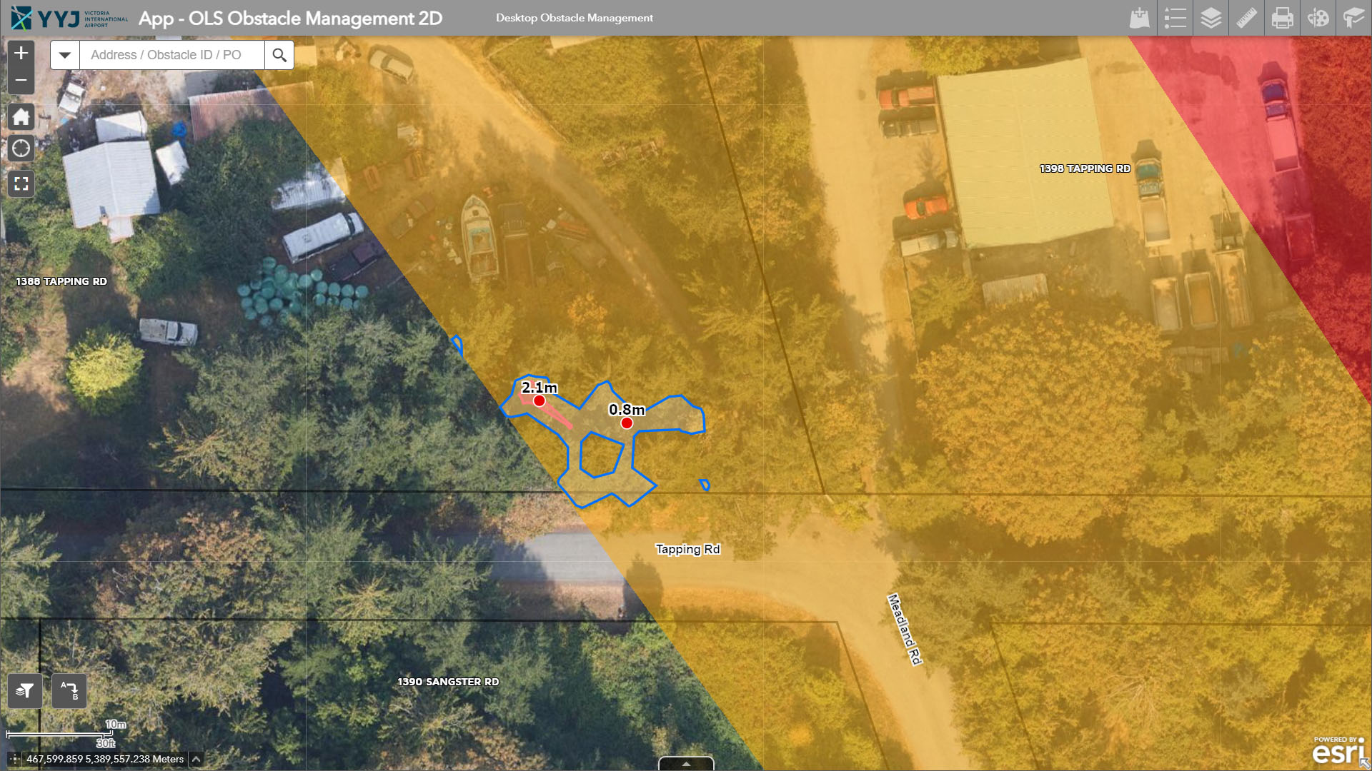
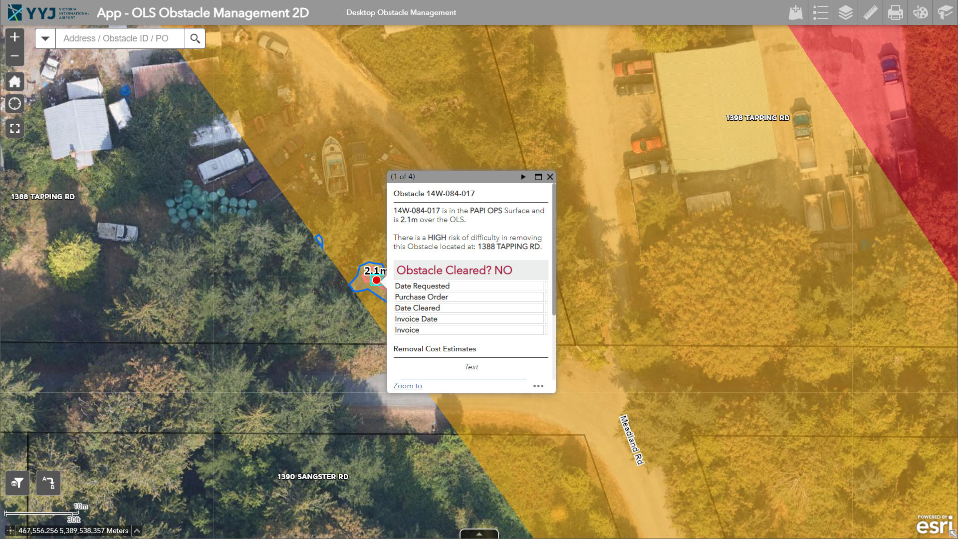
How the LIDAR Supports YYJ’s Operations
Using a colorized point cloud acquired through LIDAR and delivering this through an ArcGIS Online 3D Web-App, YYJ is able to create areas that need to be kept clear in 3D. With some modeling, YYJ’s team is able to determine where and what obstacles are above the airport’s Obstacle Limitation Surface (OLS) and are in need of immediate clearing. The App is also used to monitor the progress of clearing efforts.
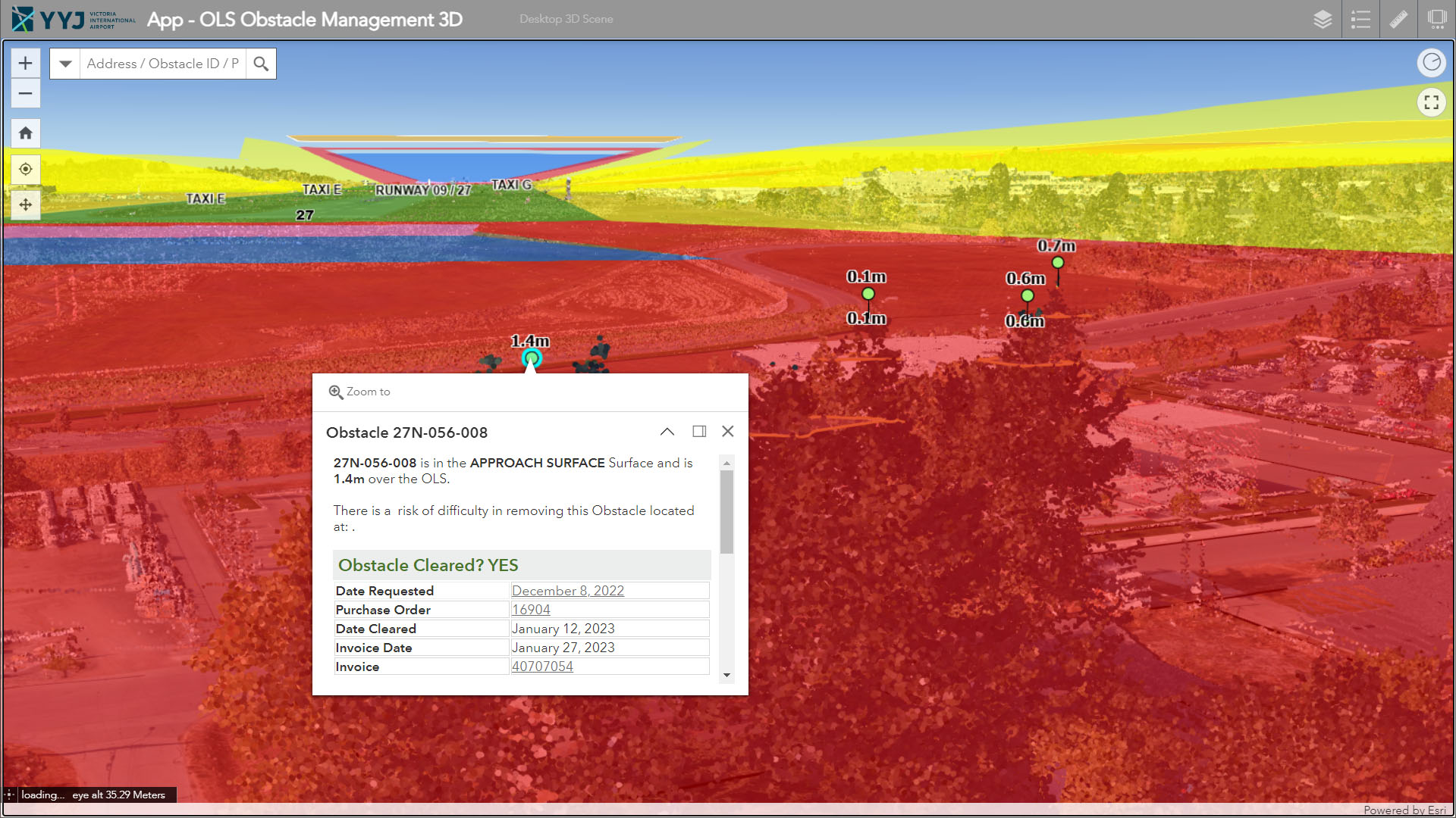
An example of this was tree growth along the approaches to the runways. Once the LiDAR data was collected, trees that were above the OLS were marked as in need of immediate clearance. Measurements as to how much the trees needed to be cut were provided as well. Next, some modeling was performed on the trees which calculated the average rate of growth and resulted in an estimated timeline of which trees need future attention.
Conclusion
Though such high-resolution visual tools, where scale, spatial awareness and asset information are combined into one platform, decision making can be performed quickly and accurately.
References
Albert, T. (2023, January 19) Interview.


Be the first to comment