
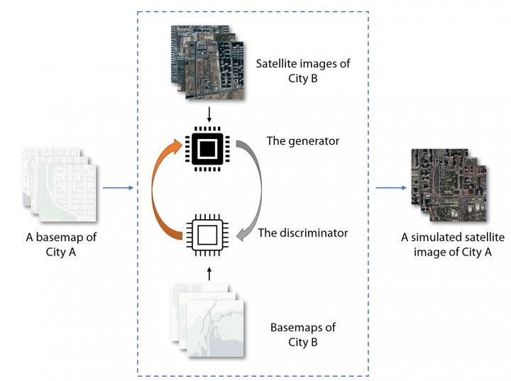
AI can alter geospatial data to create deepfake geography.
Many of us have seen the growing trend of videos of celebrities and politicians saying things they have never really said to warn us of the possibility that deepfake videos could soon infiltrate our social media feeds. It has been proven that the same methods can be applied to satellite images, creating deepfake images of different locations around the world. Researchers are beginning to study how satellite images can be fake, the implications for national security, and attempting to develop new ways to detect these falsified images. For more on this, check it out here.
Mexican duo creates first cartography with all the architectural heritage of Mexico City.
Mexican cartographers have created a platform containing interactive maps highlighting some of the different cultural, architectural, and natural heritage features around Mexico City. The project aimed to create a unified platform illustrating the city’s diverse heritage. The data was collected from the open data portal and can be displayed by many different themes. This is a great resource for students, professors, researchers, and anyone with a keen interest in Mexico City’s fascinating history. Find out more about this exciting project here.
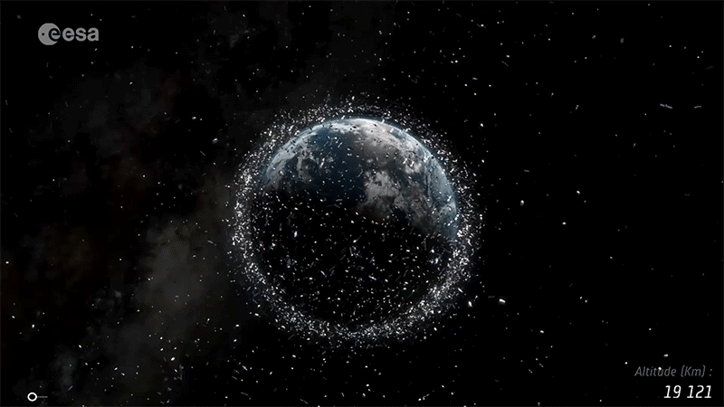
Chinese rocket’s chaotic fall to Earth highlights the problem of space junk.
Earth has a space junk problem. This problem is something we have known about but have been able to ignore. Last week’s close-call with the Chinese Long March 5b rocket’s dramatic fall from space was a stark reminder of just how much of a threat this space junk can be. For more on just how much of a problem we have, check out this article from the Guardian that dives into the issues of space junk.
Women In GIS: Preparing for a Female Future in GIS
Creating opportunities for women in STEM fields is an important part of fostering a more equal and fair society. Industries that are traditionally male-dominated often are slow to diversify and provide equal opportunity to females. Fei Jiang PhD. shares her experiences of being a woman in GIS, where males often outnumbered females 5:1, in her essay about Preparing for a Female Future in GIS.
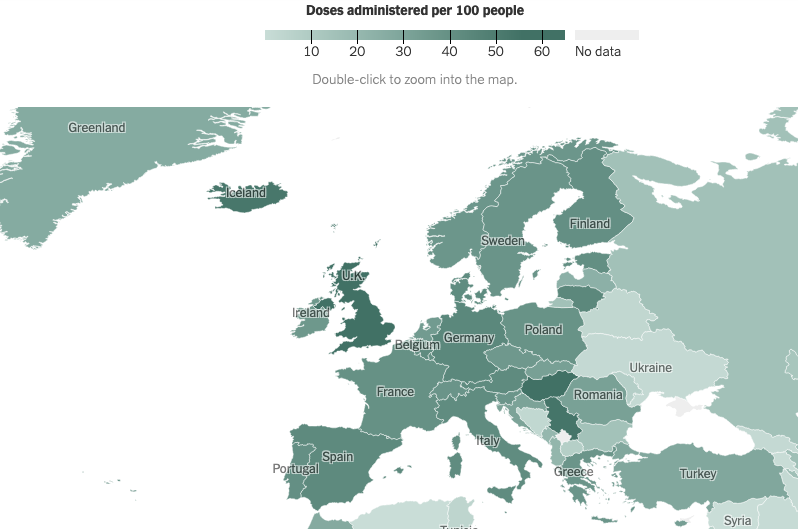
Tracking Coronavirus Vaccinations Around the World
As Coronavirus vaccines are administered, a new map from the New York Times is helping to visualize the process. Collecting vaccine information from countries wherever it is available, the map outlines the number of doses administered on a country-by-country basis. The data also illustrates the rate of vaccinations, vaccine use by country, and percentages of the population with a single dose and those fully vaccinated. For more insights and to explore the data for yourself, check it out here.
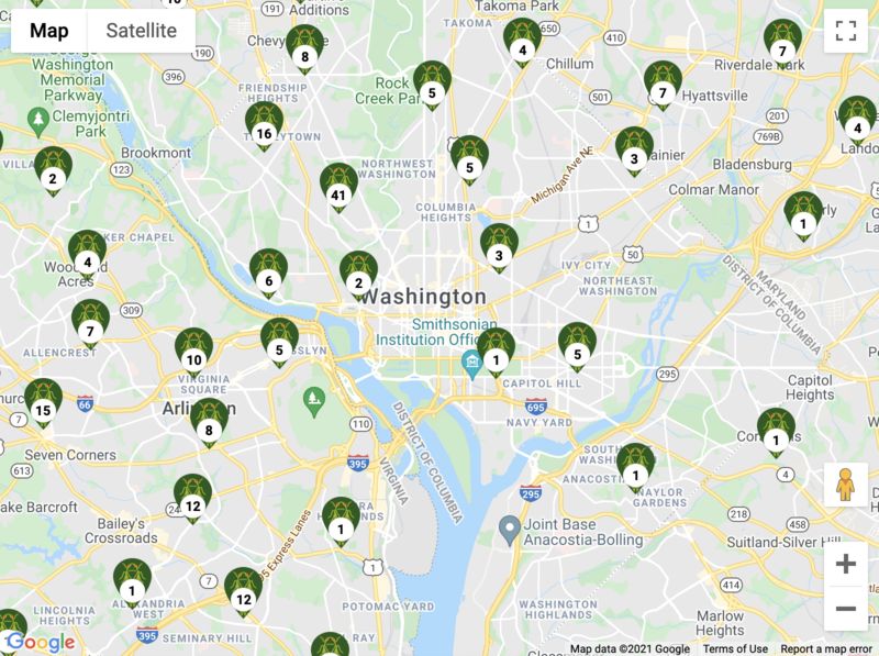
To Map Billions of Cicadas, It Takes Thousands of Citizen Scientists
Efforts in citizen science often revolve around smaller-scale local projects. With the upcoming hatch of Brood X cicadas, we have seen a multistate effort to track the different locations of the bugs as they grow. The map contains data crowdsourced from volunteers across the region where Brood X is expected to hatch in the coming months. Users can submit geotagged photos to be added to the map after they are confirmed and verified by student researchers. For more information about the effort behind this large scientific undertaking, check it out here.


Be the first to comment