
How are the GoGeomatics Briefing created?
All across Canada, our volunteer editors and group writers gather virtually, on a weekly basis, to discuss and share the newest geospatial news together. Each Writer prepares a few interesting articles that they have researched about, and they share why the reason behind selecting their piece with the other writers. Each researched article is selected based on the relevancy, credibility and interest to the geospatial community. After the team shares all their researched articles, all members vote on the most relevant pieces to write a briefing about.
Our volunteers’ dedication is very valuable to our community. Their efforts embody the spirit of what it means to really be the change you wish to see in the community.
- Iran: How we are uncovering the protests and crackdowns
-
How Artificial Intelligence is enriching mapping technology
-
Using the Geographic Approach, Technology to Understand a Global Water Crisis
-
Satellite tags on track to explore climate impacts on whale migrations
-
Lidar Sensor Price Plunge Leads to Orders From GM, Volkswagen
Iran: How we are uncovering the protests and crackdowns
Since September 16th, a nationwide protest has begun in Iran. This protest has been sparked by the death of a 22-year-old girl, Mahsa Amini. The Iranian authorities have severely restricted internet access to control protests and stop people from sharing protest videos and photos with the world.
Moreover, the government does not permit independent media to cover the protests inside Iran. despite this hard situation, Iranians are still sending their videos and photos to media outside of the country such as BBC Persian using messaging applications.
These videos are vital to understanding what is happening inside Iran. However, journalists need to verify them before broadcasting. They have to find out where and when a video was captured.
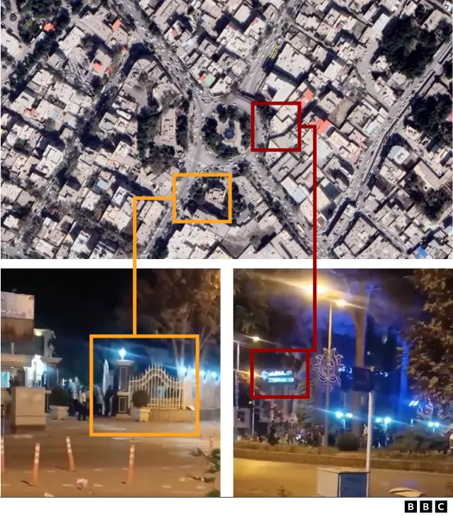
For location verification, they look for landmarks and signs in the videos and compare them with satellite imagery, street-level images and prior footage. To confirm when the video is taken, journalists use reports on the weather, the sun’s position and the angles of shadows sun creates.
Image caption: After looking at satellite images of Neyshabur City, it is possible to confirm that the video was filmed outside the city hall. One of the frames shows the building’s entrance gate (marked below in orange). A fluorescent sign can also be seen in another frame, and that can be matched to that of a branch of Bank Mellat in Iran Square (marked in red). Source: BBC
Read more here
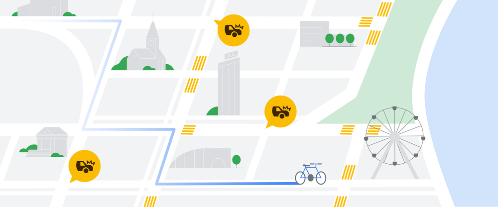
How Artificial Intelligence is enriching mapping technology
These days we use map applications rather than paper maps to find our locations for travelling or work. One of the crucial components of digital maps is Artificial Intelligence. Al help improve the accuracy of map details such as the traffic status of the roads and its predictions.
Google Maps is one of the examples that shows how AI is useful in navigation systems. In partnership with an Alphabet AI research lab called DeepMind, the accuracy of Google Maps’ ETA predictions has increased to 97 percent of the time. Read more here
Satellite tags on track to explore climate impacts on whale migrations
During the 2022 whales migration season, a new research program between Australian, South African and South American university researchers has begun by tagging ten humpback whales with satellite transmitters in Ecuador.
The satellite transmitters on the tags will help track the activities of whales during a three to six-month period. The result will enable researchers to understand humpback whales’ adaption to climate change. Read more here
Using the Geographic Approach, Technology to Understand a Global Water Crisis
Around one-third of the population in the world is living in countries with no access to safe drinking water. The insufficient water supply leads to big issues in hygiene, health, education levels, and economies of entire regions. These problems will the most impact negatively women and children.
Hippo Roller, a South Africa-based water solution provider is one of the initiatives that expand access to water in many communities around the world. However, the impact of this successful project is not broadly recognized.
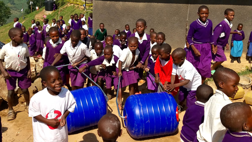
The Hippo Roller team has decided to use Geographic Information Systems to spread the word about global water access and the outputs of their project. In partnership with Visual Knowledge, it assists nonprofit organizations to tell their stories with geospatial technology, they have created a storytelling platform called Hippo Hub
Read more here
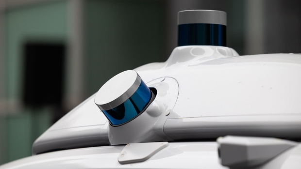
Lidar Sensor Price Plunge Leads to Orders From GM, Volkswagen
While automated driving systems developers are still using camera-based systems, employing lidar technology will help them improve their vehicles’ functions and provide safer driving.
Automakers are using lidar in more production vehicles to enhance their ADAS (advanced driver assistance systems). It seems more automotive manufacturing companies are looking into the auto industry that SAE Level 3 automated-driving systems will have lidar. For instance, General Motors is utilizing lidar from Cepton, a California-based supplier for its Level 3 system Ultra Cruise.
Read more here


Be the first to comment