
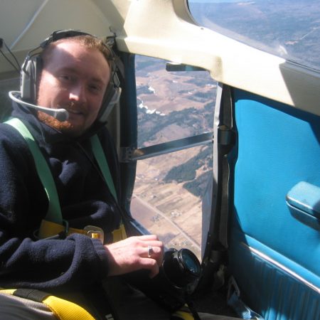
Jean-François Dionne – Senior Geomatics Specialist at WESA Group Inc in Ottawa
The first GoGeomatics Canada interview for February is with Jean-François Dionne. He is the Senior Geomatics Specialist at WESA Group Inc in Ottawa. Jean-François has many years of experience as a geomatics manager and specialist. His geospatial career has spanned the nation and even so far today as some of the more remote regions of the planet.

GoGeomatics: Jean-François tell us a little about yourself. Where are you from?

Jean-François: I am originally from Ottawa but have moved around the country following interesting and challenging GIS opportunities. Now after all these years of travelling around I decided to settle down, I’m back in my hometown still loving what I do after so many years.
GoGeomatics: Where did you go to school?
Jean-François: After finishing high school, I did a few years in human studies but quickly realised this wasn’t going to provide me with long-term contentment! So I swiftly decided to go back to college where I completed a three year technology diploma in cartography and surveying. The choice was obvious to me. Since I was a small child, maps fascinated me and I probably owned the largest collection of National Geographic maps in town! I finished in 1995 and that is about when the field of Geomatics was just starting to bubble. Desktop GIS packages and GPS systems were technologies just starting to become more mainstream and instructed in school. Back in the days, we were still working on DOS and Windows 3.1 versions of Autocad and command prompt ArcInfo workstation, Arcview GIS was just at version 2 and we would practice our statistics on MapInfo 3. We still had a few courses dating from the 70’s using photographic reproduction camera for large scale 1:50 000 maps, china ink drawn maps and Second World War analytical photogrammetric plotters. Things have changed radically since then and in such a short period of time.
GoGeomatics: How did the GIS program at College de l’Outaouais help you?
Jean-François: The many years in school taught me the theories and the basic techniques of surveying, cartography, remote sensing, and GIS. Not forgetting the large dose of practical and lab hours to have a generic idea of what I would be doing for the rest of my life. I quickly realised the importance of my education when I started my first job. My lack of experience was quickly forgotten when I applied what I had learned in school. After looking at all those years working in the field, I am still learning and still relate (almost) everyday to my school years.
GoGeomatics: Tell us about your first exposure to geomatics/GIS and what about it attracted you to start a career in this field?
Jean-François: What originally brought me to this field was cartography. I am a very detailed orientated person and graphic design and mapping interested me. Back then, like a lot of young people, I didn’t really know what I wanted to do as a career. I had a few options to decide on, geography, urban planning and cartography. I am happy that I made the decision today; this field encompasses components of each of these fields of study and even more.
GoGeomatics: Can you tell us about your first job in GIS?
Jean-François: My first job was in a small surveying firm in Northern Quebec. We worked mostly for the mining industry, a sector of the economy where projects have large budgets with very dynamic people. We worked on large surveying campaigns across vast areas on open pit mining surveys, volumetric surveys and underground alignment surveys. I started as a simple CAD/GPS technologist updating surveys, but rapidly took some larger projects under my belt. I stayed in that position for over two years.
GoGeomatics: What are some of the trials and challenges that you had to overcome when starting your career?
The urge of trying to impress your new boss on your first job is something unavoidable. I had to keep things simple and not try to overdo my first assignments and provide only what I was asked, nothing more. Keep things simple and don’t try to impress “at first” you have your whole career ahead of you to do just that. Also very important, always double check (triple check?) your work.
GoGeomatics:How long did it take to find?

Jean-François: I was lucky… I sent my resume based on a small four lined advertisement in the newspaper. I did my interview over the phone and was offered the job on the “spot”. I packed the few things I owned then in a backpack and took the bus north. I started with nothing, but I knew this could be the only chance to get in the business. The market was not great back then, so I considered myself lucky to have been given this chance.
GoGeomatics: Tell us a little about WESA and what you do there?
Jean-François: WESA Group Inc. (WGI- www.wesagroup.ca ) is a medium sized engineering company with approximately 150 professionals focusing on environmental work. WESA Envir-eau is where the company started in 1976 and does the bulk of our environmental work but we also have other divisions, WESA Energy and WESA Tech that specialises in renewable energy and water treatment systems for the heavy industrial sector. I started at WGI in 2005 and was asked to grow the GIS services for the company. We now have a team of four full time specialists with support personnel in all our offices providing a wide range of Geomatics related services to our engineers, hydrogeologists, and environmental specialists.
Our Geomatics services are spread over four sectors, GIS/Cartography, Remote Sensing and Imagery Analysis, Data Collection and finally Database and Data Management. The company has nine Canadian offices with the majority of the work located across Ontario, Quebec and Northern Canada. We also have an office in Central America where we work in El Salvador, Guatemala, and Honduras. The company is also active in many other parts of the world.
GoGeomatics: Can you give me the highlights of your working life so far?
Jean-François: I have worked in many varying fields over the years. My first, as explained earlier job was with a small surveying firm in northern Quebec focusing mainly on the mining industry. Afterwards, I went over to the municipal sector working for a rural county in Ontario managing the GIS system within the Planning Department. When I first started, there was very little data to work with. Over the years I developed many new partnerships with other departments, local municipalities, and organisations. When I left, we had a complete Web GIS server and were serving data to all departments and to the County’s population.
Afterwards, I left for Alberta to work for the Town of Banff. Apart from the greatest skiing and mountain lifestyle, I worked to redesign the corporate GIS system. I secured funding to install a new Planning and Building management system in collaboration with the neighbouring Town of Canmore. I worked within the Engineering department and another big task was to create inventories of all infrastructures to produce a capital renewal program. Most of the underground infrastructure in Banff dates back to the 1900’s and had been managed through the years by many authorities such as Parks Canada.
I came back to Ontario to work for a Conservation Authority. This provided me with a new outlook on GIS and natural resource management. I started at the same time the Source Water Protection studies were beginning in Ontario. All these studies were a result of the Walkerton Inquiry. We did a lot of background work to create a series of studies including conceptual water budgets, stream and river system hydrology models and groundwater flow models. I was also part of a team working on developing a revised Natural Heritage strategy for the region.
Then in 2005 I came to WGI. My initial responsibilities were to provide GIS support for specific studies. I quickly expanded the services to our other departments such as engineering and renewable energy sectors. A large majority of the staff realised the possibilities of the technology but the company lacked the resources to expand in this direction. Through many years of selling the ideas and promoting this service we have grown greatly. I am now managing the Geomatics service were I wear many hats but my main duties include high level GIS data analysis, development of new Geomatics services and markets, proposal writing and sometimes, go get dirty to do some fieldwork.
GoGeomatics: What software tools/equipment are you using every day?
Jean-François: We use the most common desktop software available on the market today. For our GIS work we use ArcGIS with the normal extensions. We also use many specific add-ons such as ArcHydro and HECGeoRas for surface water hydrology data preparation for in-depth modeling in external packages. If we work on designing earthwork (landfills for example) we use Autocad Civil3D. For our database work, we rely mostly on SQL Server and MS Access, but we also have Oracle for some special projects. We also have other packages for remote sensing and softcopy photogrammetry work. All of our clients have very specific requirements so we adapt our software to suit each project specifically.
Since a few years we have been experiencing with open source software such as Mapguide Open Source and Mapserver. These tools are great for the little cost of acquisition. In addition, there is a great community to support implementation.
We have different systems to collect data at WGI. We own a series of handheld GPS/GIS data collectors that we send out on the field for general data collection. We also own a series of high end GNSS systems to collect detailed topographic information. In the near future our group will install a series of base stations at some of our offices for RTK applications for real time centimetre accuracy corrections over the internet.
For very particular work we can pair our GNSS units with either bathymetric system to map bottom of rivers and streams or in some cases an acoustic Doppler current profiler (ADCP) for river discharge calculations. In some cases, we might also use ground penetrating radar and/or metal conductivity systems to locate areas of buried waste in abandoned landfills. Throughout the years we have adapted many existing environmental (water, air, soil) data collection systems to our GNSS systems. Results are quickly located on a map and analysis can start immediately.
GoGeomatics: Where do you acquire your data?
Jean-François: Most of the information we use is acquired from field collection staff using one of our data collection systems. As well, our field technicians take water and soil samples, or our geologists core groundwater monitoring wells. We have designed in-house techniques to easily transfer the data directly to our GIS system and databases.
Every year we fly airplanes to collect aerial photos to generate detailed topographic maps and orthophotos. Our base datasets come from existing online WMS services from provincial, federal and private sectors. This gives us a smaller footprint on our internal servers. We also rely heavily on the data provided by our clients to compliment and generate more detailed analysis if need be. In return the client will receive a value added product complimented with our results.
GoGeomatics: How has your career in geomatics change over time, in terms of the nature of the work that you have been doing?
Jean-François: Software capabilities and functions have grown tremendously since I started as are the tools to collect data to feed them. The connection between has become almost seamless saving an enormous amount of time managing project data.
GoGeomatics: What are some of the trials and challenges that you had to overcome when starting your career?
Jean-François:The urge of trying to impress your new boss on your first job is something unavoidable. I had to keep things simple and not try to overdo my first assignments and provide only what I was asked, nothing more. Keep things simple and don’t try to impress. Also very important, always double check (triple check?) your work.
GoGeomatics: Is there one big risk you took in your career that really ended up paying off?
Jean-François: As Geomatics Manager at WGI, I am responsible to seek and development new business opportunities. Developing new markets can be tricky and always has some element of risk. This is what I have been working on for the last five years at WGI and thus far have secured some interesting clients and taken the company into some different directions. I believe we now have a solid group of professionals delivering some incredible products to our clients.
GoGeomatics: Are there any skills or tools you are thinking of upgrading to further your career in the future?
Jean-François: Programming is something I need to get better at. I have some basic knowledge of Python and .NET. You always need that extra piece of code to get things working the way you want. I have many ideas in my head I would like to transpose into real world GIS applications to solve some of our daily routine work. We have completed custom development applications using ArcGIS .NET SDK and Oracle, but this is still an area that has not reached its full potential both for me and at WGI.
GoGeomatics: For those starting their career in geomatics what skills would you expect a recent grad to have?
Jean-François: Technical skills and work experience is an asset to a future employer, but to shine and come out of a crowd, you also need interpersonal skills, team spirit, passion and that extra little glitter that will wow the employer. I believe that the initial contact is crucial to assess the compatibility with the rest of the team.
GoGeomatics: What about the GIS industry that has you excited, i.e. future technologies, applications?
Jean-François: Laser mapping has been here for a little while and definitively becoming the new standard in data acquisition. Whether it is ground or aerial, the speed of collection, detail and levels of accuracy they bring to high resolution imagery provides great potential in many commercial sectors for base data and can promote enhanced data analysis. There is a bright future for this market sector, with the growing systems available, evolving technologies, techniques and the numbers of players on the market.
GoGeomatics: Do you have any work that GoGeomatics can showcase for you along with this interview?
1. WESA El Salvador : This map is part of a six sheet atlas of the Hydrogeology of the country.

2. WESA GIS 1 : Collage of 1. Panama HEC RAS floodplain mapping for hydroelectric project 2. Watershed characterisation and feasibility study 3. Ecological land classification for an Environmental Assessment 4. HEC RAS hydraulic model for Source Water Protection study.

3. WESA GIS 2 : Collage of a Evapotranspiration study for Eastern Ontario.

GoGeomatics: Do you have any else you would like to add?
Jean-François: I wish to thank GoGeomatics for this opportunity to showcase my experience and some of my thoughts related to the geomatics industry. I would also like to give my appreciation to my team of devoted specialists. Without them we wouldn’t be doing all this amazing work every day.
GoGeomatics: Jean-François, thanks for taking the time to talk with us and sharing your experiences in the Canadian Geomatics industry.


As a recent grad trying to find work it’s nice to see it is possible to have a career. This guy is so lucky! International work on crazy interesting GIS projects…..
I wonder if they are taking resumes at WESA…..
I wonder what kind of hand held GPS units they are using he’s talking about?
Trent,
We have a series of Trimble Nomads and Ashtech MMCX running ArcPAD, Fast Survey and or Carlson Survey. The units being Bluetooth can easily connect to any of our data collection systems (RTK, Bathymetry system, GPR, etc…).
Data collected on the field in a specific feature layer can then be used to automatically populate soil, water and paint samples information and then be used to generate our labs chains of custody. Almost fully electronic except for the small amount of field notes needed to support our work.
JF
What great experiences working in the GIS field. Working for in Banff sounds like a dream job! Great article. Data collection, sharing and analysis is becoming very portable.
How important do you think it is to have Autocad experience in the GIS/Geomatics industry? I have been debating whether or not I should go back to university and take an Autocad course.
Steph,
AutoCAD and all the derivatives of the vanilla flavour (Civil3D for example) is definitively an asset. Not as much as it was 25 years ago when 95% of the data was in CAD, but since most (if not all) surveying and engineering companies still rely almost on AutoCAD for the surveys and design work, having the know how to extract that data correctly from CAD is quite important.
Nowadays, you will always find an import or export function from GIS and/or CAD. Having the knowledge to handle the CAD component is also very important for data management.
I encounter this data exchange from CAD to GIS and/or GIS to CAD on a weekly basis.
JF
I appreciate the feedback JF. Thank you.