Between the Poles – The Geoff Zeiss Archives
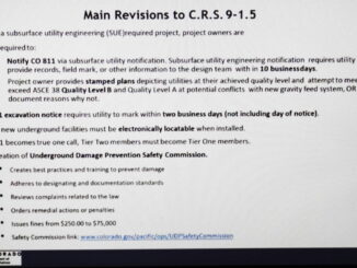
Two states mandate subsurface utility engineering surveys during pre-construction
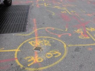
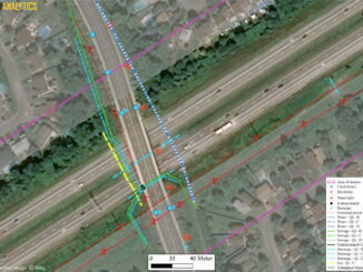
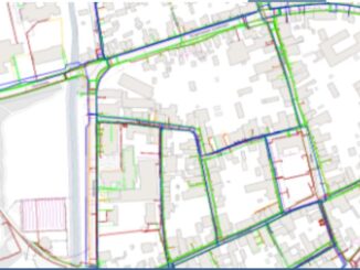
A major gap in the construction process is the unavailability of reliable information about the location of underground utilities during the design stage of civil engineering construction projects such as highways and pipelines. All states […]