• facebook
  • Twitter
  • Linkedin
  • Youtube
  • Linkedin Group
  • Post a Job
  • Post an Ad
  • Post an Event
  • Post a Directory Listing
  • Post a Press Release
  • Media Kit
  • My Account
  • Shopping Cart
  • Login
GoGeomatics
  • MAGAZINE
    • BIM & GIS
    • Community
    • Conference news
    • Earth Observation
    • Education & Careers
    • GEOAI
    • Announcements
    • Reality Capture & Lidar
    • Science
    • Technology
    • Between the Poles
  • Directories
    • ASSOCIATION
    • INDUSTRY
    • EDUCATION
    • Open Data
  • EVENTS
    • GeoIgnite Events
    • Events Calendar
    • GoGeomatics Meetups
  • Services
    • Advertising
    • Marketing
    • Post a Job
    • Post an Ad
    • Post an Event
    • Post a Press Release
    • Post a Directory Listing
    • Media Kit
    • Web Design
  • Find a Job
  • Volunteer
    • Start a GoGeomatics Group
    • Editors & Writers Group
  • About Us
    • About Us
    • Contact Us
    • Frequently Asked Questions
  • Videos
HomeGEOAI

GEOAI

Community

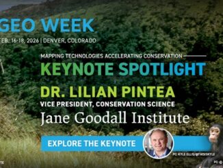
Dr. Lilian Pintea of the Jane Goodall Institute to Deliver Keynote at Geo Week 2026

11 December 2025 GoGeomatics Canada | 3D

“Mapping Technologies Accelerating Conservation” Spotlights How Geospatial Tools Drive Real-World Impact”s Denver, CO – December 11, 2025 — Geo Week announced that Dr. Lilian Pintea, Vice President of Conservation Science at the Jane Goodall Institute […]

BIM & GIS

Stories That Shaped the Geospatial World: A Conversation with GPS Pioneer Charlie Trimble

8 December 2025 Farzaneh Farshad | AI

When the history of geospatial technology is told, a handful of people stand out as architects of the modern world. Among them is Charlie Trimble, founder of Trimble Navigation and one of the most influential […]

BIM & GIS

Conversation with Bryn Fosburgh at GoGeomatics Expo 2025

8 December 2025 Farzaneh Farshad | #AIinGeomatics

At CalgaryExpo 2025 after the “Geomatics Through the Generations” by Charlie Trimble, I sat down for a deeper conversation with Bryn Fosburgh, Senior Vice President, Trimble, and a thought leader in the geospatial industry. Bryn’s […]

Earth Observation

National Elevation Data Strategy: A Decade of Innovation and Progress

27 November 2025 David Belanger | Building Footprints Automatically Extracted Buildings ArcticDEM

In 2015, Natural Resources Canada (NRCan) launched the National Elevation Data Strategy (NEDS), a bold initiative to modernize Canada’s landmass data foundation. Ten years later, the NEDS has become a cornerstone of Canada’s geospatial ecosystem, delivering […]

BIM & GIS

International Geospatial Digest Nov 17, 2025

17 November 2025 Volunteer Editors and Group Writers | 3D Mapping System

Misinterpreted Google Earth Image Sparks Viral Claims Amid Sudan Conflict Mapping Britain on Foot: One Man’s 1,600-Mile Quest for Google MIT Develops Rapid 3D Mapping System for Search-and-Rescue Robots GIS Adoption Accelerates as Japan Strengthens […]

C-Suite
BIM & GIS

Inside the C-Suite Conversation Shaping Canada’s Digital and Geospatial Future

13 November 2025 Anusuya Datta | BigGeo

As Canada’s geomatics and Earth Observation leaders gathered in Calgary for the C-Suite Panel at GoGeomatics Expo 2025, the timing couldn’t have been more fitting. The session had been planned around a clear signal from […]

Canada budget 2025
BIM & GIS

Sovereignty by Design: What Canada’s 2025 Budget Means for Data, Space and Geomatics

11 November 2025 Anusuya Datta | Artificial Intelligence

Budget 2025 doesn’t specifically mention Earth Observation or mapping, but its investments in digital, defence, and launch infrastructure make geomatics central to how sovereignty will be implemented in practice. Canada’s 2025 Federal Budget, tabled on […]

BIM & GIS

Cross-Modal Reasoning at Planetary Scale: The Rise of Google Earth AI

7 November 2025 Alefiya Dungrawala | BigQuery

As the planet’s challenges intensify, human innovation rises to meet them. However, unlocking timely and actionable insights from the vast volumes of Earth observation data demands more than traditional GIS platforms, which often face limitations […]

Posts pagination

« 1 2 3 4 … 17 »

Events

Notice
There are no upcoming events.

View All Events

Services

  • Post a Job
  • Post an Ad
  • Post an Event
  • Post a Directory Listing
  • Post a Press Release
  • Media Kit
  • My Account
  • Shopping Cart
  • Login

Jobs

Post a Job
  • Asset/GIS Coordinator
    Edson, AB
  • Senior Manager, Data Science – Geospatial
    Mississauga, Ontario
  • AI Manager
    Brampton, Ontario
  • Asset Management Coordinator
    Bracebridge, Ontario
View All Jobs
  • Directories
    • Associations Directory
    • Industry Directory
    • Education Programs
    • Open Data
  • Volunteer
    • Start a GoGeomatics Group
    • Editors & Writers Group
  • About Us
    • GoGeomatics Media Kit
    • Who We Are
    • Contact Us
    • FAQ’s
    • Advertising
    • Marketing
  • Subscribe
GoGeomatics
GoGeomatics is the largest and most popular communications hub promoting the Canadian geospatial community. The business was incorporated in 2011. GoGeomatics hosts over 100 fun, free, location technology networking events each year in cities across Canada.

© 2026 GoGeomatics

  • facebook
  • Twitter
  • Linkedin
  • Youtube
  • Linkedin Group