Mountain Pine Beetle Monitoring and The Lumber Industry
North America’s forests are a fundamental ecosystem that not only house important species diversity, but also acts as an essential resource. Forests also act as a carbon sink, which helps maintain the carbon cycle in their environment (Forest Carbon Facts, Government of Canada). Maintaining North America’s forests is arguably greatly needed due to the active and passive reliance on the resources that are provided. As a focus area, this article will look particularly at the range of lodgepole pine located along the north western parts of the United States and Canada. The figures below best demonstrate the focus area.
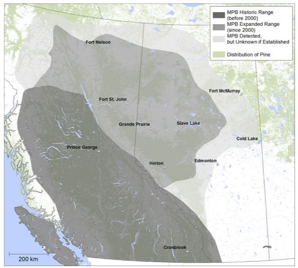
Figure 1. The historic range (before 2000) and expanded range (after 2000) of MPB in Canada. (https://www.nrcan.gc.ca/our-natural-resources/forests/wildland-fires-insects-disturbances/top-forest-insects-and-diseases-canada/mountain-pine-beetle/13381)
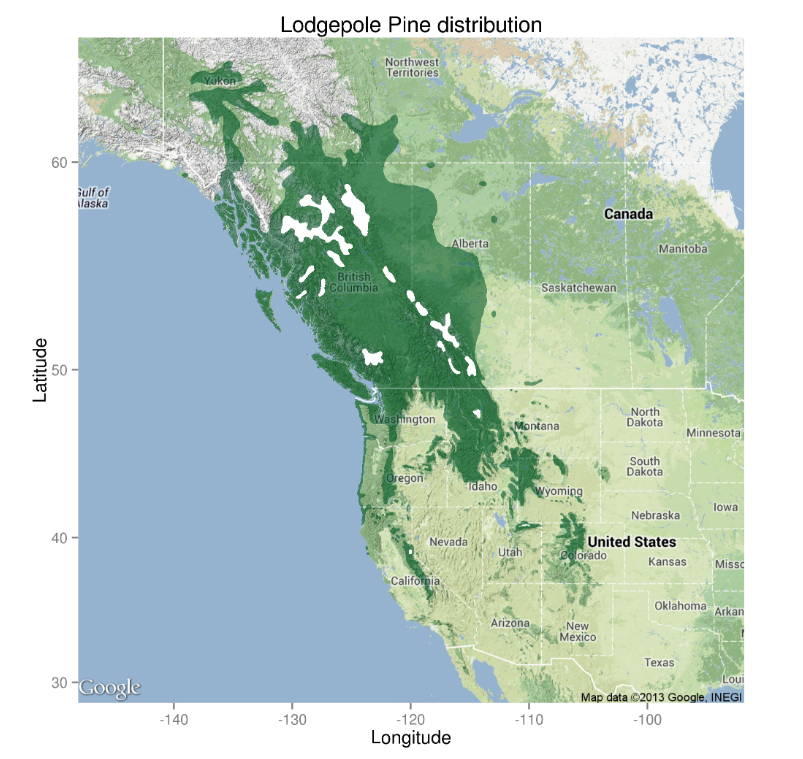 Figure 2. Pinus contorta range map including all subspecies. White areas within the distribution boundary contain no lodgepole. (https://scisus.org/tag/pinus-contorta/)
The main reason for this focus area is to address that these forests, which provide the benefits listed above, are currently being heavily impacted by the spread of mountain pine beetles. These beetles in particular attack pine when their numbers exceed the pines ability to form its natural defences by using toxic resin (Mountain pine beetle facts and research, Government of Canada).
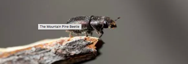
Figure 3. The Mountain Pine Beetle: What Lumber Companies Need to Know
(https://www.wagnermeters.com/forest-products/industry-info/mountain-pine-beetle-what-lumber-companies-needs-to-know/)
Mountain pine beetle attacks have been steadily increasing and monitored since around the 1960’s and spread further south indicated by studies conducted around the early 2000’s. Additionally, warming trends in these ecosystems have given rise to greater population numbers for pine beetles since they thrive in hot dry summers and mild winters (Government of Canada, Date modified: 2022-04-14, https://www.nrcan.gc.ca/our-natural-resources/forests/wildland-fires-insects-disturbances/top-forest-insects-and-diseases-canada/mountain-pine-beetle/13381). This spread is cause for concern, as it affects not only the ecosystem and carbon cycle within and around these regions, but also peoples livelihoods that depend on the forestry industry.
It should also be noted that these increased attacks and deaths of lodgepole pine have also increased the likelihood of forest fires. With growing numbers of dead, dry wood littering forest floors, natural fires spread fast. Additionally, milling pine beetle affected wood can and has caused combustion events at mills (Larry Loffer ,June 8th, 2021, https://www.wagnermeters.com/forest-products/industry-info/mountain-pine-beetle-what-lumber-companies-needs-to-know/)
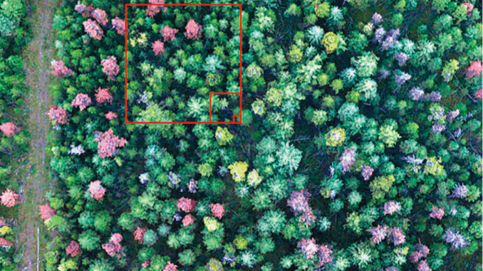
Monitoring tactics that are being used to track the spread involve the combination of GIS and Remote Sensing. By utilizing remote sensing software, we are able to detect sick trees in a study area before they begin to show physical signs. The figure below shows an example of using remote sensing to help identify infected and dying trees apart from healthy counterparts.
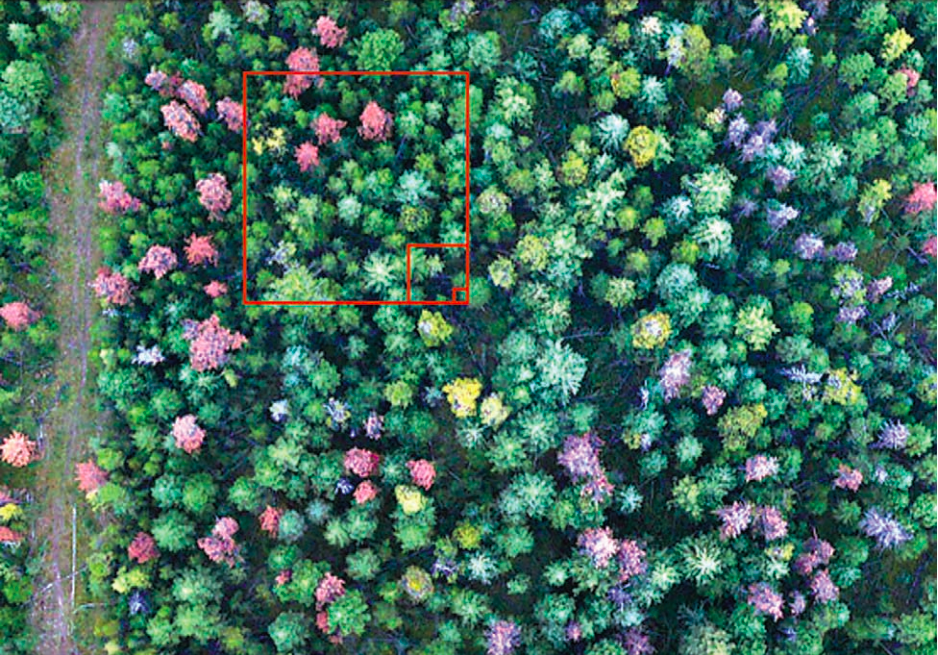 Figure 4. Illustration of information content of three common image spatial resolutions of 30×30 m, 4 x 4 m, and 1 x 1 m. Larger pixels tend to amalgamate a greater variety of stand elements. Underlying image is a true-colour digital photograph (Michael A. Wulder, Caren C. Dymond, and Joanne White, Natural Resources Canada, 2005).
By using remote sensing tactics, identification is very feasible. Different stages of the attacking process have been monitored using remote sensing and have been quantified. Green, Red, and Grey attack research represents the different stages the tree is undergoing in the attack process, as well as what level of resolution needed to effectively conduct a report. Where green needs high accuracy and resolution, red being the best time, and grey being mortality assessment surveys (Michael A. Wulder, Caren C. Dymond, and Joanne White, Natural Resources Canada, 2005). Additionally, a recent pilot study conducted in the Rocky Mountain region of Grand County, Colorado, USA have yielded results of approximately 80% (Lu Liang,Yanlei Chen,Todd J. Hawbaker,Zhiliang Zhu, andPeng Gong, 18 June 2014). With this study being conducted in 2014, it can be inferred that the tactics and accuracy have only increased in effectiveness.
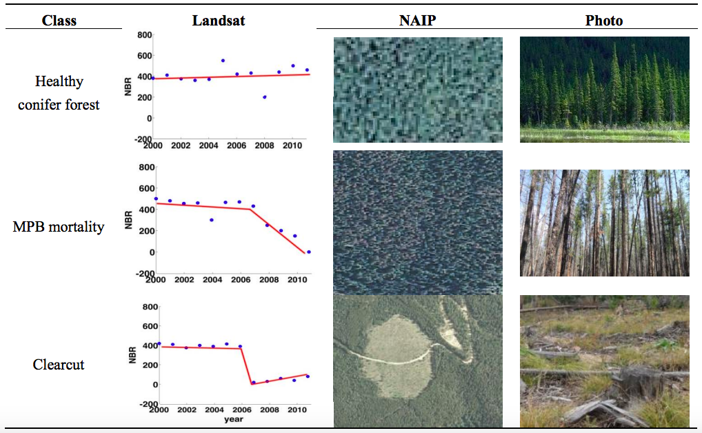 Figure 5. Examples of normalised burn ratio (NBR) trajectories, National Agricultural Imagery Program (NAIP) data and in situ photos for healthy forest, MPB mortality and clearcut classes. (https://www.mdpi.com/2072-4292/6/6/5696/htm)
By understanding the involvement forests have on Canadians and Americans and how the rapid spread of pine beetles has caused concern and attention, as well as the surveying and GIS/remote sensing technology involved, we can now discuss tactics and future possibilities these forests will go under.
With the government of British Columbia’s Forestry Waste and Residue program getting traction throughout the province, now is a good time to implement pine beetle impacts into the surveying process (Government of BC, Residue and Waste. August 1, 2022). As a short introduction to the waste and residue program; the main purpose is to “process of measuring the volume and quality of standing or felled timber that is not reserved from cutting and remains on site upon the completion of primary logging of each cut block”(Government of BC, 2022). This program utilizes GIS mapping and statistics to monitor waste and better control poor logging practises.
When implementing changes that impact people and companies, certain tactics work better than others. For instance, providing a reward system encourages the pursuit of the goal, rather than a penalty system which encourages working around loopholes. Related to the subject of Boreal forest protection, a potential reward system to implement some form of deductibles for lumber companies, if they choose to team up with forestry management companies and environmentalists. This partnership can lead to a mutually beneficial goal, while maintaining production on the industry side. The tactic itself would involve using environmental knowledge and remote sensing to find target areas before the infection spreads. By giving these areas high priority locations for lumber companies, they can contain the spread while getting access to lumber that has yet to reach a point of being poor quality. This tactic can also reduce the amount of waste built up in zones that would otherwise have increased forest fire risk.
The discussion can also focus on future ecology changes, good and bad. Although the increase in pine deaths is a cause for concern both for fire risk and sustainability of the historical ecosystem, this change has the potential to build a new ecological system. By having large numbers of pine die, this can pave the way for a more “structurally and compositionally diverse forest stands” (Amalesh Dhar, Lael Parrott, and Christopher D.B. Hawkins, 5 August 2016). This potential ecological resistance could help change future outcomes and mitigate increasing dead pine as well as forest fire spread.


Be the first to comment