
Open Source GIS for Everyone: A QGIS-based program at Langara College Vancouver
This article is the first in a monthly GoGeomatics Canada series on topics related to Open Source GIS for Everyone, by Rick Davidson and Jim O’Leary, Continuing Studies (CS) instructors at Langara College in Vancouver, B.C. This column will focus on QGIS and other Free and Open Source GIS Software, especially as it is used in Langara’s Geographic Information Systems CS Certificate program.![]() The invention of the printing press in 1440 AD caused an incredible explosion of ideas and learning across the world that continues to this day. Before the printing press reading was restricted primarily to the wealthy, the powerful, and the clergy. After the printing press, everyone had the opportunity to read.
The invention of the printing press in 1440 AD caused an incredible explosion of ideas and learning across the world that continues to this day. Before the printing press reading was restricted primarily to the wealthy, the powerful, and the clergy. After the printing press, everyone had the opportunity to read.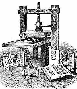
But not everybody could print. Until the 20th century printing presses were massive devices that only a few could afford. It fell to the invention of photocopier before the technology of printing became available to the common man. Now almost everyone in wealthy nations can read and access a printer.
The similar revolution is happening in the GIS world– right now. There have been amazing developments in the fifty years since Roger Tomlinson coined the term “GIS”. We have learned so much about the earth in this time, and so many tools have been developed to help us attain and manage this knowledge.
Until now the learning of GIS has not spread as widely as it could, in large part because of the high cost of GIS software. The benefits of GIS have been limited to large organizations, governments, and academia. Where is the GIS for the average person?
In September 2013, QGIS 2.0 was released, answering the question posed above. This GIS software, released under a Free and Open Source (Creative Commons CC BY-SA 3.0) license, offers a credible alternative to commercial GIS programs. Now everyone can do GIS, regardless of their budget for software. Individuals, small businesses, charities, political parties, First Nations, journalists and numerous other groups can now harness the power of GIS for their own purposes.
And QGIS gets better with each release. QGIS has caught the attention of the world’s great GIS developers, and new features are being added with each four-month release cycle. Some features are funded by campaign pledges, and some are done by highly-skilled volunteers. It seems that everyone wants to contribute to the development of QGIS.
The US Dept. of Labour saw the potential of QGIS and funded Delmar College in Texas to produce curriculum for learning QGIS that would be, like QGIS itself, free and Open Source. Delmar used feedback solicited from 2,000 professionals in the GIS field to define what skills a professional GIS analyst would need, and poured the results into a five course curriculum set.
We (Rick and Jim) picked up that curriculum and began to adapt it to our local needs, removing content related to the material’s place of origin and adapting it for an audience of students located in Vancouver, B.C. We’ve also added exercises, assignments, and exams appropriate for our academic environment, a certificate program presented by the Continuing Studies Department of Langara College in Vancouver.
The Geographic Information Systems CS certificate program begins at Langara College in January 2016. It is comprised of five courses, each of which has six sessions. The lessons will be a combination of two focuses: fundamental concepts of GIS and hands-on experience with Open Source technologies like QGIS, Inkscape, and GRASS.
The program is aimed at working professionals who already have skills in one area and want to add GIS to these skills. For this reason there will be one class per week. However, whether you are a butcher, baker, or Kindle maker, you are welcome to take this program. Anyone with a good attitude towards learning and a desire to use GIS can understand and learn to harness the spatial tools in this program.
This Geographic Information Systems program is the first of its kind in BC to be delivered entirely using Open Source software. It represents a new frontier for GIS, where spatial tools are available to all, and we are limited only by our imagination.


Open Source GIS is exciting and represents a giant step forward in making GIS Analysis available to all who can use it. Great first article Jim & Rick! I look forward to the others.
The above article is incorrect – while QGIS released under a free and open source license – that license is GNU Public License.
The documentation license (Creative Commons CC BY-SA 3.0) cited may be appropriate for the course materials? It would be more significant to this article if Langera was taking the step of opening up its course materials or joining the GeoForAll initiative to share course content between educational institutions 🙂
Hi Jody,
You are correct that QGIS software is not released under Creative Commons CC BY-SA 3.0. According to the release notes on the QGIS GitHub repository the software “is released under the GNU Public License (GPL) Version 2 or above.”
Creative Commons CC BY-SA 3.0 is the license used for the course materials released by Delmar College and adapted by the instructors of the QGIS Certificate Program at Langara College, Jim O’Leary and I. We will abide by the terms of the license and any distribution of these materials will be under the same license terms.
As to your suggestion that Langara join the GeoForAll initiative, this isn’t anything that Jim or I would object to, but (as far as I’m aware) joining the initiative is not planned at this time. We’re doing what we can for FOSS GIS software by introducing this program and adapting it for a Western Canadian audience.
As one of the co-authors of the GeoAcademy curriculum it’s exciting to see it adapted for this program!