
Recently, I reviewed a report by the Canadian Council of Geomatics on the use of Remotely Piloted Aircraft Systems (RPAS) for geomatics applications here at home. It was based on a study led by NWT Centre for Geomatics with financing from Natural Resources Canada’s GeoConnections Programs. Here is a link to the report LINK
 Its purpose was to the reduce duplication in publications by coming up with an authoritative report on RPAS.
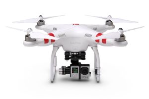
The terminology RPAS, drones and Unmanned Aircraft Systems (UAVs) are often used interchangeably. RPAS was a term originally introduced by Civil Aviation. RPAS is a subset of drones / UAVs that have specific weight requirements which determine if they comply with Canadian regulations. For example an unmanned aircraft is classified as a model aircraft if it is used for recreational purposes and weighs less than 35 kg.
In this report, you can learn about RPAS , their industrial applications, aspects of their technology and associated regulations. It is specifically useful for geospatial professionals planning to use RPAS for commercial applications or others who are somewhat familiar with them. Using drones for recreational uses is not a subject of this report.
As a young GIS professional, I would not recommend reading this report if you do not have a background in RPAS. I found this report to be long and confusing. I was overwhelmed with all the new information it introduced. The report contains many unfamiliar abbreviations. I would suggest printing out list of acronyms and abbreviations as reference while reading.
From an academic point of view, this report gives a good coverage of RPAS in Canada providing the reader with a detailed understanding of the current research and requirements. Specifically, the report discusses RPAS regulations keeping in mind that Transport Canada plans to update them in 2017. The report also describes the use of RPAS in industry by using them for jobs that are dull (boring, repetitive tasks), dirty (areas which have limited ground accessibility) or dangerous (high risk or hazardous sites). It aims to promote increased use of geomatics in the infrastructure monitoring, environmental monitoring, agriculture, emergency management and disaster response. The information in the report is supplemented with tables, figures and graphs.
Drones/ RPAS are everywhere today, you here about them on the news and you can purchase your own recreational drone for under a 100 bucks on amazon.ca. As the awareness of RPAS increases, so does the awareness of Geomatics. The report highlights the need for geomatics in infrastructure monitoring, environmental monitoring, agriculture, emergency management and disaster response. After reading this report, the reader may want to look at how data is currently obtained at their organization and determine if using RPAS in house is a possible cost friendly solution.
—————
Some useful websites for using drones within Canada:
- Unmanned Systems CANADA (https://unmannedsystems.ca/),
- Drones, UAV, UAS and RPAS, Unmanned Air Vehicle on COPA (Canadian Owners and Pilots Association) (https://www.copanational.org/home_page.cfm)
- Waypoint Drone Insights and Inspiration (http://waypoint.sensefly.com/civilian-commercial-drone-uav-legislation-rules-canada/).
- Dronin’ On for some drone related humor (http://www.scoop.it/t/drone-day).


Be the first to comment