
Stephanie Murphy – GIS Analyst for the R.C.M.P
GoGeomatics Canada would like to welcome one of their editors, Stephanie Murphy. Stephanie graduated from Ryerson University with a Master of Spatial Analysis degree. She is now back in Ottawa, Ontario and is currently working for the R.C.M.P. as a GIS Analyst.
GoGeomatics: Hi Stephanie. Where are you from and where did you go to school?

Stephanie: First, I would like to thank GoGeomatics for giving me this opportunity to share my life/career journey to the GIS community. I was born in Montréal, Québec and I was fortunate enough to have lived in other parts of Canada including Prince Edward Island, New Brunswick, and Ontario. Living in these four provinces has exposed me to some of the different Canadian cultures which I found enriching and I believe it personally made me grow into an individual that can easily adapt and is very comfortable with change. I recently moved back to the Capital of Canada, Ottawa, Ontario and I am in the midst of finding a full-time job in my field of study. I moved to Ottawa in grade 9 and went to Gloucester High School. Go Gators Go!
GoGeomatics: Can you tell us about your degrees and your masters?
Stephanie: I am very pleased to say I really enjoyed my university studies.
University of Ottawa – I graduated with an Honours Bachelor of Arts: Major in Geomatics and Spatial Analysis; Major in Geography from the University of Ottawa. When I first applied to this program I did not exactly know what the program entailed but the description provided by the University of Ottawa seemed really interesting. As a result, I ended up loving the program and decided to mainly focus in the physical geography aspect.
Ryerson University – I was really determined and adamant about furthering my studies in this field because I loved it so much that I decided to apply to the master’s degree at Ryerson University. I was accepted in their Master of Spatial Analysis (MSA) program in September 2010. This university caught my interest because of their known “hands-on” reputation and in addition the program offered unpaid field placements during the winter semester to gain work experience in the public or private sector environments. I worked at Canada Post for my placement as a GIS Analyst in their Direct Marketing Department. I was mainly responsible for creating a report template which is now used on the Canada Post’s online targeting solution website for direct mail. The report contained information demystifying data analytics and GIS.
GoGeomatics: Can you tell us the topic of your major research paper for your masters?
Stephanie: I continued to focus in the physical geography aspect where I successfully completed my Major Research Paper (MRP) titled “Identifying and Quantifying the Change of Perennial Snowpacks at Melville Island, Nunavut, Canada” with the help of my advisor, Professor David Atkinson. I collected a variety of data such as IKONOS and Landsat 4-5 TM satellite images, Digital Elevation Models (DEMs), topographic, and meteorological data.
I had to conduct an extensive methodology approach to successfully determine potential changes to perennial snowpack and/or its surroundings. The following diagram illustrates the steps that were taken to complete any necessary preprocessing and the analyses on Cape Bounty and Sabine Peninsula. This required concentrated focus and attention to detail during analyses in order to produce the required accuracy in the results.

GoGeomatics: What was the most challenging part of your master work? Do you have any analysis or maps you can share with us?
Stephanie: I am an individual that likes to be challenged because when I succeed at accomplishing a task it is a rewarding experience for me. The most challenging part of my master’s work was the tedious interpretation of the data when I was conducting my analyses for my MRP.
I conducted a supervised classification for both of my study areas. I chose four separate classes to classify my ground surface landscape; snow/ice, bare/exposed soil/, mesic/wet sedge, and polar desert. The purpose of conducting a supervised classification was to be able to calculate the area extent of the snowpacks over time. However, during my supervised classification, haze/cloud cover and bare/exposed soil pixels were classified as snowcover where this misrepresented the land surface. Hence, I created a mask and significantly zoomed into my satellite images to properly class the ground surface which took a large amount of time.
The following images represents one of my study areas, Cape Bounty and the area (m2) extent of the perennial snowpacks that I was able to extract from PCI Geomatica and calculate in ArcGIS. It may be a difficult to see but each selected perennial snowpack in the 5 concentrated areas had decreased significant in size over a three year period.


GoGeomatics: Were there any memorable experiences you had throughout your University studies?
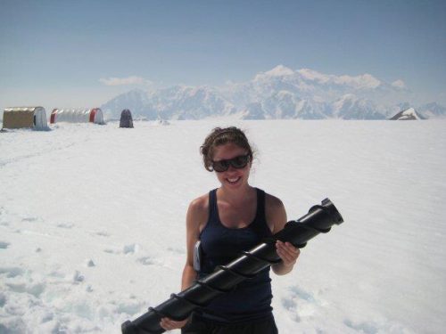
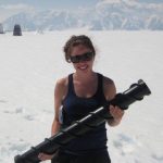
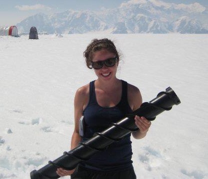
Stephanie: I really enjoy the outdoors and took advantage of the field work expeditions the University of Ottawa had to offer. One of the expeditions was a three week long data collection and analyses study in Yukon and Alaska. We were a team of twelve that had the task of completing several studies on glaciology, fluvial processes, and paleoclimate analyses. I was responsible for collecting data from a glacier fed stream where I measured such things as the velocity and turbidity of the water.

GoGeomatics: Where do you see yourself in the geomatics industry? What would be your dream job?
Stephanie: I am a very active individual and I have a lot of energy so my ideal dream job would relate to a GIS/Geomatics or Remote Sensing position with field work involved. However, I am always open to new experiences.
GoGeomatics: Currently you are working on contract with the RCMP. Can you tell us a little bit more about what you are doing?
Stephanie: I am currently working for the Royal Canadian Mounted Police as a GIS Analyst. I am responsible for providing consultation services in order to build a geospatial layer which will include the R.C.M.P.’s and all Canadian Police jurisdiction boundaries across Canada while using ArcGIS. I appreciate this job opportunity with the R.C.M.P. because it allows me to gain work experience in the Federal Government.
GoGeomatics: Are there any skill sets or areas of interest you have in geomatics you would like to expand?
Stephanie: I am always trying to expand my skills sets and I would like to focus on improving my CAD skills. I plan on registering for an AutoCAD course at the University of Ottawa this summer.
GoGeomatics: We should let everybody know that you have recently joined the GoGeomatics team as an assistant editor. What has that been like? What do you hope to accomplish?
Stephanie: When I first accepted this position as an assistant editor for GoGeomatics I was very excited because I love trying new things and I am a very social person and being able to communicate with professionals in the GIS community afforded me a great opportunity. I am very pleased with the work that I am doing for GoGeomatics and I hope by conducting these interviews for the career blog I can make some professional connections and gain some insight on how these individuals have become successful.
To view more on Stephanie’s career background check out her LinkedIn profile: click here. Or you can contact Stephanie at stephanie.nm.murphy@gmail.com.


hi steph, great initiative and nice interview. best wishes for your next career steps.
kind regards from ryerson/toronto,
claus
Hi Stephanie! I was excited to see maps of good old Cape Bounty! I did my Master’s thesis on RS of Vegetation at Cape Bounty at Queen’s, where David Atkinson used to be. Was TA for his Remote Sensing class my first semester…
Fiona Gregory
Canada Centre for Remote Sensing
Wonderful interview Steph. I am sure all of your career goals will come true, you are an inspiration.
Jessica Coleby
Research Analyst InterStratics Consultants Inc
Excellent interview. Keep up the hard work Stephanie.