
Canada

Canadian Geospatial Briefing for October 26th: C-Core wins CSA contract; Coastal Areas sensitivity to oil spills; GIS Day with Western University; Canada’s role in Webb; Fitness with AI Endurance; GHGSat’s Iris methane monitoring
Newfoundland and Labrador based C-CORE has landed a major contract with the Canadian Space Agency. C-CORE, headquartered in St. John recently inked…

GeoIgnite 2020 Video: Diversity in Leadership Panel
GeoIgnite is Canada’s National Geospatial conference hosted by GoGeomatics Canada. GeoIgnite was held online using Zoom July 22nd to 24th,…

Geospatial World Forum 2021 set to be held physically in Amsterdam
Geospatial World Forum, the premier annual gathering of geospatial professionals, is set to be held physically in Amsterdam, The Netherlands…

Geospatial Certifications Survey: GIS, Remote Sensing, Surveying, and Geomatics
GoGeomatics is hosting a survey to ask your opinion on the different certifications available. GoGeomatics is hosting two live events…
David MacLean – COGS GIS Instructor: Recipient GANS 2020 Award of Distinction
The Geomatics Association of Nova Scotia (GANS) is proud to present its 2020 Award of Distinction to a true champion…
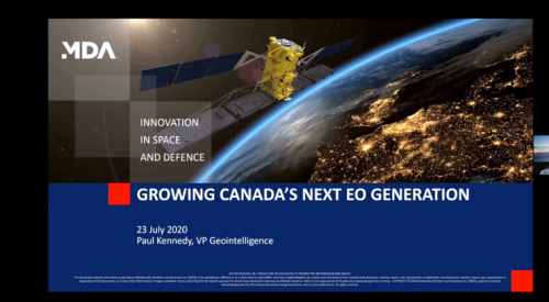
GeoIgnite 2020: Growing Canada’s Next Earth Observation (EO) Generation
GeoIgnite is Canada’s National Geospatial conference hosted by GoGeomatics Canada. GeoIgnite was held online using Zoom July 22nd to 24th,…

OGC Lifetime Achievement Award Goes to Prashant Shukle
A hearty congratulations to Prashant Shukle and his efforts on behalf of the geospatial community not only in Canada, but…

Introducing New GoGeomatics Online Community Managers : Tanya, Celso, Paul, Rosette and Elizabeth
GoGeomatics Canada is over 7000+ subscribers strong with over 1,000 published articles. Our community managers are passionate and committed to…
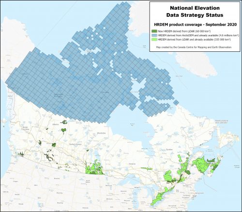
NATIONAL ELEVATION DATA STRATEGY UPDATE
July 2020 STATUS OF THE LIDAR ACQUISITIONS The National Elevation Data Strategy team of the Canadian Centre for Mapping and…

Canada Mobilizing Maps, Data, and Investigative Journalism for Project Pandemic
Access to information should not be determined by where we live. Project Pandemic is a data co-op and collaboration designed…
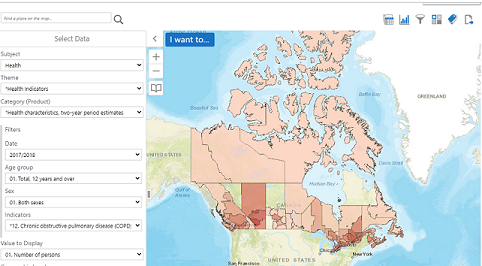
What is the Canadian Statistical Geospatial Explorer?
Statistics Canada produces statistics that help Canadians better understand their country. The agency ensures Canadians have the key information on…

Quantum Spatial Canada Supports Disaster Preparedness on Vancouver Island Through Lidar Survey Covering 9000 Square Kilometers
Located off the Pacific Coast of British Columbia, Vancouver Island is home to just under 900,000 people, as well as…
