
environmental

Ten Years Later: Interview with Wendy MacIsaac one of Canada’s Top Surveyors
Ten years ago, GoGeomatics interviewed Wendy MacIsaac of Midwest Surveys Inc. in Calgary, Alberta, about her career and being a…

M.A. or M.Sc. Opportunity – Environmental Assessment and Resource Mgt
M.A. or M.Sc. Graduate Research Opportunity Department of Geography and Planning University of Saskatchewan Opportunity: The Department of Geography…

May 16: Thunder Bay GoGeomatics Speaker: Rob Rempel – Research Scientist MNRF
You are cordially invited to our fun free event geomatics networking event on May 16th. Tuesday, May 16, 2017 –…

One of the Best Geomatics events in Canada: GeoAlberta 2017
I had a chance to attend the 2017 GeoAlberta conference earlier this month in Calgary, Alberta. This was my first…

Master’s Thesis Student Recruitment: Amphibious Housing in Vietnam
University of Waterloo searching Funded Master’s (MA or MES) research project Dr. Carrie Mitchell (UW-Planning) and Dr. Brent Doberstein (UW-Geography…

COGS NSCC students use Geomatics to explore the history of Black Loyalists & Joggins Fossil Cliff
NSCC students make major impact in two small communities with huge historical significance Students at Nova Scotia Community College’s Centre…

My COGS GIS Education, Part II
In my first article, I introduced the how and why I chose to attend COGS from the fall of 2014…
WEBINAR March 29: GSDI Coastal and Marine SDI Best Practices
COINAtlantic would like to extend an invitation on behalf of the Global Spatial Data Infrastructure (ASDI) Association to participate in…
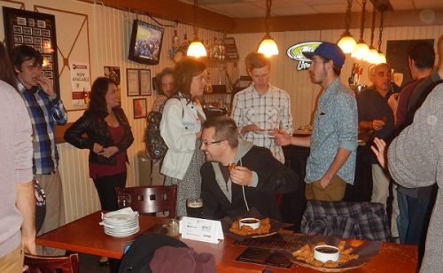
March 2017 GoGeomatics Talks: Toronto, London, Peterborough, Halifax
GoGeomatics Canada has built a thriving geospatial community by creating networking opportunities for our participants. We achieve this by holding free informal…
Free Webinar March 15th: NRCan, OGC, & USGS Arctic Spatial Data Pilot Demonstration
The Canada Centre for Mapping and Earth Observation invites you to attend the Arctic Spatial Data Pilot Demonstration Webinar. Managed and…

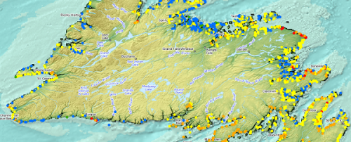
Top Ten Climate Change Maps and GIS Applications
Awareness for climate change has been steadily increasing ever since the Green Revolution in the 1960s. There is a plethora…

UBC Unveils New Masters of Geomatics for Environmental Management
The UBC Faculty of Forestry is excited to announce that the official approval of the Master of Geomatics for Environmental Management…
