
leica

Announcement – Speakers for the Canadian Underground Forum (CUF): Advances in locating and mapping underground infrastructure event at GeoIgnite April 29/30
Without accurate maps of underground infrastructure, every construction project runs a significant risk of schedule and budget overruns and causing…
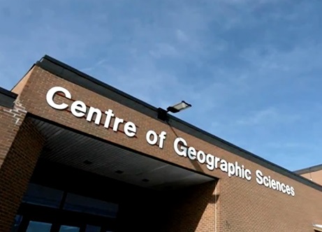
A Look at #COGS Conference in Nova Scotia: Sensors High and Low
The Nova Scotia Community College (NSCC) hosted its third annual Winter conference at the Centre of Geographic Sciences (COGS) in…

Event Recap: The 2017 Canadian Surveyors Conference in Ottawa
On March 1st and 2nd land surveyor professionals, as well as industry exhibitors, headed to Ottawa for the 2017 Canadian…

COGS NSCC students use Geomatics to explore the history of Black Loyalists & Joggins Fossil Cliff
NSCC students make major impact in two small communities with huge historical significance Students at Nova Scotia Community College’s Centre…

Event Recap: COGS & CIG & GANS Cooperate for Mapping Workshop
The Canadian Institute of Geomatics (CIG) Nova Scotia Branch and the Geomatics Association of Nova Scotia (GANS), two regional professional organizations that foster the application of geographic information within the geomatics sector recently collaborated to host a high resolution mapping workshop at the Centre of Geographic Sciences (COGS) in Lawrencetown, Nova Scotia.

Atlantic Canada: COGS: Geomatics Professionals Coming to Discuss High Resolution Coastal Mapping
High Resolution Coastal Zone Mapping This collaborative effort by GANS & the CIG will engage the geospatial community & increase awareness on the value…

Feb 7-8: Two Day Workshop on High Resolution Mapping Along Coastal Zones
The coastal zone, that dynamic geographic region where the interaction of the sea and land occurs, is vital to the…
June Seo: Geomatics Engineering Student at NAIT & GoGeomatics Edmonton Group Leader
GoGeomatics Canada is pleased to introduce June Seo to the community. She is one of the great new group leaders…
Hexagon takes top Honors in the Wichmann Innovations Award at INTERGEO 2015
Hexagon, a leading global provider of information technologies that drive productivity and quality across geospatial and industrial enterprise applications, recently…
PixR3 the new Gexcel imaging software for 3D point clouds extraction from UAV and terrestrial camera images
9th April, 2014, Brescia, Italy — Gexcel Srl, at the 2014 Faro User Meeting (Germany, 3-4 April), has released the…

Prince George BC: Lidar / GPS Terrain Modelling for Ice Jam Emergency Response
Unprecedented ice jams led to extensive flooding in Prince George as temperatures dipped to record lows in the winter of…
Special Announcement at Intergraph Ottawa User Conference
Intergraph Canada has kicked off its User Conferences, with the first of three events in Calgary last week. The show…
