
A GIS is not much use without the data. GoGeomatics turns our attention to Tarin Resource Services in order to share another Canadian geospatial success story. We welcome Kim Koons co-owner of Tarin a leading Canadian owned and operated geospatial data business to the community.
Jonathan Murphy: Hi Kim, and thanks for taking the time to share the Tarin Resource Services story with the Canadian geospatial community. We like to start off by getting to know you and Tarin a bit better.
Kim Koons: Hi Jon, thanks for setting up this interview.

Jonathan Murphy: Can you tell us about yourself. How did you get involved in the geospatial sector first as a career and now as a successful business owner?
Kim Koons: I was born and raised in Northern Manitoba and ended up in the “data game” because of my love of photography. When I went to the University of Winnipeg back in the early 90’s I wasn’t sure where I was headed as far as a career was concerned. As I sat in the registrar’s office studying the calendar I noticed classes called “Aerial Photography”. I mentioned my interest to the counselor and 4 years later I graduated with a BA in Geography and Political Science. My first job after University was with a small GIS company – they had one client – the Town of Morris. The plan was to then attract other towns, but these were the early days of GIS and no one was ready. At this time, I started with a small mapping company and received my advanced diploma in GIS from Red River Community College. I was lucky I came through school before the digital age really began in earnest and was able to learn basic cartographic skills and conventional aerial photo techniques. I moved to Alberta looking for new opportunities in 1999 and since then I have worked in various photogrammetric mapping shops and aerial photo companies, and taught GIS and photogrammetry at SAIT. While I have been called an “imagery guru” my real love is making maps.
Jonathan Murphy: Why are you personally so passionate about data?
Kim Koons: I find the whole geospatial data industry very “cool”. I know that is not a very sophisticated word! A lot of the new tech and advancements in the past 10-15 years have been mostly related to the collection and use of geospatial data. I find it exciting to be part of an ever-changing industry that is always pushing the limits. I also really enjoy being able to provide my clients what they need to make their projects run smoothly.
Jonathan Murphy: Tarin is a major player in the geospatial data market in Canada. How long has Tarin been in business? Can you tell us the names of a few of your clients?
Kim Koons: Tarin was started in 1993 to provide aerial photography to those that needed it in an economic way. Initially that meant fostering partnerships with Forestry and Municipalities, to help them better access their land holdings and to better plan for the future. We were the first, and for a long time the only private company to own a large library of data in western Canada. 
We have many clients, in many different markets – I love it when we get to show a new industry how imagery can solve their problems. Earlier this year we did that with an insurance company, Charles Taylor Adjusting, and they were blown away by how much easier it made their jobs. We have well over 300 clients that utilize us on a regular basis including the Alberta Government, West Fraser Mills, CNRL, Husky, Cenovus, Meridian Surveys, Wood PLC, Ducks Unlimited, Stantec, Golder, Caltech Surveys and well over half of the Counties and Municipal Districts in Alberta.
Jonathan Murphy: What are the most popular types of data you provide to customers? What do they ask for the most?
Kim Koons: Data types include orthophoto, stereo images & aerial triangulation, historical images and LiDAR. Orthophoto is still our most-sold product, but LiDAR is quickly becoming equally requested.

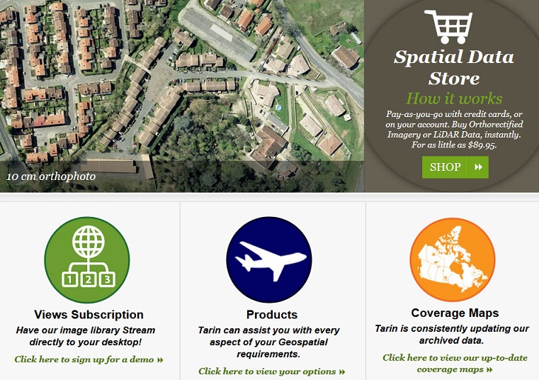
Jonathan Murphy: The Tarin website has a subscription service. Can you describe that for the readers?
Kim Koons: Subscribing to the dataset allows the user to stream the most up-to-date imagery directly into their mapping systems, without having to manage the data on their own. We offer subscriptions to 3 different services: 2 aerial imagery services – MapCast & Views (these services have high resolution 30-40cm imagery covering western Canada), and 1 satellite service, Planet Spot (this is a complete mosaic at 1.5m covering most of Canada).
Jonathan Murphy: Do you provide any value added services or is it just a clip, zip and ship type model? If you do value added, what are those services?
Kim Koons: We do offer custom mapping and GIS solutions to our clients that do not necessarily need the actual data. For example, town visitor maps, elevation analysis like viewsheds and pipeline profiles or online applications for vegetation management.
Jonathan Murphy: How does Tarin thrive and grow when more data providers like the European Space Agency are providing data from platforms like Sentinel free of charge?
Kim Koons: With the move to streaming services, free data is welcome. People are now paying for the delivery service rather than the data itself. Open datasets work well in the streaming service model since the whole idea behind open data is to make data accessible so that companies can add value to it by creating a new service.
Jonathan Murphy: What makes Tarin special and sets it apart from other data providers?
Kim Koons: Tarin is special because it is the only company in western Canada that has partnerships with all data owners. When a customer calls with a specific request, I can check with all players in the industry, including provincial and federal governments, and quote them on everything available in that area of interest. If there is nothing that fits their needs, we can then manage the acquisition of that data, be it LiDAR, Aerial Photo or Satellite. But what really sets us apart is our Team – we excel at customer service, which is what keeps our clients coming back!

Jonathan Murphy: What do you see in terms of change and innovations on the horizon in the geospatial data business in Canada?
Kim Koons: I do think that in the not too far future all data will be owned by one or two big companies–Apple and Google come to mind–and that all data will be free. We will be selling the information gained from the data instead of the actual pixels.
Jonathan Murphy: Do you get asked for a lot of free data from students and non-profits?
Kim Koons: We often provide data free of charge to students and researchers at institutions such as SAIT, University of Calgary, and St. Francis Xavier.
Jonathan Murphy: We appreciate you taking the time to talk to GoGeomatics Canada and discussing Tarin Resources Services.
Kim Koons: Thank you very much for getting in touch with me and giving us the opportunity to tell the geomatics community in Canada about Tarin. I think the more we can foster open collaboration with the industries that use the data and those collecting the data, the stronger we all become.
Visit the Tarin website here to see all of their data and service offerings.


Be the first to comment