
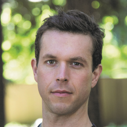
This installment of our ongoing series on GIS and education in Canada features GoGeomatics talking to Dr. Trevor Jones, the Program Coordinator for the Master of Geomatics for Environmental Management (MGEM) program and lecturer in Forest Resources Management at the University of British Columbia.
Jonathan Murphy: Hi Trevor. Thanks for taking the time to talk to the GoGeomatics community about your career and work at UBC coordinating the MGEM program. Let’s get started. Where are you from and where did you go to school for geomatics?
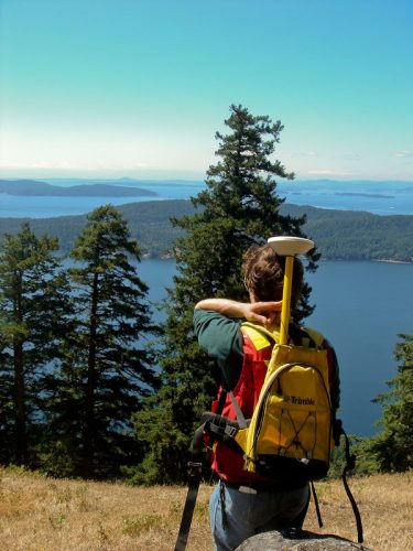
Trevor Jones: Hi Jon, thanks for having me! I’m originally from the outskirts of Utica in central NewYork State. I received a BA in Geography and MA in GIS from Clark University in Worcester, Massachusetts. For my PhD – through the Integrated Remote Sensing Studio in the Faculty of Forestry at UBC – I used airborne lidar and hyperspectral data to improve terrestrial ecosystem mapping in BC’s Gulf Islands National Park Reserve.
Jonathan Murphy: Can you tell us about your first geomatics job? What was it like and what did you do?
Trevor Jones: I worked for the marine conservation NGO Blue Ventures in Madagascar to help establish a mangrove conservation program (Blue Forests) to diversify and sustain livelihoods, safeguard biodiversity and mitigate climate change through conservation, restoration, and managed-use. I first led national-level mapping and dynamics assessments to identify loss hotspots. This led to helping recruit, train and manage a team to conduct detailed mapping and biodiversity surveys within hotspots. The position involved working with / training Malagasy and international scientists and students as well as local community members. It further involved helping manage all things geospatial for Blue Ventures.
Jonathan Murphy: Why are you passionate about geomatics?
Trevor Jones: I am fascinated by the interconnected relationships that humans have with their surroundings – whether natural or highly humanized landscapes. Geomatics provides the tools, techniques and datasets required to properly characterize landscapes and ultimately tackle complex environmental management challenges. Geomatics empowers people to better understand past and current relationships and optimize future planning – this holds true for anywhere people live in the world.

Jonathan Murphy: You coordinate a very interesting geomatics program at UBC. Can you tell us about it? What is the MGEM and who should take it?
Trevor Jones: The MGEM is a 9 month course-based program in the Faculty of Forestry. It uniquely blends technical skills (GIS, remote sensing, spatial statistics, programming, writing) with professional development (project management, leadership & sustainability, entrepreneurship, policy analysis) and is grounded in the appropriate landscape ecological backdrop. It goes beyond technical training to help contextualize the application of geomatics to actual pressing environmental challenges. These skills and their informed application are pertinent to just about any landscape – from forests, to cities, to agricultural systems, to intertidal areas. We welcome applications from a diversity of backgrounds, including professionals in related fields (e.g., forestry, geography, environmental science) who are looking to enhance their skills, professionals from unrelated fields (e.g., computer science, engineering, mathematics) who are looking to apply their skills in new ways, and recent graduates of undergraduate programs with at least some quantitative components.
Jonathan Murphy: What is the history of this Masters program? How old is it and how did it get started?
Trevor Jones: We are in our second year of the program – our first cohort graduated this past May. We had 29 students in year 1 and currently have 27. The MGEM started based on a recognition that existing Master’s programs either focused on technical skills or the related ecological theory/context. No program focused on blending the two. In addition, our program further helps prepare graduates for a diversity of collaborative scenarios through professional development training. We believe this combination is timely, novel, and crucial for optimally preparing graduates for real-world scenarios.
Jonathan Murphy: What type of jobs have graduates of the program gone on to get after they complete?
Trevor Jones: It’s very exciting to see what our first cohort is up to! Our May 2018 graduates have gone on to work in geomatics-related jobs across several sectors, including government (Remote Sensing Technician; GIS Analyst – BCFLNRO), private (GIS Analyst – FYBR Solutions), Forest Resources (GIS Analyst – TimberWest), Integrated Resources (GIS Analyst – GeoTerra) and NGO (Mapping & GIS Technician – Firelight Group). Several of our graduates have also continued in academia as Research Associates and PhD students.
Jonathan Murphy: Thanks for taking the time to share your program with us, and also for being one of our GoGeomatics Vancouver groups sponsors for this year. Your sponsorship supports the GoGeomatics Meetups, where students can meet and mingle with professionals each month in Vancouver. Click here to visit our Vancouver Meetup group and the date of our next free social.
Trevor Jones: It’s my pleasure to talk about the program, and it’s MGEM’s pleasure to help sponsor monthly GoGeomatics events – these monthly meetings are a fantastic opportunity for everyone in the Vancouver geomatics community to interact and network and we will gladly continue to promote the event series!
For information on the MGEM Program and how to apply, please visit this site:
https://pm.forestry.ubc.ca/programs/master-geomatics-for-environmental-management/


Be the first to comment