
In the news: Climate data and those who can access it, LiDar mapping at work in the Okanagan, and Business Forecasts for Urthecast and MDA
In geomatics news this week, we look at ongoing debates on data—specifically, climate data—and watch the fortunes two geospatial companies go in drastically different directions.
A Dim Forecast for Urthecast
Vancouver-based earth observation company Urthecast faces financial crisis according to their 2017 financial results, which reveal that the company’s revenue has dropped by 63.7% since 2016. From the resignation of CEO Wade Larson to the company brokering the private placement of up to CAD$35 million in subscription receipts with Clarus Securities, is Urthecast in a downward spiral?
Has Urthecast hit the deadend?
Sunny Future for MDA Maxar 
Having better luck in business is MDA (a Maxar Technologies company), who announced the recent signing of multiple geospatial contracts involving RADARSAT-2 satellite information in land and maritime monitoring. The contracts, which have an overall value of $16 million, will extend the provision of RADARSAT-2 information to EarthSTAR Inc., Canada’s Department of National Defence, the European Maritime Safety Agency, and various oil and gas customers.
A Map of Our Changing Climate
The Climate Atlas of Canada is an interactive website that makes the consequences of climate change accessible to Canadians. Based on data for 2,000 regions across Canada, the map gives users tools to compare temperature changes, understand high/low carbon scenarios, and watch documentaries on the correlation between climate change and extreme weather events like forest fires and flooding.
New atlas shows projected impact of climate change across Canada’s major cities
A Fresh Image for the Okanagan 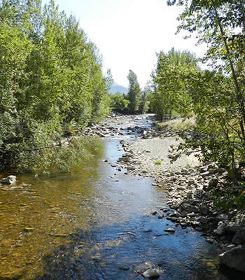

The kind of technology that built the Atlas is also at work in the Okanagan Basin. Okanagan has historically had only a handful of outdated maps of its terrain—but that’s about to change. The Okanagan Basin Water board will be using LiDar to map the floodplain and use that data to predict the movement of water and its impact on the communities of the basin. Wastewater treatment, land use planning and other infrastructure are about to get an information upgrade.
Okanagan will use LiDAR to map flood plain
New Horizons in Compatible Software
Open source software is one of the best things to happen to the geospatial sector. It works smoothly in tandem with pre-existing software architectures, with numerous benefits including cost savings, more flexibility, more technical agility, and greater opportunities for users to develop skills. Open source is quickly becoming the standard infrastructure software for its compatibility with modern IT, and Anthony Calamito gives tips on where to start with the technology.
Hybrid GIS Architectures: The Best of Both Worlds
The Debate on Data in a Climate Context
While experts point to the need for stricter personal data regulations in the wake of probes into Facebook and Cambridge Analytica, satellite data related to the changing climate remains out of reach for most citizens. Valuable information is available on climate change, weather, natural disasters, agricultural development—but only if governments make it available to those who can use it.
Half of Earth’s satellites restrict use of climate data
CCMEO and ArcticDEM Take a Major Step in Elevation Data
Augmenting their National Elevation Data Strategy, the CCMEO will be integrating elevation data from the ArcticDEM project. This is a public-private initiative led through the United States’ National Geospatial-Intelligence Agency and National Science Foundation. This new elevation data for science support and decision making in the Arctic, including geology and climate change monitoring. It represents an important advance in national elevation data.
CCMEO’s Elevation Data Revolution: Part 2 – ArcticDEM development
Subscribe at the bottom of the page to the GoGeomatics the newsletter the Canadian Spatial Times to stay up-to-date on the latest news from the sector.
Be the first to comment