

What is the Difference Between Geomatics and Geography?
There seems to be great confusion between these two great disciplines, especially noting that some geographers and schools claim that Geomatics is a geographical science when it is not. There has been a general confusion over the term Geomatics since its adoption in the mid-eighties. Let’s look at some general definitions one can find on the web to help understand the matter.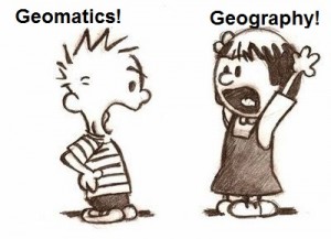
Geomatics (from the University of New Brunswick) comprises the science, engineering, and art involved in collecting and managing geographically-referenced information. There are some typical specializations:
- Geodesy is the science of mathematically determining the size and shape of the earth and the nature of the earth’s gravity field.
- Cadastral work consists of geodetic and engineering surveys, survey law, land use planning, hydrographic surveying, and skills required for determining property boundaries and the measurement and analysis of land related information.
Geography (from the University of Calgary) focuses on places and spaces, on humankind’s stewardship of the Earth, and on the inter-related problems associated with urban, environmental, economic, political, and cultural change.
Geography as a discipline can be split broadly into two main fields:
- Human geography – focuses on the built environment and how humans create, view, manage and influence space.
- Physical geography – which examines nature and how life, climate, soil, water and landforms produce and interact.
So though geography and Geomatics do overlap, Geomatics is an engineering applied science involving measurement of the earth whereas geography is a social or humanities science studying human influences on the earth.
One point of confusion is that both fields use Geographic Information Systems (GIS) to display and analyze data. A misnomer that exists (and is the fault of many schools that market GIS programs) is that GIS is a profession, when it is truly a toolset. For example, there are many people with the title ‘GIS Analyst’ when really they are geologists or archaeologists or geographers or surveyors or some other kind of specialists who happen to use GIS as a part of their work.
Lately the term “geospatial” has also become popular, muddying the waters even further. To break down the term, ‘geo’ is of or relating to the earth and Spatial is of or relating to space, or more specifically relating to the position, area or size of things.
Therefore, geospatial has to do with relating geographic position and characteristics of features on, above or below the earth’s surface. Based on that, geospatial rightfully belongs more fully in the domain of Geomatics as pertains to measurements. Geography also measures, but only to support the study of human interactions, not for measurement for the purposes of engineering. An adage that is floating around states that 80% of all data has a spatial component. Therefore, it is important to understand spatial relationships from an engineering point of view via Geomatics and for the human perspective via Geography. One can analyze the data from either perspective with GIS, especially as GIS is great for connecting non-spatial data with spatial data and can generate unique realizations of the data once it has been spatialized. For example, take a highway network. From a Geomatics perspective, one would be interested in the slope of the crown of the road for drainage and the radii of curvature and superelevations of the curves to allow safe transit by vehicles as well as the ability to survey such a road for the purpose of construction. Geography would be more interested in the network capability and the ability of such a roadway to convey people from one point to another.
So why do I even bother to try to differentiate these fields? Geomatics, being a relatively new term, has suffered an identity crisis – most people have no idea what it is. Mention survey engineering or civil engineering (as survey is technically a specialization of civil), and people envision someone with GPS or a total station out measuring something. And because the field of surveying is a rare exception to be an engineering discipline with its own exclusive practice (most engineering acts specifically exclude the act of surveying as its own form of engineering) it is a very small, but important, niche market that attracts employees that like to calculate and work outdoors in oftentimes harsh environments.
Being a reviewer for my local professional association over the years, a number of people that have a geography-based or GIS-based background have applied for professional credentials in the hopes of securing a professional Geomatics designation. Unfortunately, there generally is not enough overlap between Geomatics and their own backgrounds for which they are routinely denied the desired credentials to their great frustration. They are generally offered reclassifications to upgrade their skillsets, which typically involves completing additional engineering-related training and/or experience. Although I can empathize with these applicants, the proper relevant skillsets must be in place in order to achieve such a credential.
So in the end, although there is much overlap between tools used by practitioners of Geomatics and geographers (GIS, remote sensing, GPS, etc.), one must carefully distinguish that these two fields are significantly different enough that they cannot be considered the same. Not that we can’t all work together to get things done.


This post should make for interesting debate. I’d like to learn of the true origin of some terms here: GIS, geomatics, geospatial. Would that clarify things?
I suggest you review the article in relation to the evolution of GIS, geography and geomatics in http://www.slideshare.net/armando_guevara/on-the-evolution-of-gis-and-the-spatial-enabling-of-information-armando-guevara
While I appreciate the difficulty in trying to forge a commonly understood discipline identity (geomatics), much of this article is predicted on a misleading view of another. Geography itself means “writing of the Earth”. This writing (mapping and spatial analysis) has been occurring for millennia, and is now enhanced by tools and algorithms as provided by Geomatics (matics meaning performing, self-acting). In other words, Geomatics enables us to represent the Earth, and any features on it, and in essence, helps many geographers do Geography. And let’s be clear that Geography is NOT all about the human element as described, for example “Geography also measures, but only to support the study of human interactions”. No. We can certainly apply our techniques and concepts to the physical environment or the human interaction with such, but there’s even more. The same Department website where the author retrieved his definition of Geography states “In our department, faculty members and graduate research teams conduct world-class geospatial research, which includes novel algorithm and tool/model development as well as the analysis of data …”. Note the term geospatial. Geospatial is not limited to a discipline, nor belonging to Geomatics as suggested above. It is a perspective or way of thinking that is critical to both Geography and Geomatics (and others: Environmental Science, Geology etc…. ). Going back to the original definitions (Golledge, Marsh & Battersby, 2008; Ishikawa, 2013), spatial thinking in the geographic and environmental scales is referred to as geospatial thinking to identify the spatial subset and scale that is being considered. That is not owned by a discipline.
Ultimately, I think the main point of the article is that each of the disciplines, while closely related, has their own skill sets and competencies that need to be respected. I can agree with that. Hopefully better awareness of both will help.
Golledge, R. G., Marsh, M., & Battersby, S. (2008). Matching Geospatial Concepts with Geographic Educational Needs. Geographical Research, 46 (1), 85-98.
Ishikawa, T. (2013). Geospatial thinking and spatial ability: An empirical examination of knowledge and reasoning in geographical science. The Professional Geographer, 65 (4), 636-646.
While I technically agree with your statement: “A misnomer that exists (and is the fault of many schools that market GIS programs) is that GIS is a profession, when it is truly a toolset”, I think it needs further clarification. Yes, GIS is a toolset, but a large part of that toolset is knowledge; both of the tools themselves, and also of geospatial problem sets and how the tools can be applied to solve them. I “fell into” a GIS career 27 years ago, after dabbling as a university student in the fields of Geology, Biology, Forestry, and Surveying. Although I do not have a professional designation in GIS (let’s not open the debate on “GIS Professional” certification), I do consider myself a “GIS Professional” in the sense that the GIS toolset is central to my career, and I use it to solve an enormous variety of geospatial problems across a broad set of applications. My knowledge has been gained over 10’s of thousands of hours as a GIS Technician, a GIS Programmer, a GIS Analyst, a GIS Developer, and finally, a GIS Administrator. This is quite different from the mass of “GIS Tool Users” out there (Biologists, Geologists, and other -ologists) who operate a GIS only occasionally, using a small subset of the GIS toolset to solve problems specific to their discipline. These are the people I have been providing expert GIS advice and leadership to for the past couple of decades. Make no mistake…they are all professionals. But NOT when it comes to GIS. That’s where I (and others like me) come in.
I think we do a disservice to those of us for whom GIS is much more than a toolset when we discribe it as such.
The Ishikawa study was about a geospatial thinking test with results pointing to the necessity of targeted instruction for geospatial learning. The Golledge article assumes facilitation of learning to comprehend the geospatial environment. Neither is available without purchase nor in the public library, nor are they germane to my opinions above as they have to do with learning and not the two fields discussed in general. Geomatics root is actually geographical informatics, not matics, and was coined in Canada by Michel Paradis. https://www.fig.net/resources/proceedings/fig_proceedings/fig2010/papers/ts08g/ts08g_ipbuker_4229.pdf
And despite the assertion otherwise, respectfully, geography is a study of the Earth from and/or for the human perspective. Geographers indeed use algorithms and scientific processes/tools to do so, but even physical geography is for the benefit of the human race.
GIS, for Mr. Wedler’s benefit, was also coined in Canada by Roger Tomlinson who wished to use computers to analyze Canada’s lands. http://www.esri.com/news/arcnews/fall12articles/origins-of-the-canada-geographic-information-system.html
I’ll just add my own clarification. A GIS is an information system. The original concept and implementation that Roger Tomlinson developed included things like custom built scanner hardware, digitizing tables, reports and other printouts. These were all part of the “Information System”. With the availability of pre-packaged software like ArcGIS or QGis, we often think of these software packages as “the GIS”. I find my students have a much better understanding when they start using the tool kits ( hardware, software, imagery and other data, sensors, GPS …) to develop an information system, geographic. Now here is the question: what do you call a professional who builds information systems that handle geographic data?
I first put hand to mouse in the service of Geographic Information in 1992, not quite 25 years ago. The air then was full of debate on “Geomatics” and “GIS” and what those did and didn’t mean. The only difference I see between then and now is that (slightly) more people have heard the words. As evidenced by this article and commentary the argument itself carries on, with little signs of abating. We’ll probably still be debating it in another 25 years.
My salvo today is a riposte against the sentiment “A misnomer that exists … is that GIS is a profession, when it is truly a toolset.”
Hmmm, indeed. Following this line of reason, Surveying is not a profession, and is just a toolset. Anyone with a bit of money and time can acquire survey-grade tools & equipment and use them, drawing lines on the land in the maps, creating charts and plans. Only Surveyors though can create surveys.
Similarly paint, rollers, brushes and drop cloths are tools for house painting. Anyone with intent and willingness to learn can use the Painting Toolset to good or at least noticeable effect. In the course of life most of us probably will use them even if only for a bedroom or closet.
There are a class of people who are indubitably Painters with a capital P. The ones you want and need when the work and result is important. The professionals who get the job done rightly and excellently. Relegating them to mere “tool users” misses the mark, quite widely.
…
I work in the Geomatics field (perhaps, depends on your stance in the debate). In any case Geomatics is in my job title because my employer put it there. I do not however consider myself a Geomatics Professional, and have no aspiration to be one. I am however, completely and thoroughly, a GIS Professional. Someone who excels at using my chosen tools, and aspires and practices to continually improve my proficiency and skill those tools.
The topic and picture are interesting. But, I strongly disagree one thing. The statement above that “Geography also measures, but only to support the study of human interactions”. Is very wrong.
As the author says, Geography can be distinguished into Physical and Social Geography. Physical Geography learns aboit Geomorphology, Hydrology, Soil Science, Meteorology, and others. GIS or Geospatial is also used in these fields by Physical Geography Expert.
Starting by a definition of an university about a particular science is to much subjective. I can imagine why you write this article, probably to justify the refused applications of those (geographers) who applied for professional Geomatics designation and closing the door for the others who tend to apply! However, let me as a geographer explain the construction of geography shortly. Geography now is constructed (since it started …) with three main field: Physical geography, Human geography and Technical geography. I call the technical geography as the Integrated geography which is a science and engineering discipline as well. So, to me the Technical geography is much more than Geomatics and even Geomatics is a sub-discipline of the Technical geography and nothing more at all (If a bag is a technical geography then geomatics is a pocket of that bag).
To address Rizah Murseli, although provincial governments remain ultimately responsible for public safety and well-being, it entrusts this responsibility to professional self-regulatory associations such as doctors, engineers and others. These organizations have criteria for competent membership as their primary role is to ensure that public safety is of paramount importance. There is no technical geography other than the use of tools by geographers to execute their technical needs. Geography is NOT an engineering science or it would have that word in the title and geographers would also face licensure requirements.
See http://bit.ly/1XIoXN8 for some recent news which is very much related.
Mr Nick Chrisman provides a very nice broad explanation when he addressed the RMIT geospatial sciences program, which, by my definition, would be a geomatics program. Thumbs up to Mr. Chrisman and the other commentators. It is not my intention to trivialize the experience of specific people such as Mr. Ballard and Wilkie when I describe GIS as a toolset, no matter at which level one uses it. Everyone using GIS already has a background and skillset for which they use GIS to solve problems; therefore, they are generally highly skilled and professionals in their own right already and using GIS simply facilitates that work. The analogy is like using Microsoft Office – Microsoft actually offers certified professional designations like GISCI does for GISP, but said designations simply demonstrate a competence that one can use their product to a certain benchmark.
The meaning of these terms and buzzwords depends on time and space, as almost anything does. It have been working with GIS since 1972, so I have seen this term shift and re-shift. I trained as a geographer, working with cartography and other tools of the era. I have also taught in ‘sciences géomatiques’ (at Laval in Canada where geomatics originates) and in geospatial sciences (in Australia). The question of who has the training to do certain work depends on the jurisdiction, so it is not a real guide to anything more than the legal power of certain established groups. Land surveying might or might not be tied to engineering, depending on history. GIS has links to geography in USA, but not everywhere. Some geographer still think that teaching GIS is like teaching typing, much below the level of an academic discipline. Of course some of us beg to differ. As Matt says, we have been arguing about these words for decades (in my recollection at least 40 years). The list of skills and technologies to master has continued to broaden, and the Body of Knowledge is now huge. No single undergraduate degree can encompass all the field, though a few programmes in the world do try. At RMIT, Australia, the geospatial sciences degree took four year and worked with surveying, photogrammetry, remote sensing, GIS, cartography, geodesy and more. There were still thinks we wanted to add in terms of databases and programming. Much of this does not fit in the limited viewpoint of engineering certification (a rather 19th century view of the world).
Yes, Eric, writing from Canada sees the opposition between GIS and geomatics in a way that makes sense in the anglophone provinces. Quebec has its own contrasts, as usual. Géomatique makes more sense in French where computer science is informatique. It is not about automation in any sense, but that is French, and English makes its own twists on terms.
There is a move toward GISProfessionals to obtain certification from https://www.gisci.org/ – rather different approach from the provincial guilds that surveyors operate. Certainly, the legal process needs to regulate who can divide land for sale, a practice that requires substantial training in the regulations of a given jurisdiction. That knowledge is less portable than it should be. The knowledge required to overlay a soils map on a land use map requires different training. Each professional needs to have a bit of humility about what they do not know, and who to ask for assistance on a shared project.
I highly appreciate this intellectual discourse. I am a Kenyan Geographer who suffered from inferiority because of being a Geographer and ventured into the Geomatics world through GIS in order to be considered a Geomatics Specialist….Clearly, I was a confused chap.
Thank you guys. Keep it on
I take exception to many of the comments made related to surveying. The comment by the author related to surveying “it is a very small, but important, niche market that attracts employees that like to calculate and work outdoors in oftentimes harsh environments.” is a total misrepresentation of what a professional surveyor is or does. While there may be a very few people that would fall into that category, professional surveyors are generally in management positions overseeing technical personal that performs the actual observations. They are part of self-governing professions (in Canada) that enjoy a broad range of skills from project management, to historical research and interpretation of boundary law. Statement like the one noted above go a long way to perpetuating the myth that surveyors are the outdoor types only able to measure and calculate. I am proud to be a surveyor involved in senior management that has not been in the field in over 20 years, while at the same time being the architect of several significant surveying related products that have benefited many people in society.
Interesting comments. Mr. Maloney rebuts that professional surveyors don’t spend time in the field even though it appears that he did exactly that, even if it was 20 years ago. It again is not my intent to disparage one’s career, but if a professional surveyor has not been to the field in 20 years, one would wonder how in touch with the field one would be. According to the Ontario Surveyors Act, R.S.O. 1990, Chapter S.29 Section 11(2) reads despite subsection (1), an individual who does not hold a licence under this Act may perform an act that is within the practice of cadastral surveying if he or she does so at the direction of and under the supervision of a licensed member. 2009, c. 33, Sched. 22, s. 11 (14).
How does one supervise without a trip to the field every so often?
In response to Mr. Collins, most surveyors, even when they do attend the field to supervise do so more in a review of the observations and evidence. It is also easy to review closures, etc. in the office to understand if observations are correct and checks have been performed. In my case I have not signed a plan in 20 years, therefore not requiring me to be in the field. I have been in senior management positions with surveyors reporting to me. Surveyors do far more than measure!
Now that is something to which I can agree! Surveyors, especially venerable ones like Mr. Maloney, indeed do much more than measure and can and do contribute much to the field of geomatics. The original point is what attracts one to geomatics? And I stand by my assertion that, when young, it’s “generally” those people who like a typical mix of indoor and outdoor work and like to use their minds to solve problems.
My reaction to Eric Collins, Geography is a mother subject with construct and concept that have given birth to some specialized aspects of geosciences/geographical. So i disagree with on your view about geography and makes me think you are one of such surveyors who have complex with geographers. Interestingly, your write-up has led to a good debate and applaud your effort but can be misleading. On whether or not GIS/geomatics/remote sensing belongs to what you define as a discipline depends on the spectacle you view it and is opaque to the viewer. Therefore, it strongly depends on the level of knowledge and understanding as either a tool or science. Please, take note of the new paradigm developed at ITC, Enschede, The Netherlands (i.e Geoinformation science and earth observation). This will help you know and appreciate the role geography as a science and art with surveying which is a skill has played in establishing a science that has multi-disciplinary and inter-disciplinary outlook for common good.