
Geospatial tech makes human life easier
During the national conference at the Punjab Remote Sensing Centre on Big Geospatial Data and Analytics, Modelling and Application (BiGMAP), many specialists took the time to discuss the influence Geospatial tech has had on human life.
Dr. B Pateriya, the Director of PRSC, used his welcome address to state that “the national conference was being organised to create a platform for scientists, government officials and students of different organisations to chalk out strategies for appropriate use of geospatial techniques and big data indevelopment planning”.
All speakers and participants, while staying within the guidelines of the purpose of the event, discussed, showcased, and encouraged one another’s interest in space technology, robotics, the role of remote sensing and data collection. This open discussion allowed them to see its current and future benefit on our population.
Geospatial technology has made human life easier, says expert
Core Instrument to Transforming a Country? Geospatial Data.
Mr Drašković, the director of Republic Authority (RGA) of Serbia, was recently interviewed by GIM-International to better understand the role that Geospatial Data has had on his country and more specifically its land administration system.
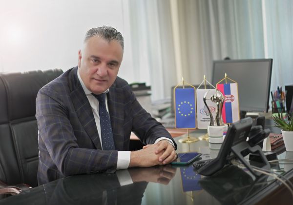
Mr Drašković has recently organized a joint international conference in Serbia to discuss the importance of digital transformation of state and society while focusing on digital spatial data and its relevant innovative services. The event informed difference stakeholder about the importance of these technologies and the related trends in Eastern Europe.
Serbia has undergone an amazing transformation as a result of his efforts. “The digital geospatial platform for Serbia’s NSDI has been in operation for more than a year, during which time it has gathered over 240 datasets from many institutions in Serbia”
Geospatial Data as a Core Instrument to Transform a Country
Historians Map Migrations with Geospatial Tech
Over the last four hundred years, it is documented that French-speaking settlers traveled to the Quebec region in Canada, in the Louisiana area of the United Stated and throughout the Great Lakes region in North America. Michigan Technological University is working on a project funded by the Social Science and Humanities Research Council of Canada to better understand the influence of “French-speakers on the Upper Peninsula”.
Michigan Tech researchers will use the Keweenaw Time Traveler and a combination of spatial and archival datasets to focus specifically on whether French-Canadians were socially mobile as they migrated from Canada to Michigan’s Upper Peninsula during the period of 1860 to 1940.
In order to better understand their mobility, Michigan Tech’s Geospatial Research Facility has built the Voyageur Research Portal. “The portal has mapping utilities and tools for spatial and statistical analysis, providing capabilities for spatial storytelling. The Voyageur Research Portal will serve as the long-term repository for the project’s data and results as well as a space for collaboration and sharing the research with communities in the diaspora.”
C’est La Vie: Historians Map French-speaking Migrations with Geospatial Tech
MAXAR Develops for the U.S. Air Force
Maxar Technologies announces that they have been granted a $14.2 million contract to develop Red Wing, a cloud-based geospatial intelligence analysis architecture for the U.S. Air Force.
The Vice-President of Global Field Operations for Maxar had this to say on the upcoming project; “Maxar’s broad portfolio of imagery and analytics products simplifies and speeds access to critical information, empowering customers to be more predictive in their decisions and more productive in their daily operations…Red Wing will help to rapidly equip the warfighter with actionable insights to solve dynamic and complex intelligence problems at scale”.
Maxar Selected to Develop Automated Cloud-Based GEOINT Analysis Architecture for the U.S. Air Force


Be the first to comment