Between the Poles – The Geoff Zeiss Archives
Managing DWG spatial data using Oracle Locator
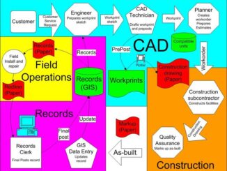
While I was in Brazil I had the opportunity to meet with Carlos Diniz and Fabio Gomes from DigiCADD. DigiCADD has been working with a large telephone company in Brazil, who have been using AutoCAD […]