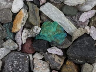
• facebook
  • Twitter
  • Linkedin
  • Youtube
  • Linkedin Group
  • Post a Job
  • Post an Ad
  • Post an Event
  • Post a Directory Listing
  • Post a Press Release
  • Media Kit
  • My Account
  • Shopping Cart
  • Login
GoGeomatics
  • MAGAZINE
    • BIM & GIS
    • Community
    • Conference news
    • Earth Observation
    • Education & Careers
    • GEOAI
    • Announcements
    • Reality Capture & Lidar
    • Science
    • Technology
    • Between the Poles
  • Directories
    • ASSOCIATION
    • INDUSTRY
    • EDUCATION
    • Open Data
  • EVENTS
    • GeoIgnite Events
    • Events Calendar
    • GoGeomatics Meetups
  • Services
    • Advertising
    • Marketing
    • Post a Job
    • Post an Ad
    • Post an Event
    • Post a Press Release
    • Post a Directory Listing
    • Media Kit
    • Web Design
  • Find a Job
  • Volunteer
    • Start a GoGeomatics Group
    • Editors & Writers Group
  • About Us
    • About Us
    • Contact Us
    • Frequently Asked Questions
  • Videos
HomeGEOAI

GEOAI

BIM & GIS

DND Launches New Research Challenge on Trust and Human-Autonomy Teams

2 June 2026 GoGeomatics Canada

The Department of National Defence has launched a new Innovation for Defence Excellence and Security challenge focused on one of the emerging questions of the AI era: how humans and autonomous systems can work together […]

Community

International Geospatial Digest – May 18th, 2026

19 May 2026 Volunteer Editors and Group Writers | Africa Mining Watch

 Satellite imagery highlights the impacts of Sudanese War on agriculture A resurgence in American satellite capability NASA-ISRO collaboration is measuring changes in places like Mexico City Taylor Geospatial and Microsoft partner to build first global […]

GEOAI

Canadian Geospatial Digest – May 4th, 2026

4 May 2026 Volunteer Editors and Group Writers | 2023 Quebec Flood

Next Generation Peatland Map for Canada First Street flood zone map shows twice as many homes at risk in Quebec Mapping Canada’s 92 migratory bird sanctuaries Drones could be used for avalanche control at ski […]

BIM & GIS

Canadian Geospatial Digest – April 20th, 2026

20 April 2026 Volunteer Editors and Group Writers | ADP

Teaching drones to think: UVic’s AI-powered aerial mapping system ‘Avoid the honk’: Interactive map helps Waterloo students stay away from Canada geese 33 glacial lakes hidden under the Canadian Arctic mapped Saab dangles sovereign data […]

GEOAI

From Imagery to Insight: How NV5’s GeoAgent™ AI is Reshaping Geospatial Analysis

7 April 2026 Sven Cowan | Agentic AI

Industry Perspective Executive Summary The Challenge: Turning the growing volume of geospatial information into timely, usable insight. The Solution: Agentic AI platforms like GeoAgent that integrate adaptive reasoning with scientific remote sensing. The Impact: Shortening […]

Canada digital sovereignty
Earth Observation

The Sovereign Illusion: Canada’s Digital Strategy is Missing a Critical Question

11 March 2026 Anusuya Datta | AI Governance

Canada’s debate over artificial intelligence sovereignty is accelerating, but it is currently trapped in a dangerously narrow lane. Policymakers have correctly identified that digital power is the new national currency. The latest federal budget underscored […]

Earth Observation

International Geospatial Digest, March 2nd, 2026

2 March 2026 Volunteer Editors and Group Writers | built-on analysis dashboard

Satellite monitoring is used to detect blockages along a major livestock migration route in Sudan. Swedish Armed Forces signed satellite services agreement with Planet Labs Interactive data center map for Prince William Country, Virginia MIT […]

Education & Careers

On International Day of Women and Girls in Science, Ask Who Controls AI

11 February 2026 Anusuya Datta | AI Bias

On paper, the problem looks simple: women remain underrepresented in science. Across much of the world, women are not absent from science, but the appearance of progress is largely confined to entry points. Globally, women […]

Posts pagination

1 2 … 17 »

Events

Jul 4
July 4 @ 8:00 am - July 11 @ 5:00 pm

ISPRS Congress 2026

Sep 15
September 15 - September 17

INTERGEO 2026

Sep 16
September 16 - September 17

Join ALL IN 2026, Montreal, Canada

Oct 26
October 26 - October 28

Canada’s National Geomatics Expo 2026

Oct 27
October 27 - October 29

Rendez-vous Géomatique 2026

View Calendar

View All Events

Services

  • Post a Job
  • Post an Ad
  • Post an Event
  • Post a Directory Listing
  • Post a Press Release
  • Media Kit
  • My Account
  • Shopping Cart
  • Login

Jobs

Post a Job
  • Asset/GIS Coordinator
    Edson, AB
  • Senior Manager, Data Science – Geospatial
    Mississauga, Ontario
  • AI Manager
    Brampton, Ontario
  • Asset Management Coordinator
    Bracebridge, Ontario
View All Jobs
  • Directories
    • Associations Directory
    • Industry Directory
    • Education Programs
    • Open Data
  • Volunteer
    • Start a GoGeomatics Group
    • Editors & Writers Group
  • About Us
    • GoGeomatics Media Kit
    • Who We Are
    • Contact Us
    • FAQ’s
    • Advertising
    • Marketing
  • Subscribe
GoGeomatics
GoGeomatics is the largest and most popular communications hub promoting the Canadian geospatial community. The business was incorporated in 2011. GoGeomatics hosts over 100 fun, free, location technology networking events each year in cities across Canada.

© 2026 GoGeomatics

  • facebook
  • Twitter
  • Linkedin
  • Youtube
  • Linkedin Group