
- Next Generation Peatland Map for Canada
- First Street flood zone map shows twice as many homes at risk in Quebec
- Mapping Canada’s 92 migratory bird sanctuaries
- Drones could be used for avalanche control at ski resorts
- 2026 maps and measure to protect Southern Resident killer whales
- P.E.I man created the latest map for the community
Next Generation Peatland Map for Canada
Within the Can-Peat collaborative framework, researchers are producing a comprehensive array of geospatial products that are poised to influence the identification, conservation, and restoration of peatlands across Canada. Rather than operating independently, these teams are developing complementary mapping resources that collectively establish a robust foundation for decision-making support, climate change mitigation, and land–use planning.
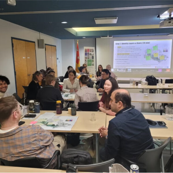
At the Can-Peat Annual Meeting’s “Build the Map” activity, participants identified which map layers would be most useful for making real–world decisions such as Canada’s peatlands and their carbon stocks, disturbances, and restoration potential, Indigenous territories, Climate projections, permafrost, biodiversity and species at risk, all layered in a single interactive map.
First Street flood zone mapping shows twice as many homes at risk
First Street, a United States-based company specializing in climate risk modeling, estimates that approximately 79,000 buildings in the province of Quebec are at risk. This figure exceeds the current projection by more than twofold and is over three times greater than the roughly 22,000 buildings identified within flood zones according to the currently utilized official maps.
Official government maps say this building isn’t in a flood zone, but First Street claims that it is. This difference comes down to how rainfall risk—and climate change—is being assessed.
The updated land-use maps will include five categories: low, moderate, high, and very high, with each one carrying a corresponding level of restrictions on development. The final category, known as the “protected area with residual risk,” was introduced after consultations in 2024 to respond to concerns from residents who were theoretically protected by dikes.
Mapping Canada’s 92 migratory bird sanctuaries
Canada’s 92 migratory bird sanctuaries, managed by the Canadian Wildlife Service, cover over 11.5 million hectares and are strategically placed along four major flyways — Pacific, Atlantic, Central, and Mississippi.
The sanctuaries protect birds at their most vulnerable — during nesting, moulting, migration stopovers, and overwintering. Highlights include Ahiak in Nunavut (Canada’s largest, hosting over 90% of global Ross’s geese), Machias Seal Island’s Atlantic puffins, and B.C.’s George C. Reifel sanctuary, which welcomes over a million shorebirds annually.
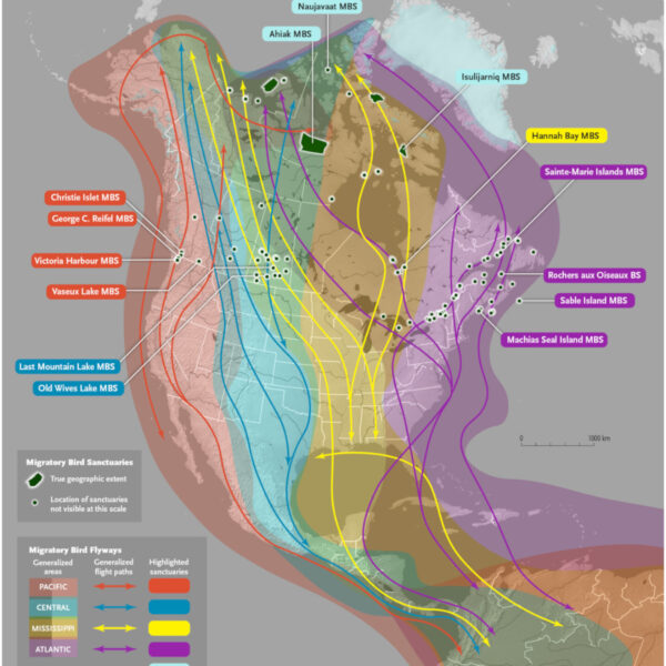
The color-coded map above is a detailed representation of migratory bird sanctuaries, with categorized migratory bird flyways such as generalized areas, generalized flight paths, and highlighted sanctuaries.
Drones could be used for avalanche control at ski resorts
A Squamish, B.C. company, Alpine Solutions, has become first in Canada to use drones loaded with explosives for avalanche control. After clearing regulatory hurdles from Transport Canada, WorkSafeBC, and drone licensing authorities, they successfully carried out controlled avalanche triggering at Whistler Blackcomb.
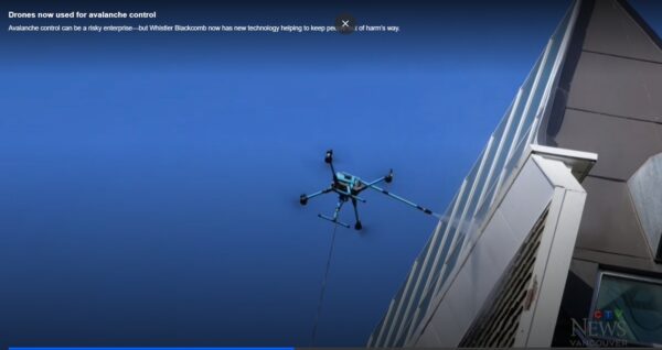
Operations manager Alexis Tessier describes it as a new tool that complements — rather than replaces — existing methods. The company plans to expand to railways, mining, and other industries. The news comes as drone use across Canada continues to grow rapidly.
2026 maps and measure to protect Southern Resident killer whales
Southern Resident killer whales, classified as Endangered under Canada’s Species at Risk Act since 2003, encounter three main threats: decreased food supply, noise and physical disruptions, and pollution. Canada’s management actions for 2026 involve area-specific fishing bans, Vessel Restricted Zones from June 1 to November 30 near North Pender and Saturna Islands, and enforced speed limits of 10 knots around Swiftsure Bank.
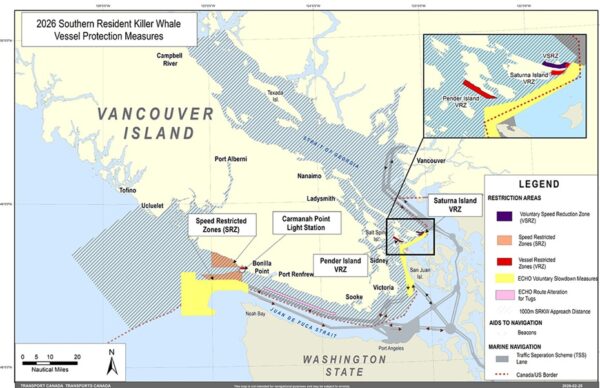
Voluntary measures encourage boaters to stop fishing, slow down, and turn off echo sounders near whales. Contaminant threats are being addressed through strengthened regulations under the Canadian Environmental Protection Act. Maps released this year shows an overview of measures by geographic area.
P.E.I man created the latest map for the community
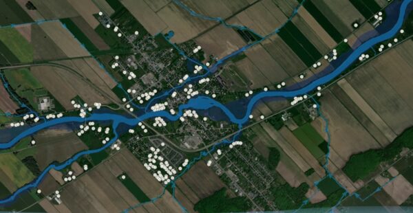
Derek Kronemeyer, a resident from Stratford, P.E.I, took an initiative of mapping the local community to fill the missing gaps in the current municipality maps.
Using free online mapping tool and collecting data by walking and biking Kronemeyer has designed a website that contains variety of maps, including some for active transportation that identify things like trails, sidewalks and bike lanes, house density, historical places.
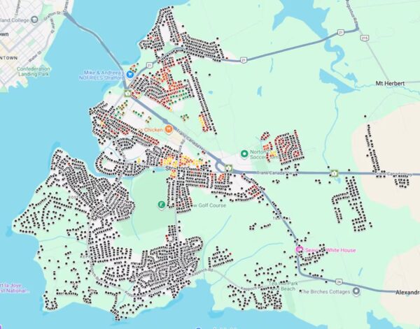
Kronemeyer creates his maps by gathering information from various sources, such as municipal and provincial data, his personal explorations around Stratford, and aerial images from Google Earth.


Be the first to comment