• facebook
  • Twitter
  • Linkedin
  • Youtube
  • Linkedin Group
  • Post a Job
  • Post an Ad
  • Post an Event
  • Post a Directory Listing
  • Post a Press Release
  • Media Kit
  • My Account
  • Login
GoGeomatics
  • MAGAZINE
    • BIM & GIS
    • Community
    • Conference news
    • Earth Observation
    • Education & Careers
    • GEOAI
    • Announcements
    • Reality Capture & Lidar
    • Science
    • Technology
    • Between the Poles
  • Directories
    • ASSOCIATION
    • INDUSTRY
    • EDUCATION
    • Open Data
  • EVENTS
    • GeoIgnite Events
    • Events Calendar
    • GoGeomatics Meetups
  • Services
    • Advertising
    • Marketing
    • Post a Job
    • Post an Ad
    • Post an Event
    • Post a Press Release
    • Post a Directory Listing
    • Media Kit
    • Web Design
  • Find a Job
  • Volunteer
    • Start a GoGeomatics Group
    • Editors & Writers Group
  • About Us
    • About Us
    • Contact Us
    • Frequently Asked Questions
  • Videos
Home2012May

Month: May 2012

Between the Poles – The Geoff Zeiss Archives

Project Stimulus: Mechanical simulation in the cloud

21 May 2012 Geoff Zeiss

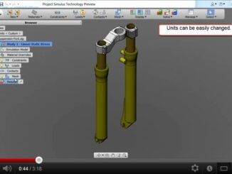
Project Simulus is a free technology preview that suppots some innovative approaches to mechanical simulation. The project provides an intuitive simplification environment to prepare CAD models for different simulation analyses as well as using the […]

3D Visualization

Standards-based intelligent modeling of urban multi-utility networks

19 May 2012 Geoff Zeiss

In a paper Semantic 3D Modeling of Multi-utility networks in Cities presented at GSDI 2012 in Quebec City, Thomas Becker; Claus Nagel and Thomas H. Kolbe have outlined how they are translating a vision of […]

No Picture
Between the Poles – The Geoff Zeiss Archives

National science teaching standards includes for the first time the science of human-driven climate change

18 May 2012 Geoff Zeiss

The first major update to national science teaching standards in 15 years includes for the first time the science of human-driven climate change.  The standards are based on a National Academy of Sciences report and […]

Between the Poles – The Geoff Zeiss Archives

Autodesk University 2012: Call for proposals

18 May 2012 Geoff Zeiss

The Call for Proposals for Autodesk University 2012 in Las Vegas closes on May 22nd. Note: The 5/22 deadline is for submissions for AU in Las Vegas.  Submissions for AU Virtual 2012 will open in […]

3D cadastre

Benefits of a 3D land and property information system for sustainable urbanization

17 May 2012 Geoff Zeiss

At the GSDI 13 conference in Quebec City, Serene Ho and Abbas Rajabifard from Australia delivered a paper on the benefits of a 3D land and property information system (3D-LPIS) to an increasingly urbanized society.  […]

Access to Spatial Data

Towards a global licensing framework for geospatial data

17 May 2012 Geoff Zeiss

In 2007 I listened to an exceptional presentation at a Spatial Sciences Institute Biennial International Conference in Hobart, Tasmania given by Tim Barker and Neale Hooper, of the Queensland Treasury, part of the government of […]

Between the Poles – The Geoff Zeiss Archives

Successful test of natural gas extraction from methane hydrate reservoir in the Alaskan North Slope

16 May 2012 Geoff Zeiss

Estimates of the amount of carbon sequestered in methane hydrates and found in Arctic permafrost and in ocean sediments along the world’s continental shelfs range widely, but is believed to be large and has even […]

Access to Spatial Data

Canada’s spatial data infrastructure (SDI): past, present and future

15 May 2012 Geoff Zeiss

Prashant Shukle, Director General of the Mapping Information Branch (MIB), Natural Resources Canada,  gave an overview of the Canadian experience in developing a national spatial data infrastructure (SDI).  He echoed the Minister of Natural Resource’s […]

Posts pagination

« 1 2 3 4 »

Events

Feb 24
All day

Digital Leadership Day Federal

Feb 24
February 24 - February 26

Government Innovation Week – Federal

Feb 24
5:30 pm - 7:30 pm

GoGeomatics Kelowna February Social

Feb 24
5:30 pm - 7:30 pm

Kelowna Mural Map – User Feedback & Networking Social

Feb 24
6:30 pm - 8:30 pm

February Ottawa GoGeomatics Meetup

View Calendar

View All Events

Services

  • Post a Job
  • Post an Ad
  • Post an Event
  • Post a Directory Listing
  • Post a Press Release
  • Media Kit
  • My Account
  • Login

Jobs

Post a Job
  • Volunteer Editorial Contributor – Be Part of Canada’s Geomatics Story
    Remote
  • Junior Geomatics Field Technician – Technical Surveys
    Montréal, QC
  • GIS Specialist
    Amherst, Nova Scotia
  • Precast Structural BIM Specialist
    Calgary, Alberta
View All Jobs
  • Directories
    • Associations Directory
    • Industry Directory
    • Education Programs
    • Open Data
  • Volunteer
    • Start a GoGeomatics Group
    • Editors & Writers Group
  • About Us
    • GoGeomatics Media Kit
    • Who We Are
    • Contact Us
    • FAQ’s
    • Advertising
    • Marketing
  • Subscribe
GoGeomatics
GoGeomatics is the largest and most popular communications hub promoting the Canadian geospatial community. The business was incorporated in 2011. GoGeomatics hosts over 100 fun, free, location technology networking events each year in cities across Canada.

© 2026 GoGeomatics

  • facebook
  • Twitter
  • Linkedin
  • Youtube
  • Linkedin Group