
Education & Careers
Ethics for the GIS Consultant is Good Business
I just finished a small GIS job for a client. A really small job. They wanted to know where the Crown lands were in a part of New Brunswick. Not sure what they were going […]
I just finished a small GIS job for a client. A really small job. They wanted to know where the Crown lands were in a part of New Brunswick. Not sure what they were going […]

In 2007 the Federation of Canadian Municipalities (FCM) commissioned McGill University to survey Canadian municipal governments to determine their infrastructure needs. Based on the responses to the survey, FCM estimated that the municipal infrastructure deficit […]
Steve Walli of the Outercurve Foundation has published a very perceptive discussion of why the phenomenon of the open source software foundation (neutral non-profit) has become so important in the free and open source software […]
GIS training and teaching is a fascinating endeavor. Undergraduate classes are a mélange of students from disciplines that span the University curriculum. Graduate training is usually highly focused on task-specific outcomes, while professional training can […]
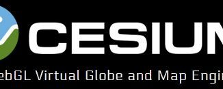
Earlier this week on an Eclipse Foundation Locationtech teleconference, Matt Ford of Cesium provided an overview and demonstration of the features of Cesium. You can watch the video here. Cesium is an open source virtual […]

Last week on an Eclipse Foundation Locationtech teleconference, Tim Schaub of OpenGeo outlined the plans for the next version of OpenLayers. You can watch the video and contribute to the effort here. OpenLayers2 was released […]
First off, HAPPY GIS DAY! Twitter was having a hayday with #GISDay tweets, and LinkedIn became a geospatial frenzy. What did you do for GIS Day? GoGeomatics Canada was happy to host our second annual […]

The International Energy Agency (IEA) in its World Energy Outlook 2012 is projecting that by 2020 the U.S. will surpas Saudi Arabia as the world’s largest oil producer. US oil and gas production, driven by […]