• facebook
  • Twitter
  • Linkedin
  • Youtube
  • Linkedin Group
  • Post a Job
  • Post an Ad
  • Post an Event
  • Post a Directory Listing
  • Post a Press Release
  • Media Kit
  • My Account
  • Login
GoGeomatics
  • MAGAZINE
    • BIM & GIS
    • Community
    • Conference news
    • Earth Observation
    • Education & Careers
    • GEOAI
    • Announcements
    • Reality Capture & Lidar
    • Science
    • Technology
    • Between the Poles
  • Directories
    • ASSOCIATION
    • INDUSTRY
    • EDUCATION
    • Open Data
  • EVENTS
    • GeoIgnite Events
    • Events Calendar
    • GoGeomatics Meetups
  • Services
    • Advertising
    • Marketing
    • Post a Job
    • Post an Ad
    • Post an Event
    • Post a Press Release
    • Post a Directory Listing
    • Media Kit
    • Web Design
  • Find a Job
  • Volunteer
    • Start a GoGeomatics Group
    • Editors & Writers Group
  • About Us
    • About Us
    • Contact Us
    • Frequently Asked Questions
  • Videos
Home2013

Year: 2013

Between the Poles – The Geoff Zeiss Archives

Estimating the economic impact of climate change on national flood insurance

27 December 2013 Geoff Zeiss

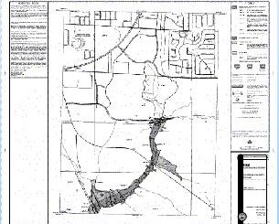
One of the industries where geospatial data and technology is having a major impact is insurance. I blogged previously about a ground breaking risk assessment study of sea level rise in North Carolina.  The study […]

Between the Poles – The Geoff Zeiss Archives

Wind power becomes commercially competitive with coal – with help from GIS

26 December 2013 Geoff Zeiss

It is incredible how rapidly wind power generation has grown over the past decade.  The latest Global Wind Report Annual Market Update 2012 from the Global Wind Energy Council (GWEC) reports that the 2012 global […]

No Picture
Community

A Recap: GoGeomatics Canada’s Top Articles of 2013

20 December 2013 GoGeomatics Canada | 2013

At the end of each year, we at GoGeomatics Canada like to wrap up by taking the time to look back and see which articles have had the strongest impact on our readers. With 2014 […]

Between the Poles – The Geoff Zeiss Archives

64th university joins the ICA-OSGEO Lab initiative “Geo for all”

19 December 2013 Geoff Zeiss

In September 2011, the Open Source Geospatial Foundation (OSGeo) and the International Cartographic Association (ICA) signed a Memorandum of Understanding with the objective of creating collaboration opportunities for academia, industry and government organizations in open […]

Between the Poles – The Geoff Zeiss Archives

IBM’s “5 in 5” innovations: cities will help you live in them

19 December 2013 Geoff Zeiss

IBM has published its predictions for five big innovations that will change our lives within five years. This is the eighth year that IBM has published its 5 in 5.  I find all of these […]

No Picture
Community

Surveying in Action – Occam’s razor at Gull River Indian Reserve: The south boundary

19 December 2013 Association of Ontario Land Surveyors | 2013

By Dr. Brian Ballantyne Surveyor General Branch, NRCan Reprinted from the Ontario Professional Surveyor, Volume 56, No. 4, Fall 2013 Abstract – The south boundary of the Gull River Indian Reserve is a straight line […]

Between the Poles – The Geoff Zeiss Archives

Winter school in open source geospatial software development announced

18 December 2013 Geoff Zeiss

At this year’s GIS in the Rockies, James Fee gave the keynote which was targeted at GIS professionals on the topic of how to remain relevant in the age of change. He  concluded that a […]

Access to Spatial Data

OGC’s Geopackage standard enables geospatial data sharing for mobile devices

17 December 2013 Geoff Zeiss

The Open Geospatial Consortium’s draft GeoPackage (GPKG) standard is an open, app-independent, platform-independent, portable, interoperable, self-describing data container and API.  This standard is intended to support multiple mapping and geospatial applications such as fixed product […]

Posts pagination

1 2 … 54 »

Events

Feb 16
February 16 @ 8:00 am - February 18 @ 5:00 pm

GeoWeek 2026

Feb 18
6:30 pm - 8:30 pm

Vancouver GoGeomatics Meetup – February 2026

Feb 19
February 19 - February 22

Spatial Knowledge and Information Canada 2026

Feb 19
February 19 - February 22

SKI Conference Canada 2026

Feb 23
7:00 pm - 9:00 pm

Toronto GoGeomatics Networking Social – February 23, 2026

View Calendar

View All Events

Services

  • Post a Job
  • Post an Ad
  • Post an Event
  • Post a Directory Listing
  • Post a Press Release
  • Media Kit
  • My Account
  • Login

Jobs

Post a Job
  • Volunteer Editorial Contributor – Be Part of Canada’s Geomatics Story
    Remote
  • Junior Geomatics Field Technician – Technical Surveys
    Montréal, QC
  • GIS Specialist
    Amherst, Nova Scotia
  • Precast Structural BIM Specialist
    Calgary, Alberta
View All Jobs
  • Directories
    • Associations Directory
    • Industry Directory
    • Education Programs
    • Open Data
  • Volunteer
    • Start a GoGeomatics Group
    • Editors & Writers Group
  • About Us
    • GoGeomatics Media Kit
    • Who We Are
    • Contact Us
    • FAQ’s
    • Advertising
    • Marketing
  • Subscribe
GoGeomatics
GoGeomatics is the largest and most popular communications hub promoting the Canadian geospatial community. The business was incorporated in 2011. GoGeomatics hosts over 100 fun, free, location technology networking events each year in cities across Canada.

© 2026 GoGeomatics

  • facebook
  • Twitter
  • Linkedin
  • Youtube
  • Linkedin Group