Between the Poles – The Geoff Zeiss Archives
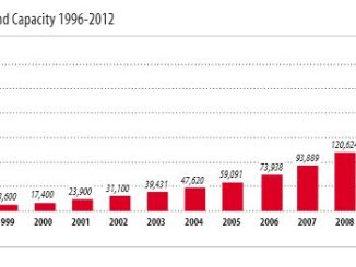
Global installed wind power generation capacity reaches 283 GW
It is incredible how rapidly wind power generation has grown over the past decade. The latest Global Wind Report Annual Market Update 2012 from the Global Wind Energy Council (GWEC) reports that the 2012 global […]