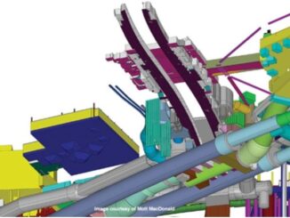
• facebook
  • Twitter
  • Linkedin
  • Youtube
  • Linkedin Group
  • Post a Job
  • Post an Ad
  • Post an Event
  • Post a Directory Listing
  • Post a Press Release
  • Media Kit
  • My Account
  • Login
GoGeomatics
  • MAGAZINE
    • BIM & GIS
    • Community
    • Conference news
    • Earth Observation
    • Education & Careers
    • GEOAI
    • Announcements
    • Reality Capture & Lidar
    • Science
    • Technology
    • Between the Poles
  • Directories
    • ASSOCIATION
    • INDUSTRY
    • EDUCATION
    • Open Data
  • EVENTS
    • GeoIgnite Events
    • Events Calendar
    • GoGeomatics Meetups
  • Services
    • Advertising
    • Marketing
    • Post a Job
    • Post an Ad
    • Post an Event
    • Post a Press Release
    • Post a Directory Listing
    • Media Kit
    • Web Design
  • Find a Job
  • Volunteer
    • Start a GoGeomatics Group
    • Editors & Writers Group
  • About Us
    • About Us
    • Contact Us
    • Frequently Asked Questions
  • Videos
Home2014

Year: 2014

3D data

Challenges in deriving engineering information from “scan to BIM” models

7 March 2014 Geoff Zeiss

At this year’s Royal Institution of Chartered Surveyors (RICS) BIM National Conference 2014, Nick Bleukarn, of the Severn Partnership, described a “scan to BIM” project sponsored by RICS to create a BIM model for the […]

No Picture
Between the Poles – The Geoff Zeiss Archives

U.S. House of Representatives passes energy efficiency bill with bipartisan support

6 March 2014 Geoff Zeiss

Yesterday with bipartisan support the U.S. House of Representatives passed the Energy Efficiency Improvement Act of 2014 (HR 2126) which was sponsored by Representatives David McKinley (R) and Peter Welch (D).  The bill includes several […]

Between the Poles – The Geoff Zeiss Archives

Challenges of “scan to BIM” for existing buildings

6 March 2014 Geoff Zeiss

At this year’s Royal Institution of Chartered Surveyors (RICS) BIM National Conference 2014, Christopher Gray, of the Mollenhauer Group, Los Angeles, gave an overview of his experience in creating a BIM model from laser scans […]

No Picture
Community

Join Geospatial Niagara to Discuss the CGCRT Education and Capacity Building Community Discussion Document

6 March 2014 Darren | 2013

Recently we, as geomatics practitioners, have witnessed much discussion and debate between colleagues and over a number of social media channels about the Canadian Geomatics Community Roundtable (CGCRT) and specifically the discussion draft of the […]

Asset management

Major benefits realized from ensuring quality geolocation data for utility assets

5 March 2014 Geoff Zeiss

At the National Rural Electric Coop Assn (NRECA) TechAdvantage Conference in Nashville, Nathan Frisby, GIS Engineer at Big Sandy Rural Electric Coop (RECC), and David Herron of Leidos gave a presentation about their experience implementing […]

Between the Poles – The Geoff Zeiss Archives

UK Government aims at BIM Level 3 potentially supporting whole lifecycle modeling by 2018

5 March 2014 Geoff Zeiss

The UK Government’s goals for construction industry is to reduce the CAPEX for public construction (design and build) projects and to reduce the UK’s carbon intensity in line with its EU carbon committments. To reach […]

Between the Poles – The Geoff Zeiss Archives

Private sector clients are also engaging with the BIM agenda in the UK

4 March 2014 Geoff Zeiss

At this year’s Royal Institution of Chartered Surveyors (RICS) BIM National Conference 2014, Martin Quinn, who is with Great Portland Estates (GPE) gave the perspective on BIM in practice from the perspective of a construction firm […]

No Picture
Newsmakers & Press Releases

Intergraph® Canada Introduces Hexagon Geospatial to Canadian Geomatics Leaders at Geospatial Advancement Canada Event

4 March 2014 GoGeomatics Newsmakers | 2014

Intergraph and Hexagon Geospatial Offer Complete Solutions for Canadian Geomatics Community MISSISSAUGA, ONT., February 27, 2014 – Intergraph® Canada will introduce new geospatial innovations to the Canadian geomatics community as a participating key sponsor of […]

Posts pagination

« 1 … 46 47 48 … 55 »

Events

Notice
There are no upcoming events.

View All Events

Services

  • Post a Job
  • Post an Ad
  • Post an Event
  • Post a Directory Listing
  • Post a Press Release
  • Media Kit
  • My Account
  • Login

Jobs

Post a Job
  • Volunteer Editorial Contributor – Be Part of Canada’s Geomatics Story
    Remote
  • Junior Geomatics Field Technician – Technical Surveys
    Montréal, QC
  • GIS Specialist
    Amherst, Nova Scotia
  • Precast Structural BIM Specialist
    Calgary, Alberta
View All Jobs
  • Directories
    • Associations Directory
    • Industry Directory
    • Education Programs
    • Open Data
  • Volunteer
    • Start a GoGeomatics Group
    • Editors & Writers Group
  • About Us
    • GoGeomatics Media Kit
    • Who We Are
    • Contact Us
    • FAQ’s
    • Advertising
    • Marketing
  • Subscribe
GoGeomatics
GoGeomatics is the largest and most popular communications hub promoting the Canadian geospatial community. The business was incorporated in 2011. GoGeomatics hosts over 100 fun, free, location technology networking events each year in cities across Canada.

© 2026 GoGeomatics

  • facebook
  • Twitter
  • Linkedin
  • Youtube
  • Linkedin Group