• facebook
  • Twitter
  • Linkedin
  • Youtube
  • Linkedin Group
  • Post a Job
  • Post an Ad
  • Post an Event
  • Post a Directory Listing
  • Post a Press Release
  • Media Kit
  • My Account
  • Login
GoGeomatics
  • MAGAZINE
    • BIM & GIS
    • Community
    • Conference news
    • Earth Observation
    • Education & Careers
    • GEOAI
    • Announcements
    • Reality Capture & Lidar
    • Science
    • Technology
    • Between the Poles
  • Directories
    • ASSOCIATION
    • INDUSTRY
    • EDUCATION
    • Open Data
  • EVENTS
    • GeoIgnite Events
    • Events Calendar
    • GoGeomatics Meetups
  • Services
    • Advertising
    • Marketing
    • Post a Job
    • Post an Ad
    • Post an Event
    • Post a Press Release
    • Post a Directory Listing
    • Media Kit
    • Web Design
  • Find a Job
  • Volunteer
    • Start a GoGeomatics Group
    • Editors & Writers Group
  • About Us
    • About Us
    • Contact Us
    • Frequently Asked Questions
  • Videos
Home2018

Year: 2018

Access to Spatial Data

Ordnance Survey releases vector basemap optimized for national overview to street level

24 July 2018 Geoff Zeiss

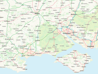
The Ordnance Survey has just released OS Open Zoomstack for public feedback. OS Open Zoomstack is very impressive because it is a vector basemap optimized for different scales – from a national overview to street […]

|||||
Technology

Your Canadian Geospatial Briefing for July 23rd: Thai cave rescue; TECTERRA LEAP program; data and cannabis; Marine Emergency Response; Behr technologies

23 July 2018 GoGeomatics Canada | intermap

Thai Cave rescue aided by Calgary geomatics company Intermap Technologies provided crucial data that helped rescuers reach the 12 children and soccer coach trapped in an underwater cave in Thailand. Using sensors and data sets which […]

|||||
Technology

Leading in times of disruption: Canada’s geospatial past, present and future

23 July 2018 Bilyana Anicic | Canada

Canada’s Geospatial Past We can be proud of our history and achievements in the fields of Science, Geography, and Geomatics. From the first edition of National Atlas of Canada back in 1906, the National Air […]

3D data

Towards a digital twin of infrastructure: on the cusp of efficient reality capture of underground utilities

17 July 2018 Geoff Zeiss
||
Newsmakers & Press Releases

First GIS maturity benchmarking initiative launches for Canada’s public sector organizations

16 July 2018 GoGeomatics Newsmakers | Canada

The Geospatial Maturity Index (GMI) is the latest addition to the suite of public sector benchmarking initiatives developed by the Public Sector Digest (PSD). The GMI will serve to audit existing GIS programs in Canada […]

||||||
Education & Careers

Karl Kliparchuk talks top GIS Education at BCIT in Vancouver, BC, Canada

16 July 2018 Jon Murphy | BCIT

GoGeomatics kicks off our series of interview with geospatial program across the country on the West Coast of Canada.  We are highlighting some of the very best geomatics education programs in the world by talking […]

No Picture
3D data

Call for participation to develop model for sharing location of underground infrastructure

6 July 2018 Geoff Zeiss

Public safety is at risk whenever underground excavation occurs. For example, when a gas line penetrates sewer lines during trenchless horizontal drilling, there is a risk of explosion when a sewer line subsequently backs up […]

No Picture
3D data

Dutch portal sharing information about subsurface goes live

4 July 2018 Geoff Zeiss

Increasing urbanization throughout the world challenges the sustainable development and resilience of cities.  To address this challenge cities, regions and nations are developing digital twins of their infrastructure.  However, the importance of the ground beneath […]

Posts pagination

« 1 … 13 14 15 … 28 »

Events

Notice
There are no upcoming events.

View All Events

Services

  • Post a Job
  • Post an Ad
  • Post an Event
  • Post a Directory Listing
  • Post a Press Release
  • Media Kit
  • My Account
  • Login

Jobs

Post a Job
  • Volunteer Editorial Contributor – Be Part of Canada’s Geomatics Story
    Remote
  • Junior Geomatics Field Technician – Technical Surveys
    Montréal, QC
  • GIS Specialist
    Amherst, Nova Scotia
  • Precast Structural BIM Specialist
    Calgary, Alberta
View All Jobs
  • Directories
    • Associations Directory
    • Industry Directory
    • Education Programs
    • Open Data
  • Volunteer
    • Start a GoGeomatics Group
    • Editors & Writers Group
  • About Us
    • GoGeomatics Media Kit
    • Who We Are
    • Contact Us
    • FAQ’s
    • Advertising
    • Marketing
  • Subscribe
GoGeomatics
GoGeomatics is the largest and most popular communications hub promoting the Canadian geospatial community. The business was incorporated in 2011. GoGeomatics hosts over 100 fun, free, location technology networking events each year in cities across Canada.

© 2026 GoGeomatics

  • facebook
  • Twitter
  • Linkedin
  • Youtube
  • Linkedin Group