• facebook
  • Twitter
  • Linkedin
  • Youtube
  • Linkedin Group
  • Post a Job
  • Post an Ad
  • Post an Event
  • Post a Directory Listing
  • Post a Press Release
  • Media Kit
  • My Account
  • Login
GoGeomatics
  • MAGAZINE
    • BIM & GIS
    • Community
    • Conference news
    • Earth Observation
    • Education & Careers
    • GEOAI
    • Announcements
    • Reality Capture & Lidar
    • Science
    • Technology
    • Between the Poles
  • Directories
    • ASSOCIATION
    • INDUSTRY
    • EDUCATION
    • Open Data
  • EVENTS
    • GeoIgnite Events
    • Events Calendar
    • GoGeomatics Meetups
  • Services
    • Advertising
    • Marketing
    • Post a Job
    • Post an Ad
    • Post an Event
    • Post a Press Release
    • Post a Directory Listing
    • Media Kit
    • Web Design
  • Find a Job
  • Volunteer
    • Start a GoGeomatics Group
    • Editors & Writers Group
  • About Us
    • About Us
    • Contact Us
    • Frequently Asked Questions
  • Videos
Home2022

Year: 2022

||
Technology

InfraMappa Introduces Software to Assist Construction Planning and Execution

19 June 2022 GoGeomatics Canada | Better GIS

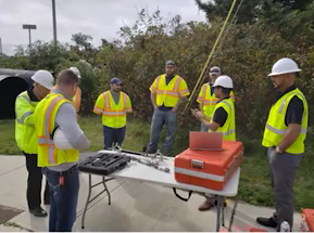
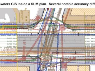
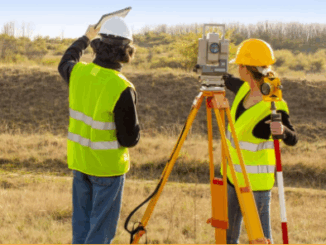
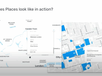
Construction companies are saving time and money by using a new software that enables them to view virtual sites. On March 23, 2022, a live stream presentation by Moufid Charafeddine, CEO of InfraMappa, was held […]

||
Technology

PriSUM Technologies Discusses the NJ DOT Project and How IMU Mapping Tools Reduce Damages

17 June 2022 GoGeomatics Canada | 3D Gyro mapping system

PriSUM Technologies believes in a proactive approach. The last livestream presentation of SUMSF on March 23, 2022, was given by Santosh Saride, the VP of Strategy & Business Development for PRISUM Technologies, a division of […]

3D data

Combining traditional data with advanced GPR provides a complete picture of the subsurface

16 June 2022 Geoff Zeiss

When we look at some of the major projects that have gone sideways, it often can be attributed to the lack of planning for underground infrastructure. This is a global issue and we know that […]

|
Newsmakers & Press Releases

OGC Calls for Participation in Federated Marine Spatial Data Infrastructure Pilot 2022 (FMSDI-22)

16 June 2022 GoGeomatics Newsmakers | emporis

The Open Geospatial Consortium (OGC) invites interested organizations to respond to a Call for Participation for Phase 3 of the Federated Marine Spatial Data Infrastructure Pilot (FMSDI-22). Funding is available. The deadline for responses is 19 June, 2022. has been […]

||||||||||
Technology

Collaboration of VertiGIS and Statistics Canada Update Census Program Data Viewer

16 June 2022 GoGeomatics Canada | accessibility

  Overcoming Challenges to Make Complex Data Accessible to All VertiGIS and Statistics Canada presented the collaborated result of the updated Canada Update Census Program (CPDV) during a GeoIgnite, Winter Geo conference livestream on March […]

||
Education & Careers

Free Webinar Supports Surveyors and Geospatial Professionals Through Marketing

15 June 2022 GoGeomatics Canada | geomarketing

Are you struggling when communicating your value to job-seekers? Are you struggling to develop a strong marketing campaign? Do you need of staff but still need to turn down projects because there is a lack […]

|||||
Technology

Sparkgeo Uses a Geospatial Lens to Look at Earth’s Issues on a Planetary Scale

15 June 2022 GoGeomatics Canada | business

Cadell Asks Us To Rescale Our Way of Thinking The keynote speaker for GeoIgnite, Winter Geo conference on March 2, 2022, was Will Cadell, Founder, and CEO of Sparkgeo.  Cadell leads a team of geospatial […]

||
Technology

SafeGraph Discusses The Importance of Accurate Geospatial Data

15 June 2022 GoGeomatics Canada | @safegraph

The Constantly Changing World Provides Information Challenges Geographer, Briana Brown from SafeGraph, recently presented via livestream at Canada’s National Geospatial Conference, GeoIgnite, Winter Geo. Brown holds a Master’s degree in Geographic Information systems and a […]

Posts pagination

« 1 … 20 21 22 … 38 »

Events

Notice
There are no upcoming events.

View All Events

Services

  • Post a Job
  • Post an Ad
  • Post an Event
  • Post a Directory Listing
  • Post a Press Release
  • Media Kit
  • My Account
  • Login

Jobs

Post a Job
  • Volunteer Editorial Contributor – Be Part of Canada’s Geomatics Story
    Remote
  • Junior Geomatics Field Technician – Technical Surveys
    Montréal, QC
  • GIS Specialist
    Amherst, Nova Scotia
  • Precast Structural BIM Specialist
    Calgary, Alberta
View All Jobs
  • Directories
    • Associations Directory
    • Industry Directory
    • Education Programs
    • Open Data
  • Volunteer
    • Start a GoGeomatics Group
    • Editors & Writers Group
  • About Us
    • GoGeomatics Media Kit
    • Who We Are
    • Contact Us
    • FAQ’s
    • Advertising
    • Marketing
  • Subscribe
GoGeomatics
GoGeomatics is the largest and most popular communications hub promoting the Canadian geospatial community. The business was incorporated in 2011. GoGeomatics hosts over 100 fun, free, location technology networking events each year in cities across Canada.

© 2026 GoGeomatics

  • facebook
  • Twitter
  • Linkedin
  • Youtube
  • Linkedin Group