New tool empowers engineers to save thousands of dollars on surveying costs, win more work, and slash the time it takes to source quality data.
Introduction
When I was working as a water resources engineer, I spent a few years conducting topographic surveys. I’d head out there with a rented total station and GNSS receives and spend days gathering data. If any of you have spent time out in the field, you know that surveying comes with many unforeseen challenges that don’t always have to do with the terrain. Rainstorms, hot days, and clouds of insects are to be expected. But there were also times when the challenges I faced went far beyond my paygrade. In one case, I faced an angry dog while trying to get data from a tract of farmland. The dog didn’t care that I needed to get quality topo of his farm, and we both agreed that I needed to get out of there as fast as possible.
I got my data that day
But couldn’t help think: there must be a better way
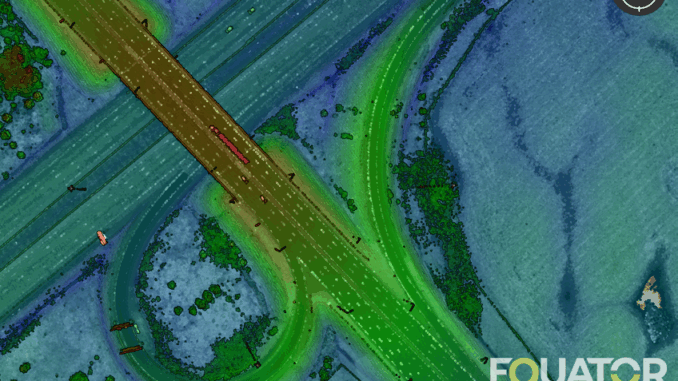
In recent years, the US and Canadian governments have been investing heavily in carrying out airborne LiDAR surveys of large areas. You can now access centimeter-accurate elevation data at home in your PJs. The US is on track to complete 100% coverage by the end of 2023 through the USGS 3DEP. At the same time, public organizations worldwide are investing billions in digital elevation infrastructure to support everything from precision agriculture to flood management and land development.
Many professionals, however, still don’t realize that in 2022 you don’t need to visit a site to get centimeter-accurate data for your project.
It’s available.
For free.
The trick is finding it and figuring out what to do with it.
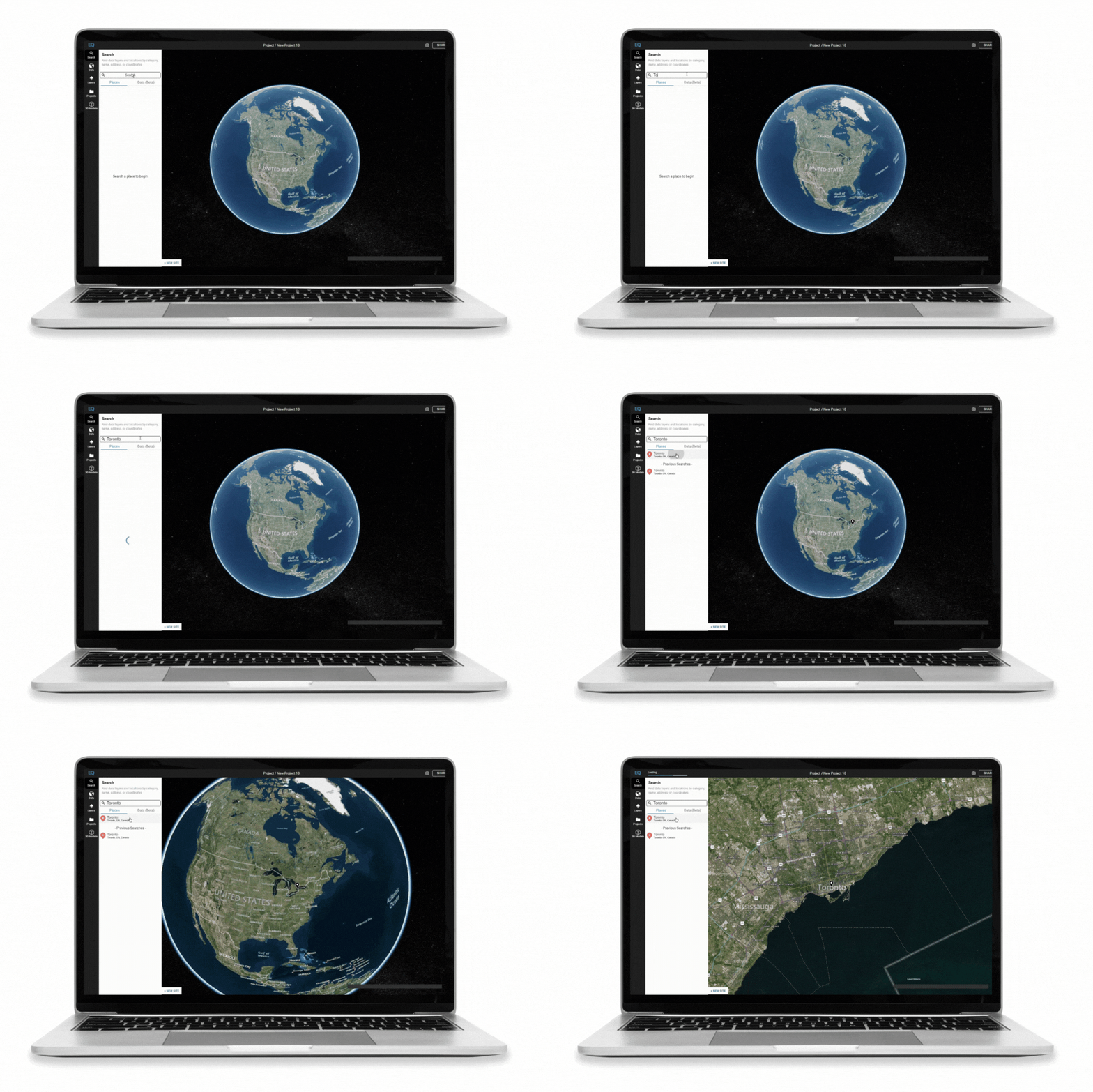
We built Equator to help engineers and surveyors source quality data in just a few clicks. Saving them not only survey costs and time prepping proposals but giving them a head start in competing for those contracts.
“What a lot of firms don’t realize is that you don’t need to visit a site to get centimeter-accurate data for your project”

How Julie is using Equator to shave months off of project planning and save her firm thousands
Julie is a civil designer for a small (but super busy) engineering firm based in the Colorado mountains. Like many places in North America, that region has been experiencing a lot of demand for new developments. Large tracts of land are being parceled out and developed over time.
I chatted with Julie a few months ago, and she shared this with me: For one particular project, the firm Julie works for was dealing with a 300+ acre parcel that was being developed piecemeal. Julie has been using Equator to pull data and get a head start on planning. Julie was able to get the data she needed to get started on the project- in minutes.
“I’ve been able to get terrain info so easily without sending guys over there for six weeks every day. Before, I honestly don’t know what we were doing. We would have to go out and shoot all that topo.”
In most cases, Julie’s company still sends out surveyors to verify the data as the project progresses. This is what she has to say about the data she pulled using Equator: “I have taken a lot of surveys that we did and shot topo for. I’ve taken those that I have processed them, and then I have run the same area through Equator, and I’ve compared them, and it’s been incredibly accurate.”
Julie was able to get to the preliminary design stage of this large project months ahead of schedule. By eliminating the need for preliminary survey work, Julie was able to save the firm thousands and drive bottom line revenue growth, without compromising the quality of the work. Needless to say- her boss was impressed!

How Zeke is using Equator to get client buy-in and cut out costly sub-contractors from his business
Zeke runs his own business as a sole proprietor out in Texas. After spending decades in the industry working for large companies, he decided to go out on his own in 2018. Because of his small operation, Zeke hires subcontractors as needed.
Equator has transformed the way Zeke does business:
“A lot of jobs at the beginning start with nothing. We scramble to get the best available data. When I found Equator, I was very pleased with how I could take data that used to take several hours or even hiring a sub-consultant to process it for me. It now takes me maybe 15 to 20 minutes.”
On the client side, Equator is helping Zeke communicate better with his clients, who are not experts in this area and don’t know how to read topographical information. Zeke shared with us one particular instance where a client was pushing for a pond in an area with insufficient drainage elevation. “I was able to log them into Equator, and they could see what I was trying to describe to them in real-time”
This saved Zeke a lot of back-and-forths, not to mention a potential client conflict.

Why pay for a free resource?
Lidar data is free and publicly available. You might be wondering why professionals are choosing to invest in a paid solution like Equator. In the US, high quality Lidar data can be downloaded from the USGS lidar explorer and visualized using open platform such as Potree.
The bottom line is that our customers enjoy the experience Equator provides, and how easy it is to integrate LiDAR data into their design process – it’s fast, it’s fun, and it provides added value compared to the free resources online.

What Equator can do for you:
- Create contours and CAD ready base plans: Save hours of tedious processing time and get CAD ready base plans in a few clicks.
- Source LiDAR data in minutes: Start your design or analysis right from the kick-off. Equator provides instant access to the highest-resolution LiDAR elevation data without leaving the office (or your couch).
- Generate smooth and accurate contours: Does anyone else get excited over smooth contours? I know we do! The Equator makes your work shine with clean, beautiful contours.

Conclusion
There’s been a big shift in the industry over the last few years. With more and more quality data becoming accessible online, we can do better work, faster. Visiting the site, using costly survey equipment, and waiting on subcontractors to process your data is no longer the only option. You can now access centimeter-accurate topographic information from anywhere – all you need is an internet connection. At Equator, we are on a mission to elevate the work of our fellow infrastructure designers by providing them with instant access to the best data.
Try Equator For Free
Visit the Equator website and sign up for a trial today. Find out what data is available in your area and try out unlimited exports for your first week.
About Equator
How it all started: Most innovations start with a frustrated founder, unable to find a solution to their problem. Equator is no different. Back in the day, I was working in the civil engineering industry. During one drainage study, my work ground to a complete halt. Why? Because it was impossible to get my hands on the topographic data I needed. There were weeks and weeks of delays, and I was so frustrated that this process was difficult.
I decided to do something about it, and Equator was born. Since 2019 Equator has helped 10,000 professionals access over 1 billion hectares of LiDAR data.


Be the first to comment