Education & Careers
The Lifecycle of Geodetic Reference Systems
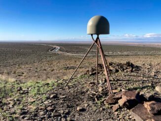
This article is the second piece in a series on reference system modernization. If you have not read the first article, you can find it here. How Reference Systems Age Reference systems are built to […]