Between the Poles – The Geoff Zeiss Archives
China to Include Smart Grid in Five Year Plan
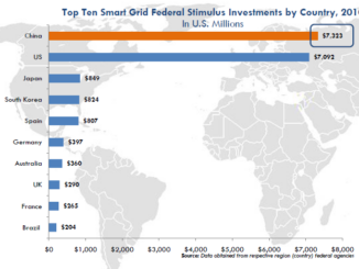
China is drafting a five-year energy plan for 2011 through 2015 which will include smart grid technology as a key industry focus. An analyst at Essence Securities Ltd has estimated that China may spend up […]