Between the Poles – The Geoff Zeiss Archives
OGC issues RFI for underground infrastructure maps and models
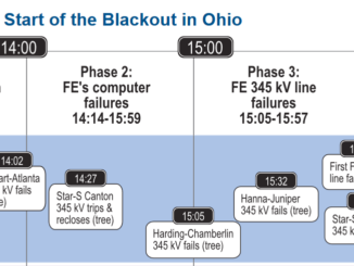
The Open Geospatial Consortium (OGC) has announced the initiation of a three-phase project to develop interoperability standards for underground infrastructure. The underground infrastructure data interoperability project will take two and a half years to complete […]