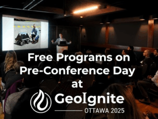
GoGeomatics Canada
GoGeomatics Canada’s Online Magazine is your source for the latest news in the Canadian geomatics sector. We publish articles about technology, projects, events, Canadian companies, and interviews with industry leaders. To submit an article to the GoGeomatics Magazine, please email your pitch to info@gogeomatics.ca.
Articles by GoGeomatics Canada
Canadian Geospatial Briefing March 7th: 1. MDA to Build 17 satellites to Enhance Globalstar’s LEO Constellation. 2. DDC’s new management. 3. DDC’s update on Canary drone testing. 4. Need for RADARSAT in disasters. 5. Cape Breton Highlands image looks like a kitty.
MDA to Build 17 Satellites to Enhance Globalstar’s LEO Constellation According to MDA’s announcement on Feb 24th, this company is…
Watch Live GeoIgnite 2022 on YouTube Here: Canada’s National Geospatial Conference
Watch live as Canada’s Geospatial Community comes together for 3 days of engagement on climate change and location technology, services,…
International Geospatial Briefing Feb. 28th: 1. Indian government starts work on mapping villages. 2. Scottish space sector charts path to a sustainable future. 3. Five ways AI is saving wildlife. 4. Satellite images show military movements by Russia. 5. Underground Railroad secrets revealed with drones, lasers and radar. 6. NASA ‘NACHOS’ Instrument May Help Predict Volcanic Eruptions.
Indian Government starts work on mapping villages The Indian government is using geospatial technology and drones to map six lakh…
Canadian Geospatial Briefing Feb. 21st: 1. Interactive tool for avalanche risk. 2. Using drones to reforest. 3. Global glacier retreat measured. 4. Drone imitating the peregrine falcon. 5. Communities growing and shrinking in Alberta. 6. Wyvern receives funding for hyperspectral imaging.
Avalanche Canada issues special warning for B.C. and Alberta Avalanche Canada and Parks Canada had issued an advisory for many…
Geospatial Training at GeoIgnite: March 4th to the 14th
GeoIgnite offers a wide variety of training opportunities built on current standards led by leading industry experts. Upgrade your knowledge and…
International Geospatial Briefing Feb 14th: 1. GIS in Transportation; 2. Black Culture Mapped Across the U.S.; 3. Geospatial Trends to Watch in 2022; 4. GIS & Disaster Damage Assessments; 5. Improving Opportunities for Women in Geospatial Careers; 6. Using AI to Measure Antarctic Surface Ice; 7. Tracking Wildfires in the Arctic
India using GIS to Improve and Expand Transportation Infrastructure India has the second-largest road and rail network in the world,…
Register Now For GeoIgnite 2022 Winter Geo
GoGeomatics is proud to present GeoIgnite, Canada’s largest geospatial conference. This year, Winter Geo 2022 is being held March 1st-3rd,…
Canadian Geospatial Briefing Feb. 7th: 1. Canada is dropping ocean sensors; 2. Calgary’s Chinatown has new mapping; 3. Canadian cities are losing greenspace; 4. Government funding announced for Earth observation sector; 5. GoAigua and WatSyn Solutions join forces
How a sailboat helped Canada drop ocean sensors in the remote south Atlantic to study climate change Canada is partnering…
International Geospatial Briefing Jan 31st: 1. Exploring the World’s Food Sources; 2. Tracking Sinkholes with Satellites; 3. New Map Shows 2016 Methane Emissions Worldwide; 4. AI and McDonald’s Locations; 5. Satellites Proving Useful in Aftermath of Tonga Eruption
New Interactive Map Explores World’s Food Sources A new application recently published by Visual Capitalist allows users to explore food…
Canadian Geospatial Briefing Jan 24th: 1. Mapping Canada’s World Juniors teams; 2. Ecopia AI awarded contract to support rural broadband mapping; 3. Map project will publish energy efficiency ratings; 4. Study on cross-border drones for trade; 5. Prashant Shukle elected Vice Chair of OGC Board
Mapping Canada’s World Juniors teams A new interactive map tracks the hometowns of Team Canada players since the World Juniors…
LIDARCOMEX & SUMSF: two major new events you should not miss for LIDAR & Underground Mapping
GoGeomatics is presenting two major new online events coming up fast in 2022. Does your organization want to learn more?…
International Geospatial Briefing Jan 17: 1. New National Geospatial Intelligence Agency Director Nominee; 2. New Biomass Mapping Tool; 3. Azure Space Introduces Azure Orbital; 4. Falcon 9 and 100 Satellites; 5. New Version Of I3S
President Biden has nominated Frank Whitworth to be the next director of the National Geospatial Intelligence Agency Frank Whitworth is…