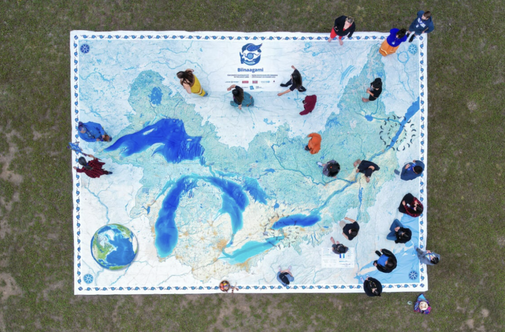

Mapping has a rich and storied tradition in Canada, reflecting the country’s diverse landscapes and complex geographic features. Indigenous peoples in Canada initially drew maps on the ground and in the snow, and sometimes recorded them on media such as animal skins or bark. These early maps, along with those from the 16th century, were often rough and conjectural. As European exploration progressed, maps became more accurate in well-known areas. By the 19th century, the widespread use of sextants, advanced astronomical techniques, and tools like the marine chronometer helped fill in major gaps in Canada’s maps, with the 20th century witnessing significant refinement in mapping skills.
From these early beginnings to modern geospatial technology mapping urban development and the intricate changes in the Great White North, Canada has played a significant role in the evolution of cartography.
The Traveling Gallery project
As the world of cartography continues to evolve, a new chapter is unfolding with the Canada Maps Traveling Gallery project. This initiative — a dynamic collaboration among the International Map Industry Association (IMIA), the Canadian Cartographic Association (CCA), and GoGeomatics Canada — builds on the success of last year’s National Expo Map Gallery held in Calgary. It promises to inspire audiences across the country with a sweeping tour of cartographic excellence.
“The traveling map gallery is more than just a collection of maps; it’s a curated narrative that illustrates how cartographers, geographers, academia, and industry can collectively push the boundaries of what maps can represent and achieve,” said the IMIA in a statement.
Ted Mackinnon, former CCA President and chair of the program, emphasizes the gallery’s significant role in promoting cartography and geographic literacy in Canada. “The CCA feels the Canada Maps gallery plays a crucial role in promoting cartography and the importance of maps in society in several ways, including public awareness, educational outreach, and promoting geographic literacy,” he explains.
The gallery highlights essential aspects of cartography and helps unite different groups within the Canadian geospatial community, achieving shared goals through its various events.
The gallery made notable stops in 2024, starting with submissions at GeoIgnite Ottawa from May 14-15, followed by a display at the CCA Conference at the University of Toronto Scarborough on May 23-24. Industry submissions were gathered at an IMIA Event in Denver from June 5-6, after which a full display of the gallery was showcased at the IMIA Event in Toronto on August 22, completing the final submission phase.
Looking ahead, the project gears up for its grand finale at the GoGeomatics Expo, taking place in Calgary October 28-30, 2024. This event will showcase the complete collection of maps and posters from contributors across the country, providing a final opportunity for the public and industry professionals to engage with the work on display.
“This year’s expanded project aims to showcase the full breadth and depth of cartographic art and technology, offering a platform for participants to display their work in both physical and digital formats. It’s an invitation to those passionate about mapping to share their creative and technical achievements with a broader audience,” says Jonathan Murphy, CEO and Founder of GoGeomatics.
The involvement of students and academic researchers is seen as key to the gallery’s impact on the future of cartography in Canada. “Students are the next generation of cartographers and play a crucial role in sustaining the geomatics industry. The CCA has been running student map contests for many years, providing a platform for students’ creative work to be introduced to the industry,” notes Mackinnon.

Collaboration to drive innovation
The project is a great example of how collaboration within the geospatial and cartographic community can drive innovation. “By bringing together professionals, students, and enthusiasts, we’re helping to build a deeper appreciation for the role of maps and making them more accessible to everyone,” Murphy adds.
The CCA’s involvement is noteworthy given the organization’s tradition of including map galleries at events. “We all know that people love maps, and the CCA has always included map galleries at events. Having a national map gallery amplifies this cause, providing a much broader medium with more exposure,” says Mackinnon.
While the response to the gallery has been gradual, momentum is building. “Like most new initiatives, the response has been somewhat slow, but we’re seeing an increase in momentum as we work together. Having key partners like IMIA and CCA is crucial for gaining more exposure and enhancing community engagement,” Murphy explains.
The project is expected to act as a catalyst for innovation and progress in cartography by enhancing community engagement, providing access to resources, and showcasing advancements in the field. While it may take a while to gain full momentum, its success is anticipated to highlight Canada’s rich geographic heritage and contributions to cartography, with the potential to expand further and drive additional contributions and innovation in the field.
“As more groups help increase participation, people will soon realize why Canada was the home to the Father of GIS, and how we are a geographically inclined community,” chips in Mackinnon.
Canada was home to Roger Tomlinson, whose pioneering work laid the foundation for modern GIS and spatial analysis. The Canada Maps Traveling Gallery not only honors this rich legacy but also invites current mapmakers to showcase their work, bridging the past with the present and highlighting ongoing innovation in the field.
“The gallery is not just an exhibition — it’s a celebration of the artistry and precision of mapping. It offers a unique opportunity to be part of a national conversation about the significance of maps in driving growth and development across all industries, and to inspire the next generation of map-makers,” says Murphy.
As the project approaches its final showcase, it continues to highlight the vital role of cartography and geospatial science in shaping our understanding of the world.


Be the first to comment