
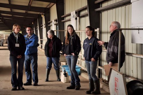
Lakeland College Launches Canada’s first degree in Agriculture Technology
Lakeland College is starting Canada’s first degree in agriculture technology in 2021 fall. The degree would help students keep ahead of the rapidly evolving agricultural technology curve. The new program would produce graduates that can use emerging technologies in commercial agriculture and provide important answers on investment returns. Likely courses would be in Smart agriculture as a management system, data collection and analysis, robotics, geospatial tools, artificial intelligence and more. The students will complete their online studies and hands-on training at Lakelands new Agricultural Technology center that will open later this year. You can read more about this here:
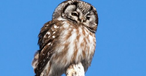
U of A study maps uncharted territory for cavity-nesting Owls in Boreal Forest.
A study by the University of Alberta study may help protect two elusive cavity-nesting owls specie in the North American Boreal Forest by tracking their habits. This is part of Zoltan Domahidi’s masters thesis in collaboration with the Ecosystem Management Emulating Natural Disturbance project. The result of the study found that Boreal owls prioritize areas with cold winters while Northern Saw-Whet Owls care most for local crop cover and low precipitation. The two species were also found to have opposite reactions to what the team describes as linear features such as roads and pipelines. More details here:
Data from space could help protect the endangered North Atlantic right whale.
The Government of Canada is investing $5.3Million in five companies under the smartWhales initiative. The intention is to advance innovative solutions that could enhance Canada’s ability to detect and monitor presence of whales in Canadian waters and predict their movements. The Canadian Space Agency (CSA) is leading this initiative in collaboration with Fisheries and Oceans Canada and Transport Canada. Selected projects will be implemented over the next 3 years and would mobilize over 80 highly qualified individuals to support Canada’s economic recovery. More details about this story here.
Canadian company releases video of its low-noise drone props
Drones are noisy, however a Delson Aeronautics; a Canadian company is producing a low-noise alternative. Michael Deloyer, the founder of Delson Aeronautics says his company is at the functional prototype stage seeking seed funding, pilot projects and a motor manufacturing partner. Their primary target is the drone delivery industry as this is where noise will be most critical, military as a second and Cinematography as a third. Deloye is planning for production with the goal of producing blades with diameters ranging from 15’’ – 28’’. More details about this article here.
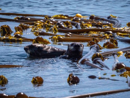
Sea charts and satellites: Mapping critical kelp beds along the Pacific coast.
Scientists are carrying out an ambitious project to map and monitor sea kelp forests along the entire B.C. coast using both ancient and modern tools. They are engaging the use of centuries-old British sea charts and advanced technology, such as camera drones and satellite images, to trace shifts in the abundance and distribution of kelp beds over time. The use of these variety of data collection methods was to combine efforts in understanding how these areas have changed because of the lack of complete Kelp beds data along the coast. More details about this story here.


Be the first to comment