
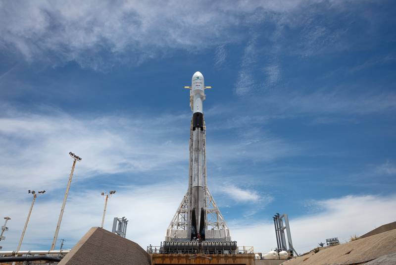
Newfoundland and Labrador based C-CORE has landed a major contract with the Canadian Space Agency.
C-CORE, headquartered in St. John recently inked a $350,000 deal to replace Canada Space Agency’s third generation of RADARSAT technology while the current generation will be replaced in 2026. Desmond Power, the Vice-President of Remote Sensing at C-CORE, says the information gathered by the satellites is very useful to monitor things like ships, icebergs, the movement of land, the oil sands, and the Arctic, and also could bring in great economic benefits to the province. Read more about the contract here and on their website.
Clear Seas conducts analysis to identify areas along Canada’s Pacific Coast that are sensitive to oil spills from ships.
An analysis commissioned by Clear Seas Centre for Responsible Marine Shipping (Clear Seas) helps identify and visualize areas along Canada’s Pacific Coast that are sensitive to oil spills from ships. This analysis is a part of Clear Seas’ Marine Transportation Corridors initiative, which aims to provide a comprehensive overview of the risks to Canada’s Pacific Coast from commercial marine shipping activities. Sensitivity in this context is not a measure of risk or of the probability of an oil spill, but rather a measure of vulnerability if an oil spill were to occur.
- It considers where ships are travelling
- The drift rates of disabled ships
- The capacity and availability of tugs to rescue a disabled ship
- The sensitivity of coastal areas to an oil spill where a ship to release oil at any point on Canada’s Pacific coast. Click here if you are unable to see the map visualization below.
Western University virtual GIS Day celebrations
Celebrate Geographic Information Systems (GIS) Day alongside community leaders at this free, virtual, interactive event, hosted by Western University, Canada. Scheduled between the 16th – 19th of November, this event promises interesting demonstrations, lightning talks, tutorials and presentations. Schedule coming up soon. Stay tuned for updates here.
Canada plays an important role in NASA’s James Webb Space Telescope
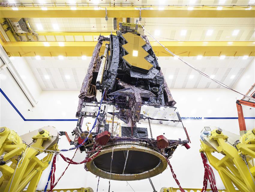
Due to impacts from COVID-19 and technical challenges, the launch of NASA’s James Webb Space Telescope is now planned for October 31, 2021. Webb is the most complex and powerful space telescope ever built. The Canadian Space Agency is collaborating with NASA and ESA by contributing two important elements; the Fine Guidance Sensor and the Near-Infrared Imager and Slitless Spectrograph, which will enable breakthrough discoveries in astronomy. Click here for a detailed description of events since the construction of the James Webb Telescope in 2016 to the current success of final acoustic and vibration tests. Webb will enable world-class science that sheds light on the most profound mysteries of our universe.
Optimizing your training with artificial intelligence – AI Endurance
AI Endurance app helps you get the best results from the time you invest in training. The app’s AI will not only create a plan for you, but it will constantly update it based on your steady flow of workout data. This ensures that no matter what changes occur in your life, your training will be optimized and personalized for you. After connecting your AI Endurance profile to your Strava, Garmin or other training files, the app will analyze your athletic history and determine what will work best for you. Then, you can edit your weekly availability. If your schedule changes and work or anything else prevents you from training one day, you can simply move a workout to another day in the week. Next, you input your plans for any upcoming races. Find more about the app here.
Smallest methane emission ever detected by GHGSat satellite
Canada’s smallest startup, GHGSat has announced that the first results from its latest methane monitoring satellite Iris (GHGSat-C1) and indicates five times better performance than its predecessor. The Iris sensors were able to detect the controlled release of methane from a facility in Alberta, Canada.
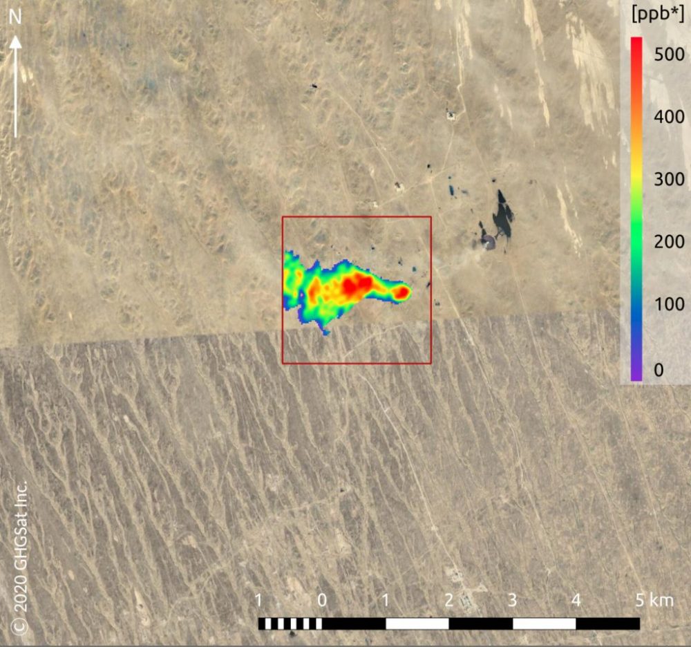
Methane may not be as abundant in the atmosphere as carbon dioxide, but its potential to cause global warming is several times more. Satellite-based methane monitoring has been a domain of national space agencies, and GHGSat is the only one in the commercial space so far. The company uses its own satellites and aircraft sensors to measure greenhouse gas emissions directly from industrial sites; providing actionable insights to businesses, governments, and regulators. Know more about it here and the press release on the company’s website.


Be the first to comment