
- Canadian wildfires, Smoke map, hotspot map, fire intensity, and more
- An immense underwater mountain off the coast of British Columbia
- Modernizing Workflows with Mobile Technology and GIS
- On the Map with Jennifer Rasp
- Canada’s Leadership in Methane Reduction
- Prince Edward Island interactive map in trails navigation
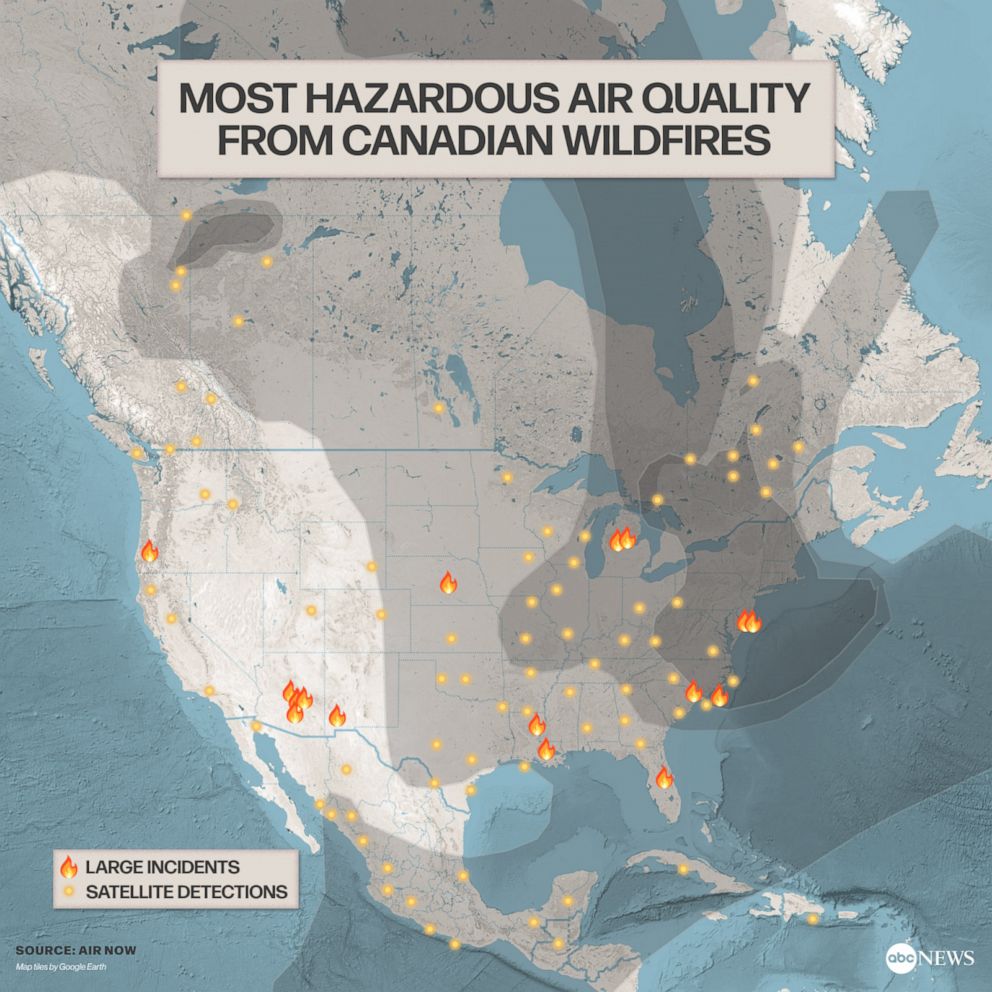
Canadian wildfires, Smoke map, hotspot map, fire intensity, and more
During the summer season, wildfires have returned once again, posing a significant threat. Currently, Canada is grappling with widespread wildfires that are impacting numerous cities and states in the United States.
The number of wildfires in Canada has exceeded 400, and the situation is not expected to improve in the coming days. Northern U.S. states have been affected by the smoke since mid-May when the early-season wildfires started. Air quality alerts have been issued in several states, including Montana, Idaho, Colorado, and Arizona, due to wildfires in Western Canada. Read more here.
The Canadian Wildland Fire Information System (CWFIS) generates daily maps depicting fire weather and fire behavior all year round, while also providing hot spot maps specifically during the forest fire season, typically from May to September. Find the maps here.
An immense underwater mountain off the coast of British Columbia
A team of scientists mapping the ocean floor off the coast of British Columbia has made a significant discovery—an enormous underwater mountain comparable in size to Mount Baker. They used sonar to investigate the area located 645 kilometers off Vancouver Island. Read more here.

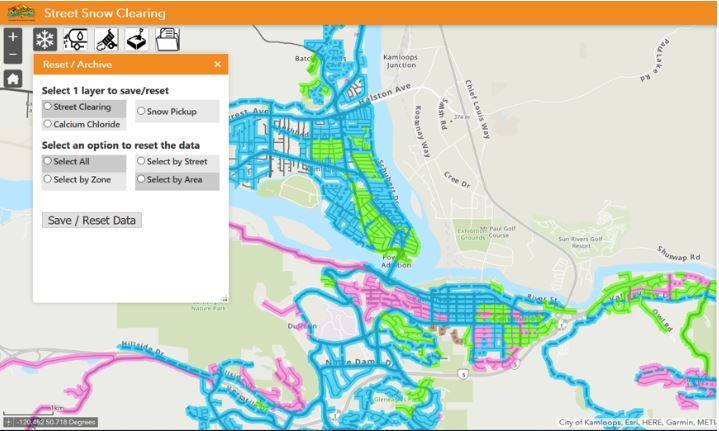
Modernizing Workflows with Mobile Technology and GIS
The City of Kamloops harnesses the power of a centralized GIS system, enabling them to leverage location intelligence for enhanced resource utilization, streamlined workforce activities, and improved management of public assets. Read more here.
On the Map with Jennifer Rasp
Jennifer Rasp, a preservice teacher from Queen’s University, shares her insights gained from using ArcGIS in her teaching and explains how she integrated it into her English courses. She developed an activity called “The World of Symbols” using ArcGIS StoryMaps, which aimed to visually represent the spatiotemporal variations in the interrelationships between people, place, and environment. Read more here.

Canada’s Leadership in Methane Reduction
Given the exceptionally high level of spatial resolution by plane-mounted LiDAR, Canada has been detecting methane emissions and conducting large-scale surveys over oil and gas sites in B.C., Alberta, and Saskatchewan to detect methane emissions. Canada has set goals to reduce methane emissions by a certain percentage below 2012 levels based on new standards in U.S. and Europe. Read more here.
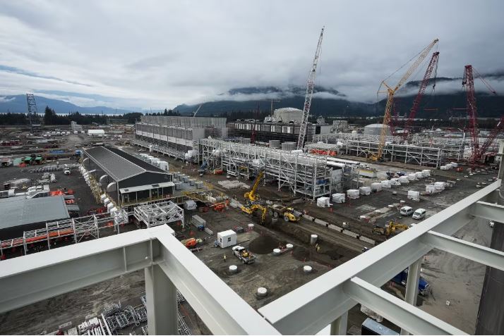
Canada energy project under construction in Kitimat, B.C., in 2022, Source: CBCNews
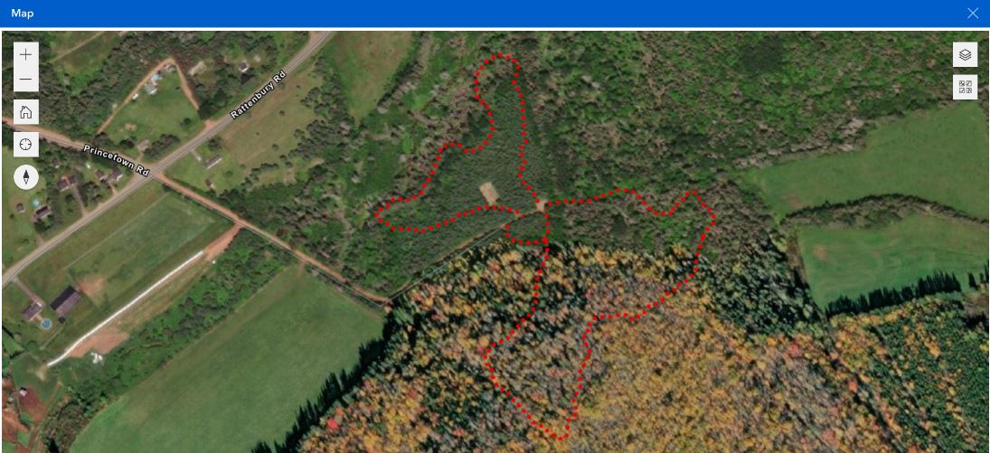
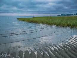
Prince Edward Island interactive map in trails navigation
In partnership with the province and incorporating sections, Recreation P.E.I. released an interactive trail map allowing users to plan their routes and customize their hiking experience. The trails were mapped using advanced satellite system technology, with ongoing additions of new trails. The map is accessible on the Recreation P.E.I. website and is optimized for mobile devices, featuring a “locate me” feature. Read more here.

Be the first to comment