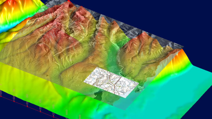
From underground infrastructure mapping to smart cities preparing for natural disasters, digital twins are becoming an important part of geospatial projects. While the first GIS was created to quantify Canada’s vast reserves of natural resources, modern computing advances have led to an increase of processing power that will continue to shape the future of the resource industry. Digital twins are already enhancing our abilities and leading to productivity increases in mining, but can digital twins also lead to increased sustainability?
The problem with natural resources, especially in a country like Canada, is that our reserves are so vast and plentiful that at times they may seem incomprehensible and unquantifiable. Only recently have we gained the computing and processing power necessary to account for these vast reserves. Resource extraction is dirty, unforgiving work, and Canada is home to some of the largest resource industries in the world.
Forestry, mining, and oil and gas have all come under fire in recent years as the world shifts focus to sustainability goals, reducing carbon footprints and environmental destruction. For resource-intensive economies like Canada’s to survive and thrive, new, sustainable methods must be found. While solutions are on the horizon with electric cars replacing gas-guzzlers and fast-growing options like bamboo or hemp replacing traditional forestry products, mining is left to sort itself out. After all, many of these net-zero technologies like electric vehicles and solar panels rely heavily on the availability of precious metals and minerals that must be mined. This seems like the perfect time for geospatial technologies to help mining reduce its impact and create data-driven green exploration practices.

Finding Leapfrog Geo
In reading about the advances being made with geospatial technology for mining exploration, like Hyperspectral imagery applications in mineral exploration, I came across a 3D modelling software, Leapfrog Geo, that hopes to be part of the solution. Intuitive, adaptable, and efficient, here are some of my biggest takeaways from an introductory course in the fundamentals of this software.
About the software
The software is based on a volumetric algorithm called Fast Radial Basis Function (FastRBF), which is incredible at aggregating large packages of data and providing first-pass surfaces quickly. This allows users to get general insights into the data they are working with much faster than typical modelling software. Similar to Kriging models and local neighbourhood searches in a GIS, the FastRBF uses a global neighbourhood to infer patterns and output the results.

3D models can be created from a wide variety of different data sources, including drill data, geologic maps, or historical cross sections. Combining these varied sources opens the possibility of fast, accurate first assessments of mining potential in an area of interest. If companies can cut out not only the cost but also the footprint of early, exploratory drilling efforts, this could begin dramatically reducing the environmental impact mining has.
Geospatial and geoscience collide
The ability to create 3D models from only surface-level maps increases the potential that new methods like mapping with hyperspectral image analysis can help companies create first-pass maps and models that allow them to narrow down the search for economically viable deposits. The software also allows for the integration of geospatial data to increase the quality of the analysis and processing. Not only can typical products like line and point data be snapped to the topography layer of a model, but georeferenced images can be overlain for added visual confirmation.

LiDAR data can also be integrated to create extremely accurate elevation profiles, increasing the reliability of topography meshes over traditional sources created from point data. The software also integrates functionality to make large datasets like LiDAR easier to process by allowing users to select only every 5th, 10th, or any other numbered point they would like. Compatibility with a diversity of formats is extremely beneficial as well, with Leapfrog accepting GIS data in the form of shapefiles, Esri Personal Geodatabase files, or MapInfo Batch files.
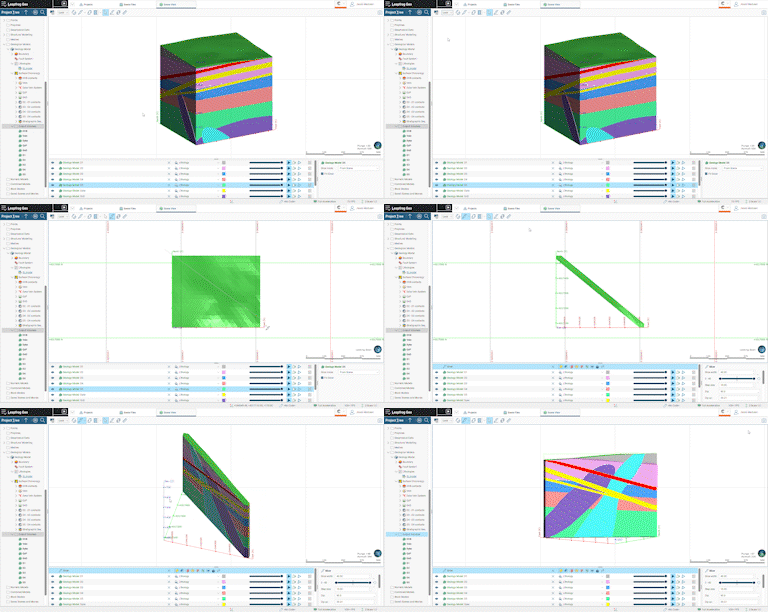
The geologic interpretation itself is intuitive and user-friendly, with the ability to create stratigraphic sequences, chronologically arrange layers, assign structures like intrusions, dykes, and deposits unique geometries, and adjust hypotheses for formations on the fly. The visualizations are helpful and the FastRBF makes a huge difference in how quickly users can assess changes they make to their datasets. The responsiveness of the software allows users to seamlessly integrate new observations or data, like additional drill cores, to which the models dynamically respond and update. This dynamic ability is what I think makes Leapfrog Geo so promising to the mining industry.


The solution 3D modeling provides
Data storage and sharing are critical in the modern world, and instead of having to re-drill the same old formations, creating 3D models of these formations with the ability to dynamically update them is a game-changer for the industry. With proper record storage and maintenance, historical drill data can be used again and again, greatly reducing travel, cost, and environmental footprint, while also decreasing the time in which effective decisions can be made.
The way that Vinicius Duarte, a project geologist with Seequent (the developers of Leapfrog Geo), sees it: “The more detailed, up to date, holistic and insightful your geological models are, the better targeted your drilling can be, helping to reduce cost and aid sustainability.” This nicely sums up what the goal of the industry should be. With all of this incredible technology at our fingertips that allows us to digitally recreate our physical world, we need to create a path forward to extract these valuable resources in a sustainable, minimally invasive, and non-destructive way. A 3D model that is stored, shared, and able to be dynamically updated goes a long way towards a sustainable future, which must be our ultimate goal.
Resources
[1] https://www.seequent.com/how-mining-can-lean-on-its-data-to-deliver-greener-exploration/#:~:text=Better%20storage%20of%20data%20reduces,of%20effort%2C%20energy%20and%20resources
[2] https://www.esri.com/en-us/industries/mining/gis-ensures-that-mining-operates-responsibly-and-efficiently?rsource=https%3A%2F%2Fwww.esri.com%2Fen-us%2Findustries%2Fnatural-resources%2Fsegments%2Fmining%2Fgis-ensures-that-mining-operates-responsibly-and-efficiently
[3] https://www.mckinsey.com/industries/metals-and-mining/our-insights/the-raw-materials-challenge-how-the-metals-and-mining-sector-will-be-at-the-core-of-enabling-the-energy-transition
[4] Leapfrog Geo Fundamentals course – seequentlearning.com
[5] https://ellipsis-drive.com/blog/natural-resource-management-using-gis-technology/


Be the first to comment