
Some years, conferences come and go as part of the regular cycle.
Other times, the broader context makes them more important. 2026 is shaping up to be one of those years.
Across Canada, there is a noticeable shift in how infrastructure, data, and digital systems are being planned and managed. From energy and transportation to defence, Arctic sovereignty, and environmental monitoring, decisions are being made that will have long-term impact.
Geospatial is increasingly central to that work.
And yet, there has never really been a consistent place where leadership across this sector comes together to have that conversation as a whole.
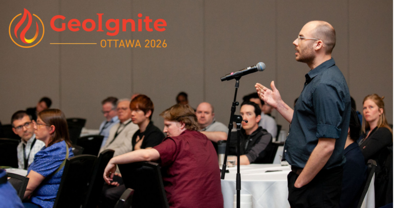
GeoIgnite was created to fill that gap. The event takes place in Canada’s capital, Ottawa, from May 11th to 13th.
The conversations taking place today have been building over time, as seen in previous events such as GeoIgnite 2025, where many of these themes were already coming into focus.
A Forum Designed for Alignment
Many of the most important discussions shaping Canada today are happening in parallel.
They are taking place in the space sector, in defence and national security, in infrastructure and digital delivery, and in procurement and data policy. But they are often happening in silos, without much opportunity to connect across those domains.
Geospatial is one of the few areas that cuts across all of them.
GeoIgnite brings those threads together. Held in Ottawa, it creates a space where industry, government, academia, and associations can meet, close to federal decision-making, and engage directly.
This is not a product-driven trade show.
It is a forum focused on understanding where things are heading and how the pieces fit together.
If you’ve spent time trying to understand how government and industry actually connect in this space, you’ll know there are very few places where those conversations happen in a direct and open way.

Why 2026 Stands Out
2026 stands out for a few reasons.
There is a clear shift toward building more domestic capability across infrastructure, technology, and data systems. Governments are looking more closely at how they work with Canadian companies and trusted partners, and how they reduce reliance on systems they don’t fully control.
At the same time, artificial intelligence is no longer experimental. It is being applied in real workflows, changing how geospatial data is processed and used.
There is also the ongoing development of a Pan-Canadian geospatial strategy, which will influence how capability is coordinated across jurisdictions.
This is already playing out in the decisions being made.
What Is Being Discussed
The program reflects that shift.
Across the conference, discussions focus on:
- Canada’s geospatial capability and its role in sovereignty
- Digital infrastructure supporting major national development
- Earth observation and space-based systems as strategic assets
- Artificial intelligence as an operational capability in geospatial workflows
- The implementation of Canada’s collaborative geospatial strategy
- Real-world applications of geospatial technology in complex environments
These are practical conversations, grounded in what is happening now and what needs to be addressed next.
View the full program and sessions:
GeoIgnite 2026 Program
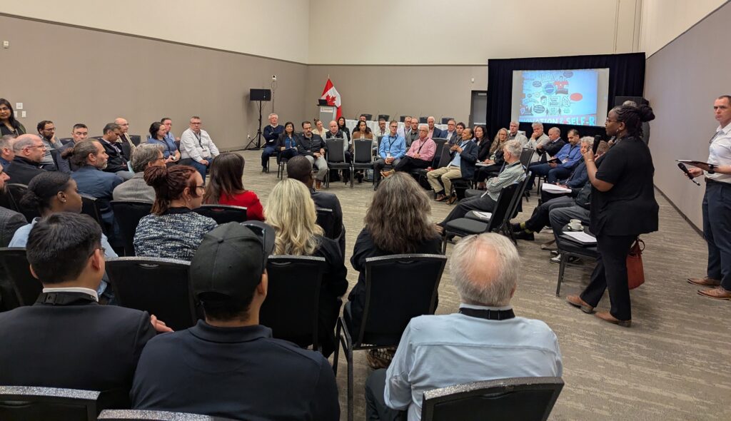
Who Is in the Room
The value of GeoIgnite is not only what is presented on stage.
It is who is in the room.
Federal departments and agencies involved in geospatial policy, infrastructure, procurement, science, and national security are represented.
This includes Natural Resources Canada, the Canadian Space Agency, the Canadian Armed Forces, the Royal Canadian Mounted Police, Public Services and Procurement Canada, and the National Research Council. There is also participation from specialized units such as the Mapping and Charting Establishment and the Canadian Forest Service, along with institutions like Library and Archives Canada, which reflects the broader role of national data stewardship.
This federal presence is complemented by provincial and municipal participation, including representation from Manitoba and cities such as Ottawa and Saint John. That mix reflects how geospatial work is actually applied across the country.
On the industry side, the room includes a mix of Canadian firms and international players working across geospatial, infrastructure, defence, and space-based capability. Organizations involved in these discussions include companies such as MDA Space, Esri Canada, NV5 Geospatial, and Kongsberg Geospatial, alongside a strong group of Canadian small and medium-sized companies.
There is also participation from key industry and standards bodies shaping how geospatial capability is implemented and aligned, including buildingSMART Canada and the World Geospatial Industry Council. Their involvement reflects the connection between geospatial, digital infrastructure, and broader global industry coordination.
There is also participation connected to the Open Geospatial Consortium (OGC), helping align Canadian work with international standards, and regional leadership such as the Centre de géomatique du Québec, reflecting the importance of collaboration across jurisdictions.
Academic institutions from across Canada are part of the mix as well, contributing to workforce development and research alignment.
Initiatives such as the Canada Maps Traveling Gallery also reflect how the broader geospatial community contributes to the conversation beyond formal sessions, creating a platform to share work and connect across the country.
It reflects how the sector actually operates, across government, industry, defence, standards, and research.
Why Being There Matters
These conversations are already happening across the geospatial sector.
The difference is being in the room when they take place, rather than hearing about them afterward.
GeoIgnite gives you:
- A clearer view into how government is approaching capability, infrastructure, and procurement
- Insight into how industry is responding and where opportunities are emerging
- Access to a network of practitioners and decision-makers across the sector
- A better understanding of how geospatial fits into Canada’s broader priorities
These are things that are difficult to pick up second-hand. They come from being in the room and hearing how people are thinking about these issues in real time.
The Cost of Absence
At a time when Canada is shaping its approach to infrastructure, sovereignty, and digital capability, the geospatial community is part of that conversation.
A lot of the value of a conference like this isn’t just in the formal sessions. It’s in the discussions between them, the side conversations, and the shared understanding that develops when the right people are brought together.
Those conversations will move forward regardless.
GeoIgnite is one of the few places where they are brought together across government, industry, and the broader ecosystem.
A Platform Built by the Community
GeoIgnite is intentionally vendor-neutral and not underwritten by government funding.
It exists because the sector supports it, through participation, sponsorship, and attendance. That model keeps the focus on the conversation itself and allows the event to reflect the priorities of the community it serves.
A Question of Representation
GeoIgnite 2026 takes place in Ottawa from May 11 to 13, bringing together Canada’s geospatial community at a time when the direction of the sector is being shaped.
The conversations taking place there, around infrastructure, sovereignty, capability, and the future of geospatial in Canada, will continue to move forward.
The question is how your organization chooses to be part of them.
GeoIgnite 2026 Sponsors
We thank the organizations supporting Canada’s national geospatial leadership conference.
Platinum Sponsor
 |
Gold Sponsors
 |
Silver Sponsors
 |
 |
Bronze Sponsor
Supporting Sponsors
 |
 |
Lanyard Sponsor
 |
Lunch Sponsor
 |
Association Partners
 |
 |
 |
|
 |
 |
Media Partner
 |
Event Partners
 |
 |


Be the first to comment