
![]()
![]()
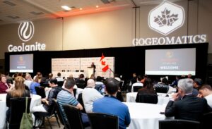
First launched in 2019, GeoIgnite quickly established itself as Canada’s national geospatial leadership conference. Now entering its 7th annual edition, GeoIgnite is a forum focused not just on technology, but on leadership, policy, and the role of geospatial capability in shaping Canada’s future.

As GeoIgnite 2026 takes shape, the program is being developed with a clear objective: to provide a coherent, strategic platform for examining Canada’s geospatial priorities at a time of significant global, environmental, and geopolitical change.
Taking place May 11-13 in Ottawa, GeoIgnite 2026 brings together leaders from government, industry, academia, Indigenous organizations, and the broader geospatial community. The conference is curated and delivered in partnership with federal government partners and national and international organizations, including the Open Geospatial Consortium (OGC), to ensure alignment with Canada’s priorities around sovereignty, resilience, digital infrastructure, and long-term capacity.
GeoIgnite 2026 is structured across three distinct days, each with a clear purpose and progression — from open community dialogue, to strategic leadership discussion, to focused, track-based engagement.
Monday, May 11 – National Geospatial Forum Day (Pre-Conference)

GeoIgnite 2026 opens with a free, open pre-conference day dedicated to dialogue, coordination, and community alignment across Canada’s geospatial ecosystem.
This day brings together participants from across sectors to discuss shared priorities such as sovereignty, workforce development, procurement, standards, and interoperability. The intent is to surface perspectives, identify challenges, and help shape the conversations that will carry through the main conference.
As part of the pre-conference program, GeoIgnite will host a Quebec Geospatial Forum, providing space for regional priorities and perspectives, alongside a joint Canadian Geospatial & Geomatics Advisory Forum and OGC Canada Forum. This combined forum brings together both communities under a single coordinated platform, reflecting GeoIgnite’s commitment to connecting community insight with standards-based and interoperability-focused discussion.
Tuesday, May 12 – Opening Day of the Main Conference
Tuesday marks the official opening of GeoIgnite 2026 and the first full day of the conference for ticket holders.
The day is anchored by a plenary program of keynote presentations and a high-level panel, designed to address the broader forces shaping the geospatial sector — including geopolitical change, climate risk, technological transformation, and the evolving role of geospatial capability in national decision-making.
The opening plenary will feature Canadian geospatial leadership, including participation from Eric Loubier, Director General of the Canada Centre for Mapping and Earth Observation, and Jonathan Murphy, founder of GoGeomatics Canada.

![]()
![]()
The keynote program will also feature Brian Gallant, K.C., Chief Executive Officer of Space Canada, who will offer a national perspective on Canada’s space sector and its role in economic growth, sovereignty, and long-term strategic capability. His participation highlights the growing convergence between space, Earth observation, and geospatial intelligence as foundational elements of Canada’s national infrastructure.
![]()
![]()
The Tuesday plenary will include a major keynote from Klaus Dodds, one of the world’s leading authorities on geopolitics, sovereignty, and the Arctic. Dodds has advised governments and international institutions on polar strategy, territorial governance, and emerging security dynamics, and his work is widely referenced in senior policy and defence communities. His keynote will examine how states are navigating a rapidly changing geopolitical environment, with particular attention to the Arctic, resource governance, and the growing importance of geospatial intelligence in strategic decision-making.
In addition to the keynote, Dodds will participate in an invitation-only senior leaders briefing, providing a closed-door strategic discussion for decision-makers on Arctic governance, geopolitical risk, and long-term sovereignty considerations in a multipolar world.
The keynote program will also feature Peter Rabley, CEO of the Open Geospatial Consortium, and Nadine Alameh, founder of LunateAI, contributing global perspectives on geospatial leadership, AI, standards, and innovation.
![]()
![]()
Additional keynote speakers and plenary participants will be announced and confirmed in the coming weeks as the program continues to take shape.
Tuesday’s program is intentionally strategic in nature, establishing shared context and setting direction for the deeper, more focused discussions that follow. The day includes structured networking, meals, and an exhibitor networking reception in the exhibition hall, creating space for connection and exchange across the community.
Wednesday, May 13 – Track-Based Program Day

Wednesday is where GeoIgnite moves into focused, parallel program tracks, allowing participants to engage more deeply with the conference’s core themes through applied discussion and targeted exploration.
Attendees will have the opportunity to dive deeply into three distinct program tracks, each offering a different lens on Canada’s geospatial future.
One of the tracks to look out for would be GEOINT, the Arctic, and Sovereignty, examining how geospatial intelligence and Earth Observation support Canada’s security, situational awareness, and decision-making — particularly in northern and Arctic contexts.
A second track explores Space and Earth Observation for National Resilience and Sovereignty, highlighting the role of space-based capabilities and EO as critical national infrastructure. Discussions consider how these systems support preparedness, adaptation, independence, and long-term planning in the face of climate, environmental, and geopolitical uncertainty.
The third track brings together Digital delivery for Infrastructure, the future of the built environment, and sovereign digital infrastructure and data autonomy. This program examines how geospatial technologies, digital twins, BIM, GIS, standards, and platforms are being used to plan, deliver, and operate infrastructure at scale, while ensuring trusted data, interoperability, and national control over critical digital systems.
Artificial Intelligence as a Cross-Cutting Capability
Artificial intelligence is woven throughout GeoIgnite’s program, not as a standalone topic, but as a core enabling capability across geospatial intelligence, space and Earth Observation, infrastructure delivery, and national resilience.
A National Conference, Built Through Collaboration
GeoIgnite 2026 is being developed through ongoing collaboration with federal government partners, standards organizations, industry leaders, and the broader geospatial community. This collaborative approach ensures that the conference reflects both national priorities and the practical realities of implementation and delivery.
As program details continue to evolve, this structure provides a strong foundation for informed discussion, leadership, and alignment across Canada’s geospatial ecosystem.
Interested in contributing to GeoIgnite 2026?
GeoIgnite 2026 is being built in collaboration with government, industry, standards organizations, and the broader geospatial community. We are welcoming expressions of interest for speaking slots, panel discussions, workshops, exhibitor booths, and sponsorship opportunities.
GeoIgnite 2026 Sponsors
Gold Sponsor

Silver Sponsors

Bronze Sponsor
Lanyard & Lunch Sponsors

Association Sponsors


Be the first to comment