
The GoGeomatics volunteer editors and writers have selected the most significant stories from 2023 to share and highlight as we transition into 2024. Our group consists of volunteer geomatics professionals from across Canada who convene weekly online to discuss and write about geospatial topics in Canada and around the world.
- Jonathan’s Pick Canada’s National Geomatics Expo is a Hit
- Saeideh’s pick: Mapping the health of Canada’s lakes
- Jake’s pick: World’s First Commercial CO2 Sensor in Orbit
- George’s pick: The record-breaking year of Canadian wildfires
- Jordan’s pick: 2023 North American Indigenous Games to use advanced mapping technology
- Crystal’s pick: Visualizing climate change in Canada’s Arctic using geospatial tech
- Farzaneh’s pick: The Celebration of National Indigenous History Month with ArcGIS
- Kruti’s pick: The major role Canada could play in space mining
Jonathan’s Pick
Canada’s National Geomatics Expo is a Hit
As the founder of GoGeomatics Canada and director of Building Smart Canada, I am profoundly inspired by the landmark success of our first national geomatics expo in Calgary. This event is a testament to the synergy of geomatics, land surveying, BIM (Building Information Modeling), precise positioning, remote sensing, and reality capture in driving forward Canada’s urban planning and climate resiliency initiatives. The expo has been a crucible of innovation, showcasing how these interconnected disciplines, particularly the advanced techniques of land surveying and remote sensing, are crucial for environmental conservation and sustainable development. The integration of reality capture technologies with BIM highlights our commitment to constructing resilient, climate-adaptive infrastructure. This event has not only put Canadian enterprises at the forefront, displaying their pioneering solutions on a global stage, but also served as a fountain of inspiration and education for aspiring professionals. Moving ahead, this expo symbolizes our unwavering dedication to harnessing the full potential of these technologies in land surveying, geomatics, BIM, precise positioning, remote sensing, and reality capture, steering Canada towards a sustainable, climate-resilient future in urban development.
Saeideh’s pick
Mapping the health of Canada’s lakes
Why it’s important:
Despite the large number of lakes in Canada, climate change and human activities are threatening the health of lakes and watersheds. We all heavily rely on the lakes for drinking water, farming and so on. What is the solution?
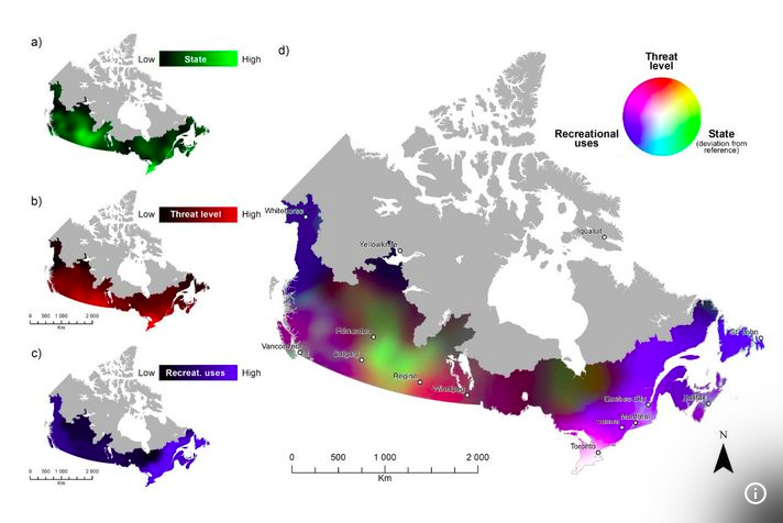
This story reveals a first-ever social-ecological map of 659 Canadian lakes’ health created by Université de Montréal biologists using three national datasets. This map displays a classification of lakes based on threat level as well as the sources of threats. The information is of great value to scientists and other parties involved in the decision-making process.
Jake’s pick
World’s First Commercial CO2 Sensor in Orbit
Why it’s important:
The launch of GHGSat’s C10 satellite was a huge step for monitoring emissions around the world in 2023. While pioneering greenhouse gas emissions tracking since 2016 with the launch of their methane monitoring satellites, GHGSat has pushed monitoring capabilities even further this year. Using the same sensor as the methane satellites but tuned for the wavelength of CO2, ‘Vanguard’ provides 25m resolution good for identifying major individual sources of CO2 emissions.
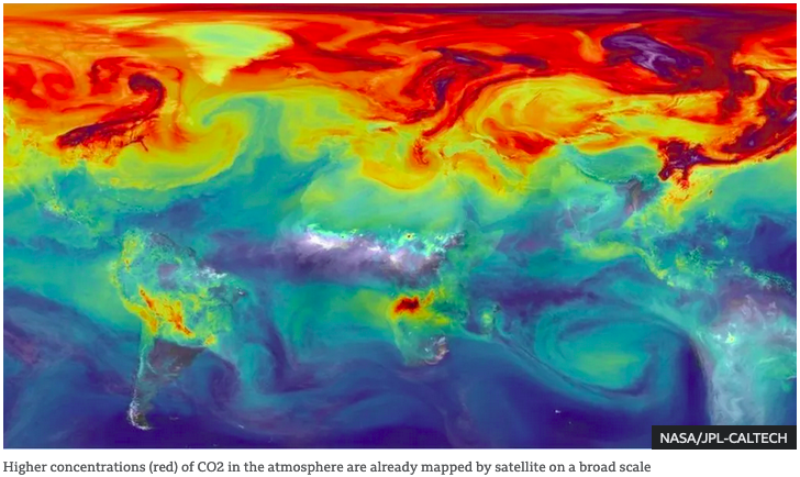
In order to reduce GHG emissions we need a clear picture of where the major sources are, and the sort of analysis that will be enabled by the launch of such an important satellite will undoubtedly provide valuable information towards these goals. Informed decision making is one of the key cornerstones of any plan to address a problem, and Montreal-based GHGSat continues to lead the world in emissions tracking, providing valuable, independent data – in addition to some of the national space agency satellites that track CO2 such as Japan’s GoSat and China’s TanSat.
George’s pick
The record-breaking year of Canadian wildfires
Why it’s important:
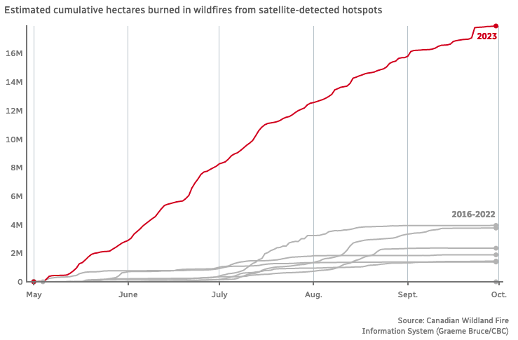
Canada faced one of its worst wild fire seasons in recorded history. All across Canada, massive fires destroyed thousands of acres of vegetation from forest to prairies. Although this is a climate change problem, mitigation should not be overlooked. Tactics such as tin roofs, wider maintained vegetation buffers, and adjusted rural zoning are some tactics that should be investigated for the future.
As we covered in our wildfire digest, there were lots of application of geospatial technology in the fight to track and extinguish these wildfires. From mapping out future at risk zones to help with mitigation, as well as using advances in real time mapping to help with wild fire control will play big roles. There are a number of associated articles with this, but this article gives the general idea of the affected scale.
Jordan’s pick
2023 North American Indigenous Games to use advanced mapping technology
Why it’s important:
In July 2023 the North American Indigenous Games (NAIG) were held in Halifax. For this event in collaboration with ESRI Canada, an advanced GIS was created in order to share information, plan, and visualize aspects of the games.
In addition to being an excellent resource for athletes, coaches, volunteers, and fans to navigate the games and see what amenities were at each facility; it also allowed for traditional native history of the area to be displayed with traditional names and stories. Hopefully this model will be used for future events in Canada that display pertanted information for travel/planning as well as traditional history and knowledge.
Crystal’s pick
Visualizing climate change in Canada’s Arctic using geospatial tech
Why it’s important:
As climate change continues to impact our planet, we see milder winters, more frequent and intense heat waves, and extreme weather events. Canada is particularly at risk due to its extensive coastline, which is the largest in the world.
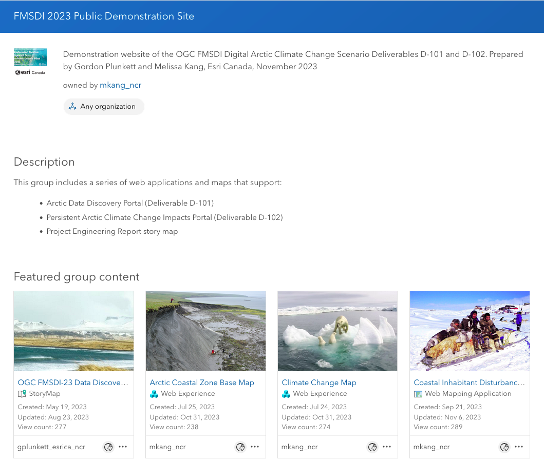
Additionally, Canada’s Arctic region is warming at a rate that is twice as fast as the global average, making the use of geospatial technology crucial for monitoring the impact of climate change in Canada’s north.
Farzaneh’s pick
The Celebration of National Indigenous History Month with ArcGIS
Why it’s important:
Exploring Indigenous history in Canada is absolutely key to creating a more inclusive society. Highlighting the power of GIS and ArcGIS resources in this context adds a valuable perspective.
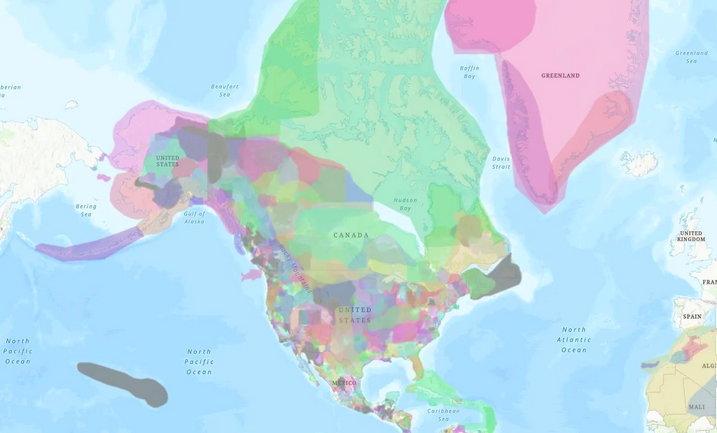
Moreover, seeing how these tools are used in real-world applications, like Andre Boutin-Maloney using ArcGIS for teaching Truth and Reconciliation, underscores how they can make learning about Indigenous history engaging.
Kruti’s pick
The major role Canada could play in space mining
Why it’s important:
By 2023, space mining is a definite possibility, and Canada will be a key player in this endeavour. Space agencies investigate resource extraction for in-situ usage as NASA’s Artemis programme prepares a lunar return. With its mining experience, Canada is ideally positioned to become an industry owner in the future. Research, including initiatives by the Canadian Space Mining Corporation, is funded by the Canadian Space Agency.
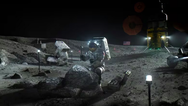
The expanding sector includes mining the moon for resources such as oxygen and water, and it will soon move on to mining asteroids. Even if there are still legal obstacles regarding space ownership, space mining’s revolutionary potential represents a significant advance for Canada in 2023.



Be the first to comment