
At GeoIgnite 2025, Louis Maltais of the Canadian Hydrographic Service (CHS) delivered a compelling presentation on Canada’s transition to the S-100 standard – a major step toward modernizing marine navigation. Blending technical insight with candid commentary, Louis outlined how this shift is redefining hydrographic services and setting a new benchmark for global maritime innovation.

From Static to Dynamic: A Federated Hydrospatial Future
Louis kicked off his talk with a blend of friendly competitiveness and sincere passion, setting the tone for what turned out to be a compelling vision of Canada’s hydrographic future. He outlined how CHS is transitioning from static paper and raster charts to dynamic, customizable, and real-time digital services under the S-100 framework.
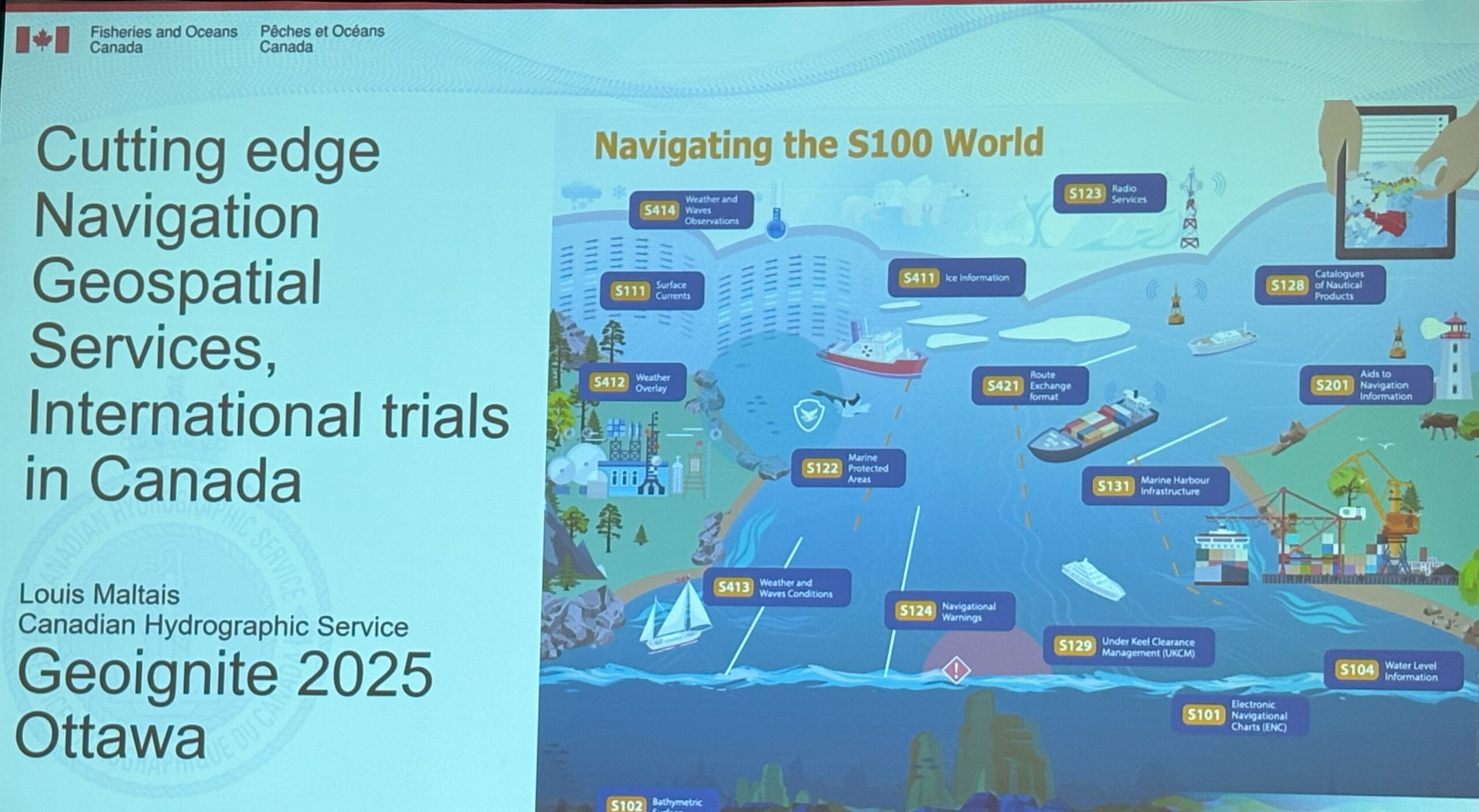
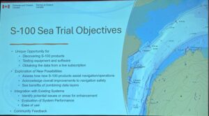
What stood out was his emphasis on data as a service, where marine navigation data isn’t just periodically updated – it’s live, machine-readable, and tailored to specific user needs. As Louis put it, “The era of static charts is over.” This approach enables safer and more efficient navigation, especially in high-traffic and environmentally sensitive zones like the St. Lawrence River, which Maltais described as a perfect testbed due to its complex currents, tides, and traffic.
Sea Trials and a Federated Architecture
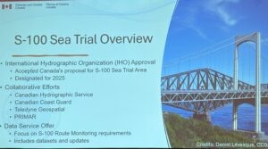
Louis spoke at length about an ambitious S-100 sea trial initiative conducted on the St. Lawrence River. The goal? To operationalize a federated distribution system where authoritative data from CHS is seamlessly integrated and disseminated via private sector partners like PRIMAR. This setup ensures that navigation services remain consistent, legally compliant, and accessible outside government firewalls.
He highlighted that Canada is currently the only nation conducting sea trials with the full S-100 layer stack — from base charts and bathymetry to real-time water levels and navigation warnings. This positions CHS as a global leader in S-100 implementation, a fact echoed during the session by participants from international hydrographic offices.
Digital Twins, AI Readiness, and Vertical Integration
Another visionary element of Louis’ talk was the integration of digital twin capabilities. The S-100 infrastructure isn’t just a navigation upgrade; it forms the geospatial backbone for autonomous shipping, machine-to-machine data exchange, and smart port management. Maltais imagined a future where a vessel submits its route digitally and is dynamically guided through updated conditions — no human intervention required.
His reflections on vertical datum integration and seamless transformation between land and sea reference systems resonated deeply. This interoperability, he emphasized, is not only technical but foundational for future applications in AI and autonomous systems.
Transparency, Community, and Moving Fast
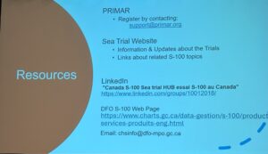
Louis returned to the need for transparency, collaboration, and open access. He encouraged everyone — from software developers to maritime stakeholders — to explore the CHS offerings, try out the trial services, and provide feedback. He also shared links to key resources:
-
YouTube Technical Sessions: Search for “S-100 CHS Canada”
-
Registration and Trial Access: https://canadas100.ca
-
LinkedIn Community: https://www.linkedin.com/groups/10012018/ Over 600 members contributing to updates and discussion
He closed with a compelling metaphor: “We’ve built a brand-new motorcycle. It’s fast. It’s exciting. It might not be perfect, but it’s a huge step forward – and I’m proud to be at the helm.”


Be the first to comment