
Announcing two conferences presented by GoGeomatics that will take place this spring
The first event we are announcing is the Subsurface Utility Mapping Strategy Forum (SUMSF). The conference will take place from March 22-23, 2022 and the workshops will take place from March 24-25, 2022. Check out our announcement and visit https://sumsforum.com/ for more details.
We are also announcing the Lidar Commercial Expo 2022, this event is being offered by GoGeomatics Canada and Lidar News and will take place on April 5, 2022 with workshops running from April 6-7 2022. Visit https://lidarcomex.com/ for more details.
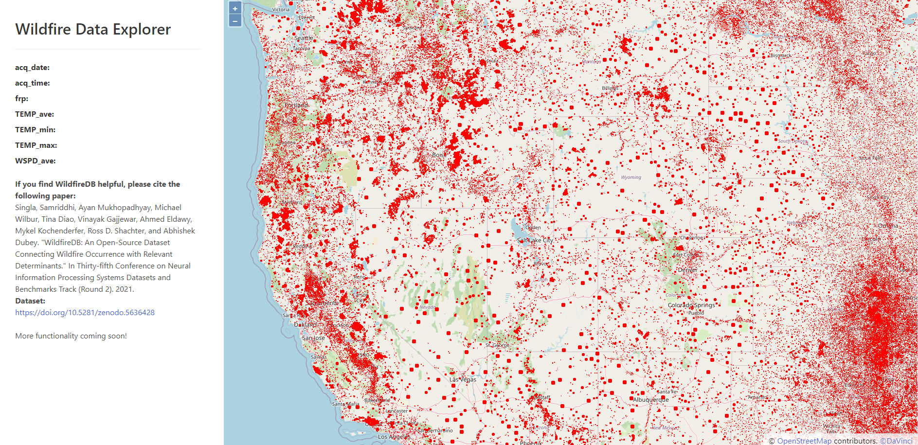
Wildfire dataset could help firefighters save lives and property
Students at the University of California, Riverside are teaming up with researchers from Vanderbilt University and Stanford University to study how wildfires spread by using data science. They have created an open-source dataset named WildfireDB, it’s comprised of over 17 million data pints that show the spread of wildfires in the continental United States over the last 10 years. This dataset can assist in evacuations and emergency response by predicting how wildfires spread in real time.
Article can be viewed here.
How are leaps in lidar driving autonomous vehicle development?
The next generation of autonomous vehicles will depend heavily on lidar technology. This evolving technology can detect objects 400 meters away and can now better operate in conditions with low lighting. The United State’s president, Joe Biden, just signed a new infrastructure bill, this will include many changes in transportation and makes room for lidar technology to lead the autonomous vehicle market. Looking into the future, more and more companies in the automotive industry are using lidar for semi and completely autonomous vehicles. Lidar is also being used in traffic intersections, being mounted on drones to monitor infrastructure and will be used in smart city infrastructure.

Article can be viewed here.
Many Faiths, One World: The Geography of Religion
This article explores the importance of GIS and mapping tools to see the migration of religion. This map shows how Buddhism spread throughout Asia, taking different paths to move through the continent. They also look at certain religious conflict regions that are present in this world as illustrated in this story map, that displays the conflict between Islamic Palestine and the Jewish state of Israel. This article also mentions the difficulty of mapping religions in the classroom, as there are many religions and numerous different ways to map them. It is especially challenging to map the movement of religion in the 21st century, as many people are moving and collecting data can be difficult. Although mapping migration may be difficult, we can see a world map of religion that shows the dominant religion of each country. There is also a more in depth map that looks at religion at the provincial and state level.

Article can be viewed here.
First-of-Its-Kind Online Public Lands Mapping Tool
This Climate Atlas released last month by the Conservation Lands Foundation and Conservation Science Partners, is a user-friendly tool that is available to the public. This tool allows users to visualize the climate resilience, climate stability, total carbon, ecological connectivity, ecological intactness, imperiled species richness and a few models such as carbon & climate model and biodiversity model for the United States. This atlas is a great visual representation of climate and biodiversity and is an easy way to see how climate change will impact the United States.
Article can be viewed here.
Trunk Road Gritter Tracker
Transport Scotland has created an interactive map that allows you to see where the Gritters, trucks that spread salt on icy roads, are in Scotland. The active gritters are represented in yellow and the inactive grey gritters indicate that those vehicles are parked at a depot. When clicking on each gritter, it will tell you the time and date that truck was last in that particular location. You can also see the direction the gritters are going and add a traffic layer to better plan your route during icy road conditions.
Interactive map can be viewed here.

Be the first to comment