New support to grow Scottish geospatial sector
Although Scotland location-based sector is thriving, Scottish Enterprise’s research has revealed that further help is required to cultivate more collaboration in the geospatial sector.
UK Government Geospatial Commission collaborates with The Scottish Government and Scottish Enterprise on founding the new Scottish Geospatial Network Integrator, with a shared investment of £200,000.
The Scottish Geospatial Network Integrator (SGNI) is helpful for shaping location-based organizations all over Scotland. SGNI will work on promoting awareness of the Scottish geospatial sector to other economic sectors, expanding the supply chain and signpost to probable development opportunities and much more.
https://www.gov.uk/government/news/new-support-to-grow-scottish-geospatial-sector
Aerial images detect and track food security threats for millions of African farmers
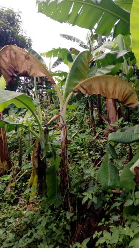
Banana is the main food source for People of the eastern, western and central parts of Africa. Climate change and land-use change escalate diseases, infections and viruses coming and spreading which cause threats for foods.
New research with case studies in the Democratic Republic of Congo and Republic of Benin, represents the way banana diseases can be tracked using aerial imagery from satellites, drones and mobile phones. Researchers used the images into a “trained” platform using machine learning for finding banana products and threats analysis.
“Threats are currently detected by experts in the field using cell phones,” said Michael Gomez Selvaraj, a crop physiologist and co-author at the Alliance of Bioversity International and the International Center for Tropical Agriculture (CIAT). “But to track and detect diseases across huge tracts of land at country, district or village level, you need a platform that quickly detects threats.
Image: A ground-level view of a banana plant affected by Xanthomonas Wilt or (BXW). Source: Michael Selvaraj / International Center for Tropical Agriculture
https://www.eurekalert.org/pub_releases/2020-10/icft-aid102220.php
OSU researchers at work on better, faster way to design, build, maintain buildings
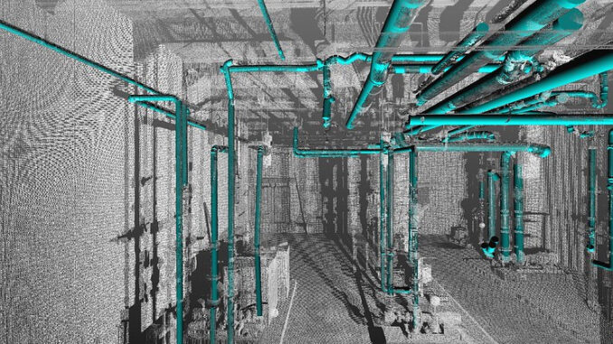
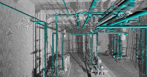
Oregon State University (OSU) researchers in the College of Engineering are working on building information models (BIMs) development using lidar data. Building designers and engineers will get benefits from this project for better and faster architecture, building construction and management.
IBMs are utilized to make building and infrastructure designs and document them. Also, BIMs are used for existing buildings, infrastructure and facilities management.
“Our team is turning lidar data into BIMs by automating the tedious and time-consuming manual work required to develop and maintain a BIM,” said Yelda Turkan, one of the project’s co-leaders. She added that they are applying deep learning algorithms to process the lidar data. The result of this project will help modellers transfer lidar data into BIMs and model building faster. https://ktvz.com/news/oregon-northwest/2020/10/23/osu-researchers-at-work-on-better-faster-way-to-design-build-maintain-buildings/
China launches latest trio of Yaogan-30 remote sensing satellites
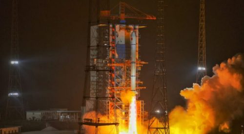
On October 26th, China’s 31st launch of 2020 is marked by launching a seventh group of Yaogan-30 reconnaissance satellites. The lunch seemed successful based on confirmation of China Aerospace Science and Technology Corp. (CASC) (Chinese).
According to Chinese state media reports, “Electromagnetic environment detection and related tests” is the purpose of this project. while it does not accord with external analysts’ perception. The analysts perceive that Yaogan series satellites are designated for military purposes. https://spacenews.com/china-launches-latest-trio-of-yaogan-30-remote-sensing-satellites/



Be the first to comment